Area Overview for DN34 5GB
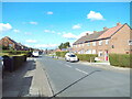
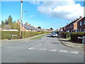
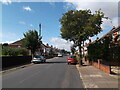
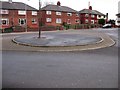
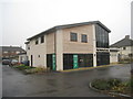
Photos of DN34 5GB


Area Information
Living in DN34 5GB means being part of a small, tightly knit residential cluster in England, with a population of just 1369 residents. This area is characterised by its modest scale, offering a quiet, low-density environment where community ties are likely to be strong. The median age of 47 suggests a mature demographic, with the majority of residents falling within the 30-64 age range. This makes DN34 5GB a place where families and long-term residents coexist, often in owner-occupied homes. The area’s proximity to Grimsby Town Railway Station and other nearby stations provides reliable access to regional transport networks, while local amenities such as Spar, Aldi West, and Heron Grange cater to everyday needs. With broadband quality rated at 100 and mobile coverage at 85, digital connectivity is robust, supporting both home-based work and leisure. For those seeking a balance between privacy and practicality, DN34 5GB offers a straightforward, no-frills lifestyle. Its small size means it’s not a place for sprawling suburbs, but rather a focused community where familiarity with local services and routes is a given.
- Area Type
- Postcode
- Area Size
- Not available
- Population
- 1369
- Population Density
- 4799 people/km²
The property market in DN34 5GB is defined by its modest scale and focus on owner-occupied homes. With 57% of properties owned by residents, this area leans more towards private homeownership than a rental market. The accommodation type is predominantly houses, which suggests a lack of high-density housing such as flats or apartments. This makes DN34 5GB unsuitable for buyers seeking investment properties or rental yields, as the housing stock is limited and tailored to individual occupancy. The small population size means the immediate surroundings are also likely to have a similar housing profile, with few commercial or mixed-use developments. For buyers, this translates to a straightforward market where properties are likely to be in good condition, given the age of the demographic and the stability of the community. However, the limited number of homes available means competition for properties may be higher, particularly for those prioritising proximity to local amenities.
House Prices in DN34 5GB
No properties found in this postcode.
Energy Efficiency in DN34 5GB
Daily life in DN34 5GB is shaped by its proximity to essential amenities, including five retail outlets such as Spar, Aldi West, and Heron Grange. These shops provide access to groceries, household items, and other necessities, reducing the need for long trips to larger centres. The railway stations nearby, including Grimsby Town and Great Coates, offer direct links to regional transport networks, enhancing mobility for those working or shopping outside the area. While the data does not mention parks or leisure facilities, the presence of retail and transport hubs suggests a functional, practical lifestyle focused on convenience. The small community size means social interactions are likely to be familiar, with local services catering to the needs of a compact population. For residents, the balance of accessibility and simplicity makes DN34 5GB a place where everyday tasks are manageable without the complexity of a larger urban environment.
Amenities
Schools
The Western Technology School is a primary school serving the area, providing education for younger children. Nearby, the Young People’s Centre offers additional support or educational services, though its specific role is not detailed in the data. This combination of a primary school and a secondary or community-focused institution suggests a basic educational infrastructure for families. However, the absence of secondary schools or specialist provision in the immediate vicinity may require parents to look further afield for secondary education. For families prioritising proximity to schools, the presence of at least one primary institution is a practical advantage. The limited range of educational options reflects the area’s small size, which may not support larger, more comprehensive school facilities.
| Rank | School | Type | Entry gender | Ages |
|---|
Explore more schools in this area
Go to Schools tabDemographics
DN34 5GB has a population of 1369, with a median age of 47 and the largest age group being adults aged 30-64. This suggests a community that is neither dominated by young families nor elderly retirees, but rather a mix of middle-aged residents, many of whom may be in their peak working years. Home ownership rates stand at 57%, indicating that nearly half of the housing stock is occupied by owners, while the remaining 43% are likely rented. The predominant accommodation type is houses, which aligns with the area’s residential character. The ethnic composition is overwhelmingly White, with no specific data on other groups. This demographic profile implies a stable, low-turnover environment where long-term residency is common. The absence of significant deprivation data means quality of life is likely to be consistent, though the moderate population size means local services are scaled to a small community rather than a larger town.
Household Size
Accommodation Type
Tenure
Ethnic Group
Religion
Household Composition
Age
Household Deprivation
NS-SEC
Explore more demographic insights in this area
Go to Demographics tabPlanning
Planning Constraints
- Flood RiskPremium
- Ramsar Wetland SitesPremium
- Area of Outstanding Natural BeautyPremium
- Protected Nature ReservePremium
- Protected WoodlandPremium