Area Overview for DN34 4PB
Photos of DN34 4PB
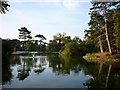
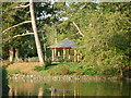
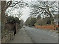
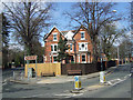
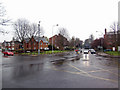
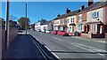
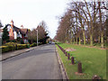
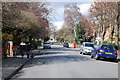
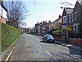
55 photos from this area
Area Information
Key information about the DN34 4PB including its size, population, and administrative classification.
- Area Type
- Postcode
- Area Size
- 1.2 hectares
- Population
- 1560
- Population Density
- 6122 people/km²
House Prices in DN34 4PB
37
Properties
£139,269
Average Sold Price
£45,000
Lowest Price
£245,000
Highest Price
Showing 37 properties
| Address | Type | Beds | Baths | Last Sale Price | Last Sale Date | |
|---|---|---|---|---|---|---|
| 19 Compton Drive, Grimsby, DN34 4PB | Semi-detached | 3 | 1 | £152,000 | Mar 2024 | |
| 29 Compton Drive, Grimsby, DN34 4PB | house | - | - | £140,000 | Feb 2024 | |
| 1 Compton Drive, Grimsby, DN34 4PB | house | 4 | 1 | £245,000 | Nov 2022 | |
| 10 Compton Drive, Grimsby, DN34 4PB | house | - | - | £207,000 | Jul 2022 | |
| 32 Compton Drive, Grimsby, DN34 4PB | Semi-detached | 3 | 1 | £160,000 | Sep 2021 | |
| 14 Compton Drive, Grimsby, DN34 4PB | Detached | 4 | 1 | £232,000 | Sep 2021 | |
| 23 Compton Drive, Grimsby, DN34 4PB | house | - | - | £157,500 | Jun 2021 | |
| 34 Compton Drive, Grimsby, DN34 4PB | Semi-detached | 3 | 1 | £162,000 | May 2021 | |
| 31 Compton Drive, Grimsby, DN34 4PB | Semi-detached | 3 | - | £122,250 | Oct 2020 | |
| 27 Compton Drive, Grimsby, DN34 4PB | Semi-detached | 3 | 2 | £168,000 | Sep 2019 |
Page 1 of 4
Energy Efficiency in DN34 4PB
Amenities
Schools
| Rank | School | Type | Entry gender | Ages |
|---|
Explore more schools in this area
Go to Schools tabDemographics
Household Size
Two person
most common
Accommodation Type
Houses
most common
Tenure
82
majority
Ethnic Group
White
most common
Religion
N/A
most common
Household Composition
N/A
most common
Age
47
median
Adults (30-64 years)
most common
Household Deprivation
N/A
with no deprivation
NS-SEC
25
in Lower managerial occupations
Explore more demographic insights in this area
Go to Demographics tabPlanning
Planning Constraints
- Flood RiskPremium
- Ramsar Wetland SitesPremium
- Area of Outstanding Natural BeautyPremium
- Protected Nature ReservePremium
- Protected WoodlandPremium