Area Overview for DN32 9TP
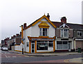
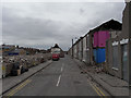
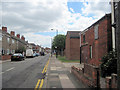
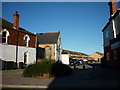
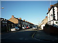
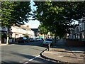
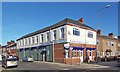
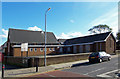
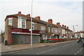
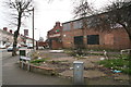
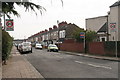
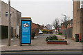
Photos of DN32 9TP
Area Information
DN32 9TP is a small, tightly knit residential postcode area in England, home to around 1,658 people. Its compact size means it functions more like a cluster of homes than a sprawling suburb, with a quiet, community-focused character. The area is predominantly composed of houses, reflecting a demographic skewed towards adults aged 30–64, with a median age of 47. This suggests a stable, established population, many of whom may have long-term ties to the region. Daily life here is shaped by proximity to key amenities: nearby supermarkets like Sainsburys Welholme and Asda Grimsby ensure grocery shopping is convenient, while rail links to Grimsby Town and New Clee stations provide straightforward access to nearby towns. The area’s low flood risk and absence of protected natural sites make it a practical choice for those prioritising safety and planning certainty. However, its small size means residents may need to look beyond DN32 9TP for broader services, such as schools or specialist healthcare. For those seeking a compact, low-maintenance lifestyle with strong local connectivity, this postcode offers a focused, manageable environment.
- Area Type
- Postcode
- Area Size
- Not available
- Population
- 1658
- Population Density
- 6911 people/km²
The property market in DN32 9TP is characterised by a focus on houses, with no data suggesting the presence of flats or other property types. Only 30% of homes are owner-occupied, which implies a strong rental market, though the exact proportion of rental properties is not specified. This dynamic may make the area appealing to investors or those seeking long-term tenancies, but buyers should note that the small size of the postcode limits the availability of homes for sale. The absence of large-scale developments or high-density housing suggests a quiet, low-traffic environment, which may appeal to those seeking privacy. However, the limited property stock also means competition for available homes, particularly for owner-occupiers. For those considering the area, proximity to rail links and retail hubs like Asda Grimsby could offset the smaller housing stock, but buyers should explore surrounding regions for broader options.
House Prices in DN32 9TP
No properties found in this postcode.
Energy Efficiency in DN32 9TP
Daily life in DN32 9TP is shaped by its proximity to essential retail and transport hubs. The area’s retail landscape includes major supermarkets such as Sainsburys Welholme, Lidl Weelsby, and Asda Grimsby, ensuring easy access to groceries and everyday goods. These stores are likely within walking or short driving distance, reducing the need for lengthy trips. The rail network, with stations like Grimsby Town and New Clee, provides direct links to nearby towns, facilitating access to broader leisure, cultural, and professional opportunities. While the area itself lacks detailed data on parks or leisure facilities, the rail connectivity suggests residents can reach larger centres for recreation. The combination of retail convenience and transport options creates a lifestyle that balances local self-sufficiency with regional accessibility. This makes DN32 9TP suitable for those who value practicality without sacrificing the ability to engage with wider services.
Amenities
Schools
The only named educational institution near DN32 9TP is the Special Educational Needs Support Service (Senss), categorised as an ‘other’ type. No primary or secondary schools are listed in the data, meaning families with children would need to look beyond the immediate area for schooling. This lack of local schools may be a significant consideration for buyers prioritising proximity to education. The absence of school data on Ofsted ratings or pupil outcomes means it is unclear whether the area’s educational provision meets broader standards. For parents, this suggests a reliance on nearby towns such as Grimsby, which may have more comprehensive school networks. The single listed institution highlights a gap in the area’s infrastructure for families requiring specialist educational support, though it does offer targeted resources for those with specific needs.
| Rank | School | Type | Entry gender | Ages |
|---|
Explore more schools in this area
Go to Schools tabDemographics
The population of DN32 9TP is predominantly adults aged 30–64, with a median age of 47. This suggests a mature, settled community, likely with a mix of long-term residents and families. Home ownership in the area is relatively low at 30%, indicating a significant proportion of residents rent their homes. The accommodation type is exclusively houses, which is uncommon in areas with high rental rates, hinting at a balance between owner-occupied properties and rental stock. The predominant ethnic group is White, with no data provided on other ethnicities. This demographic profile aligns with a community that may prioritise stability over rapid change. The low home ownership rate could reflect economic factors, such as affordability challenges or a preference for rental flexibility. For residents, this means a mix of household types, from single occupants to families, but with limited data on deprivation levels, it is unclear how this affects access to services or quality of life.
Household Size
Accommodation Type
Tenure
Ethnic Group
Religion
Household Composition
Age
Household Deprivation
NS-SEC
Explore more demographic insights in this area
Go to Demographics tabPlanning
Planning Constraints
- Flood RiskPremium
- Ramsar Wetland SitesPremium
- Area of Outstanding Natural BeautyPremium
- Protected Nature ReservePremium
- Protected WoodlandPremium