Area Overview for DN32 9NJ
Photos of DN32 9NJ
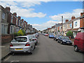

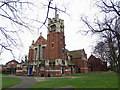
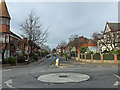
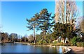
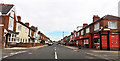
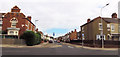
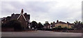
72 photos from this area
Area Information
Key information about the DN32 9NJ including its size, population, and administrative classification.
- Area Type
- Postcode
- Area Size
- 5806 m²
- Population
- 1514
- Population Density
- 9012 people/km²
House Prices in DN32 9NJ
33
Properties
£56,497
Average Sold Price
£16,200
Lowest Price
£91,000
Highest Price
Showing 33 properties
| Address | Type | Beds | Baths | Last Sale Price | Last Sale Date | |
|---|---|---|---|---|---|---|
| 359 Heneage Road, Grimsby, DN32 9NJ | house | - | - | £91,000 | Nov 2022 | |
| 330 Heneage Road, Grimsby, DN32 9NJ | Terraced | 3 | - | £62,000 | Dec 2021 | |
| 326 Heneage Road, Grimsby, DN32 9NJ | Terraced | 3 | 1 | £83,000 | Sep 2021 | |
| 331 Heneage Road, Grimsby, DN32 9NJ | Terraced | 3 | 1 | £83,000 | Nov 2019 | |
| 353 Heneage Road, Grimsby, DN32 9NJ | Terraced | 3 | 1 | £70,000 | Feb 2019 | |
| 336 Heneage Road, Grimsby, DN32 9NJ | Terraced | 3 | 1 | £72,500 | Feb 2019 | |
| 344 Heneage Road, Grimsby, DN32 9NJ | Terraced | 3 | 1 | £60,000 | Jan 2016 | |
| 357 Heneage Road, Grimsby, DN32 9NJ | house | 3 | - | £47,500 | Nov 2015 | |
| 338 Heneage Road, Grimsby, DN32 9NJ | Terraced | 3 | - | £61,000 | Jan 2015 | |
| 347 Heneage Road, Grimsby, DN32 9NJ | house | 3 | - | £57,000 | Dec 2012 |
Page 1 of 4
Energy Efficiency in DN32 9NJ
Amenities
Schools
| Rank | School | Type | Entry gender | Ages |
|---|
Explore more schools in this area
Go to Schools tabDemographics
Household Size
One person
most common
Accommodation Type
Houses
most common
Tenure
48
majority
Ethnic Group
White
most common
Religion
N/A
most common
Household Composition
N/A
most common
Age
47
median
Adults (30-64 years)
most common
Household Deprivation
N/A
with no deprivation
NS-SEC
14
in Lower managerial occupations
Explore more demographic insights in this area
Go to Demographics tabPlanning
Planning Constraints
- Flood RiskPremium
- Ramsar Wetland SitesPremium
- Area of Outstanding Natural BeautyPremium
- Protected Nature ReservePremium
- Protected WoodlandPremium