Area Overview for DN32 9EX
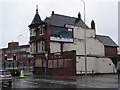
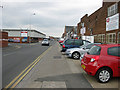
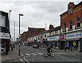
Photos of DN32 9EX


Area Information
DN32 9EX is a small, tightly knit residential postcode in England, home to 1,658 residents. The area is defined by its compact nature, with homes clustered closely together, creating a quiet, community-oriented atmosphere. Daily life here is shaped by its modest scale, where familiar faces and local routines are common. The population skews toward adults aged 30–64, with a median age of 47, suggesting a stable, established demographic. While the area lacks the vibrancy of larger towns, its simplicity offers a low-maintenance lifestyle. Proximity to rail networks and retail hubs like Asda Grimsby and Tesco Grimsby ensures practical access to essentials. The absence of major planning constraints, such as protected woodlands or AONB designations, means development pressures are minimal. However, the high crime risk score of 1/100 is a notable concern, requiring residents to prioritise security. For those seeking a calm, uncluttered environment with functional amenities, DN32 9EX provides a straightforward, no-frills option.
- Area Type
- Postcode
- Area Size
- Not available
- Population
- 1658
- Population Density
- 6911 people/km²
The property market in DN32 9EX is characterised by a low home ownership rate of 30%, suggesting that rental properties dominate the housing stock. The accommodation type is predominantly houses, which is atypical for a small postcode but may reflect the area’s layout or historical development. This mix implies a limited number of owner-occupied homes, potentially making the market less competitive for buyers seeking equity. The small size of the area means the housing stock is concentrated, with few options beyond the immediate vicinity. For buyers, this could mean a need to consider surrounding areas for more choices. The focus on houses may appeal to those prioritising space, but the low ownership rate could indicate a lack of long-term investment in the area. Prospective buyers should weigh the limited stock against the potential for future growth or the need for flexibility in their search.
House Prices in DN32 9EX
No properties found in this postcode.
Energy Efficiency in DN32 9EX
The lifestyle in DN32 9EX is shaped by its proximity to essential retail and transport hubs. Within practical reach are supermarkets such as Asda Grimsby, Farmfoods East, and Tesco Grimsby, ensuring easy access to groceries and daily necessities. The rail network is a key feature, with five stations nearby, including Grimsby Docks and New Clee, providing connections to broader regional networks. These stations are particularly useful for commuters or those needing to travel beyond the area. While the data does not mention parks or leisure facilities, the absence of planning constraints like AONB or protected woodlands suggests open spaces may be available. The compact nature of the area means amenities are concentrated, offering convenience for residents who prioritise accessibility over extensive recreational options. The combination of retail, transport, and practical connectivity defines a lifestyle focused on efficiency and ease of access.
Amenities
Schools
The only school explicitly listed near DN32 9EX is the Special Educational Needs Support Service (Senss), categorised as an 'other' type. This facility provides tailored support for children with specific educational needs, which may be critical for families with such requirements. However, the absence of primary or secondary schools in the data suggests that residents must look beyond the immediate area for mainstream education. This could pose challenges for families relying on local schools, necessitating a broader search for educational options. The single listed institution highlights a gap in the data, as no information is provided on its Ofsted rating or academic performance. For those prioritising a comprehensive school network, DN32 9EX may not meet all needs, requiring additional research into nearby towns or districts.
| Rank | School | Type | Entry gender | Ages |
|---|
Explore more schools in this area
Go to Schools tabDemographics
The community in DN32 9EX is predominantly composed of adults aged 30–64, with a median age of 47. This suggests a mature, settled population, likely with long-term ties to the area. Home ownership rates are low at 30%, indicating that a significant portion of residents rent their homes. The accommodation type is primarily houses, which is unusual for a small postcode but may reflect the area’s rural or semi-rural character. The predominant ethnic group is White, and no data indicates significant diversity beyond this. The low home ownership rate could imply a transient population or a reliance on rental properties, though the exact reasons are not specified. The absence of detailed deprivation data means the quality of life implications of these figures remain unclear, but the demographic profile points to a community focused on stability and practicality over rapid change.
Household Size
Accommodation Type
Tenure
Ethnic Group
Religion
Household Composition
Age
Household Deprivation
NS-SEC
Explore more demographic insights in this area
Go to Demographics tabPlanning
Planning Constraints
- Flood RiskPremium
- Ramsar Wetland SitesPremium
- Area of Outstanding Natural BeautyPremium
- Protected Nature ReservePremium
- Protected WoodlandPremium