Area Overview for DN32 9ER
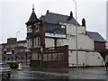
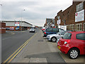
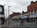
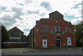
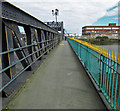
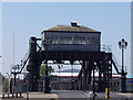
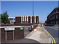
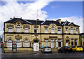
Photos of DN32 9ER


Area Information
Living in DN32 9ER means being part of a tightly knit residential cluster in England, where 1,499 people reside across just 658 square metres. This compact area, with a population density of over 2.2 million per square kilometre, creates a densely populated yet focused community. The area is defined by its proximity to essential services, including three primary schools and a range of retail and transport hubs. Daily life here is shaped by the immediacy of amenities like Asda Grimsby and nearby railway stations, which connect residents to Grimsby and surrounding towns. The median age of 22 contrasts with the most common age range of 30–64, suggesting a mix of younger and middle-aged residents. While the area’s small size limits expansion, its concentration of services and schools makes it practical for families and commuters. However, the high population density and limited space mean the character of DN32 9ER is defined by proximity and shared resources, rather than sprawling development.
- Area Type
- Postcode
- Area Size
- 658 m²
- Population
- Not available
- Population Density
- Not available
The property market in DN32 9ER is characterised by a 36% home ownership rate, with houses forming the majority of accommodation types. This suggests a limited number of owner-occupied properties, potentially leaving a larger share of the housing stock in the rental market. The small area size and high population density imply that properties are closely spaced, with little scope for new development. Buyers considering this area should note that the housing stock is likely to be older or smaller, given the lack of mention of newer builds or high-end properties. The compact nature of DN32 9ER means that property values may be influenced more by proximity to amenities like schools and transport links than by size or condition. For those seeking a home, the area’s immediate surroundings offer limited alternatives, making location a key factor in decision-making.
House Prices in DN32 9ER
No properties found in this postcode.
Energy Efficiency in DN32 9ER
The lifestyle in DN32 9ER is shaped by its proximity to retail and transport hubs. Nearby amenities include five retail venues, such as Asda Grimsby and Tesco Grimsby, providing access to groceries, household goods, and everyday essentials. The area’s railway stations—Grimsby Town, Grimsby Docks, and New Clee—offer direct links to Grimsby and surrounding towns, making commuting or day trips feasible. While the area lacks large parks or leisure facilities, its compact nature ensures that essential services are within walking or short driving distance. The presence of multiple schools and retail options suggests a practical, convenience-focused lifestyle. However, the absence of data on dining or recreational venues means the full range of local activities remains unexplored.
Amenities
Schools
Residents of DN32 9ER have access to a cluster of primary schools, including Welholme Infants’ School, Welholme Junior School, and Welholme Primary School, which provide early and primary education. The area also includes Welholme Academy, a secondary school rated ‘good’ by Ofsted. This mix of primary and secondary education options offers families a range of choices, from early years to adolescence. The presence of three primary schools suggests a strong local focus on early education, while the academy provides a broader curriculum. For parents, the proximity of multiple schools within walking distance reduces the need for long commutes. However, the lack of data on school catchment areas or pupil numbers means further research is needed to assess capacity and quality.
| Rank | School | Type | Entry gender | Ages |
|---|
Explore more schools in this area
Go to Schools tabDemographics
DN32 9ER has a median age of 22, but the most common age group is adults aged 30–64, indicating a community skewed toward working-age populations. Home ownership stands at 36%, with houses being the predominant accommodation type. This suggests a mix of owner-occupied and rented properties, though the relatively low ownership rate may reflect rental demand or limited property availability. The predominant ethnic group is White, with no specific data on other demographics. The area’s youthful median age contrasts with the adult-heavy population, hinting at a balance between younger residents and established families. However, the lack of detailed diversity data means broader social composition remains unclear. The high population density—over 2.2 million per square kilometre—raises questions about living conditions, though the area’s compact nature ensures proximity to essential services.
Household Size
Accommodation Type
Tenure
Ethnic Group
Religion
Household Composition
Age
Household Deprivation
NS-SEC
Explore more demographic insights in this area
Go to Demographics tabPlanning
Planning Constraints
- Flood RiskPremium
- Ramsar Wetland SitesPremium
- Area of Outstanding Natural BeautyPremium
- Protected Nature ReservePremium
- Protected WoodlandPremium