Area Overview for DN32 9DF
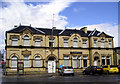
Photos of DN32 9DF


Area Information
Living in DN32 9DF means being part of a small, tightly knit residential cluster in England, home to 1,290 residents. The area’s compact size fosters a quiet, community-oriented lifestyle, with homes primarily in the form of houses rather than flats. The median age of 47 suggests a stable population, with adults aged 30–64 forming the largest demographic group. This creates a mature, established community, often centered around family life. Proximity to Grimsby’s retail hubs, including Asda, M&S, and Tesco, ensures daily essentials are within reach, while nearby rail stations offer connections to broader regional networks. Despite its small footprint, the area benefits from excellent broadband connectivity, scoring 98 out of 100, making it ideal for remote work or digital pursuits. However, residents should be aware of the high crime risk, which is above average. For those prioritising convenience, safety, and a sense of local identity, DN32 9DF offers a distinct blend of practicality and proximity to essential services.
- Area Type
- Postcode
- Area Size
- Not available
- Population
- 1290
- Population Density
- 4950 people/km²
The property market in DN32 9DF is characterised by a 40% home ownership rate, indicating that 60% of properties are likely rented. This suggests a mix of owner-occupied and rental homes, though the area’s small size means the housing stock is limited. The accommodation type is predominantly houses, which are more common than flats or apartments. For buyers, this implies a focus on single-family homes, often with gardens, suited to families or those seeking space. However, the relatively low home ownership rate may reflect a reliance on rental properties, potentially making the market competitive for buyers. Given the area’s proximity to Grimsby’s retail and transport hubs, properties here are likely to appeal to those prioritising convenience over expansive housing options. The limited scale of the area means buyers should consider nearby locations for a broader range of properties.
House Prices in DN32 9DF
No properties found in this postcode.
Energy Efficiency in DN32 9DF
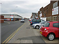
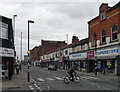
The lifestyle in DN32 9DF is shaped by its proximity to Grimsby’s retail and transport hubs. Residents have access to five retail venues, including major chains like Asda, M&S, and Tesco, ensuring everyday shopping needs are met locally. The nearby rail stations—Grimsby Town, Grimsby Docks, and New Clee—offer easy access to regional travel, whether for commuting, visiting nearby attractions, or exploring further afield. While the area lacks detailed information on parks or leisure facilities, the presence of retail and rail infrastructure suggests a practical, convenience-focused lifestyle. The small residential cluster fosters a sense of community, with local amenities designed for ease of access. For those who prioritise shopping, travel, and a compact living environment, DN32 9DF provides a straightforward, functional daily life.
Amenities
Schools
Residents of DN32 9DF have access to two primary schools: Edward Heneage Primary School and Edward Heneage Primary Academy. Both institutions cater to young children, with the latter holding an Ofsted rating of ‘good’. This combination of schools provides families with options for primary education, though no secondary schools are listed in the data. The presence of two primary schools suggests a focus on early education, which is beneficial for families with young children. However, parents seeking secondary schooling may need to look further afield. The ‘good’ rating at Edward Heneage Primary Academy indicates a reasonably high standard of education, though specific details on curriculum or facilities are not provided. For families prioritising primary education, the area offers accessible, locally based options.
| Rank | School | Type | Entry gender | Ages |
|---|
Explore more schools in this area
Go to Schools tabDemographics
The community in DN32 9DF is predominantly composed of adults aged 30–64, with a median age of 47. This suggests a population that is largely in their prime working years, often with established careers and families. Home ownership rates stand at 40%, meaning 60% of households are likely renters. The accommodation type is primarily houses, reflecting a preference for single-family dwellings over flats or apartments. The predominant ethnic group is White, with no specific data provided on other demographics. While the area lacks detailed information on deprivation levels, the combination of a mature population and moderate home ownership indicates a balance between long-term residents and newer arrivals. This demographic profile suggests a community that values stability, with a focus on family-oriented living and practical housing needs.
Household Size
Accommodation Type
Tenure
Ethnic Group
Religion
Household Composition
Age
Household Deprivation
NS-SEC
Explore more demographic insights in this area
Go to Demographics tabPlanning
Planning Constraints
- Flood RiskPremium
- Ramsar Wetland SitesPremium
- Area of Outstanding Natural BeautyPremium
- Protected Nature ReservePremium
- Protected WoodlandPremium