Area Overview for DN32 7RY
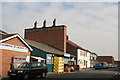
Photos of DN32 7RY


Area Information
Living in DN32 7RY means settling into a compact residential cluster defined by precise boundaries and a specific postcode identity. This small area covers just 9711 square metres of land, creating an intimate living environment where neighbours are often within immediate view. With a recorded population of 1245 people, the neighbourhood maintains a distinct density of 928 people per square kilometre. This concentration shapes daily life, fostering close-knit interactions but also requiring residents to navigate brief routes that service a concentrated group of households. The setting is not sprawling; it is a focused cluster where every street contributes to the collective footprint of the community. You will find yourself in a location where the physical space limits the scale of urban development, preserving a residential character that differs significantly from larger towns or railway hubs nearby. The distinction of DN32 7RY lies in its specificity. It is a pinpoint location rather than a broad district, offering a contained living experience that appeals to those seeking a defined home territory. Residents here move through an environment where the size of the area directly influences the pace of movement and the immediacy of local connections.
- Area Type
- Postcode
- Area Size
- 9711 m²
- Population
- 1245
- Population Density
- 928 people/km²
The property market in DN32 7RY is characterised by a heavy reliance on rental accommodation rather than private ownership. With only 11% of households owning their homes, the area functions predominantly as a rental hub for the 1245 residents living within the cluster. Flats form the standard form of accommodation, a choice dictated by the limited land area of 9711 square metres and the dense living arrangements common in such small postcode zones. This housing stock likely consists of purpose-built walk-ups or apartment blocks designed for shared living rather than detached family homes. Buyers looking for security of tenure or long-term capital growth may find this environment challenging, as the low ownership rate suggests unstable residency links. The small size of the area limits inventory diversity, meaning options are often restricted to whatever flats become available within this tight geographic slice. For those seeking a long-term stake, the 928 people per square kilometre density indicates a high demand for space that is tightly managed. You must consider the implications of renting or short-tenure arrangements when evaluating this postcode. The market here does not offer the stability of owner-occupied streets where residents invest in their own buildings. Instead, it offers the flexibility and affordability typical of flat-dominated sectors in high-density urban pockets.
House Prices in DN32 7RY
Showing 53 properties
| Address | Type | Beds | Baths | Last Sale Price | Last Sale Date | |
|---|---|---|---|---|---|---|
| 64 Weelsby Street, Grimsby, DN32 7RY | Terraced | 3 | 1 | £69,000 | Jun 2024 | |
| 54 Weelsby Street, Grimsby, DN32 7RY | Terraced | 3 | 1 | £78,500 | Feb 2023 | |
| 61 Weelsby Street, Grimsby, DN32 7RY | house | - | - | £62,000 | Dec 2021 | |
| 66 Weelsby Street, Grimsby, DN32 7RY | house | 2 | 1 | £40,000 | Feb 2016 | |
| 63 Weelsby Street, Grimsby, DN32 7RY | house | - | - | £45,000 | Jun 2012 | |
| 68A Weelsby Street, Grimsby, DN32 7RY | house | - | - | £30,500 | Jan 2004 | |
| 70 Weelsby Street, Grimsby, DN32 7RY | house | - | - | £30,500 | Jan 2004 | |
| 68 Weelsby Street, Grimsby, DN32 7RY | house | - | - | £30,500 | Jan 2004 | |
| 74 Weelsby Street, Grimsby, DN32 7RY | house | - | - | £30,500 | Jan 2004 | |
| 72 Weelsby Street, Grimsby, DN32 7RY | house | - | - | £30,500 | Jan 2004 |
Energy Efficiency in DN32 7RY
Convenience and shopping lie within practical reach of DN32 7RY, offering five retail outlets that serve the daily needs of the local population. Aldi East, Heron Grimsby, and Heron East operate as notable venues, providing straightforward access to groceries and household essentials. For those who travel by train, five railway stations remain within a short distance, including New Clee Railway Station, Grimsby Docks Railway Station, and Grimsby Town Railway Station. These transport hubs connect residents to wider regional networks despite the compact nature of the 9711 square metre area. The presence of multiple retail and rail options means you do not need to travel far for basic sustenance or career commutes. Living in DN32 7RY grants access to immediate drinking fountains, buses, and shops that anchor the routine of daily life. The mix of Aldi outinas and named railway stations ensures that both practical living and professional requirements are met without excessive driving. This blend of proximity creates a self-sufficient lifestyle where the most essential amenities are never further than a brief walk or ride away. The 1245 residents benefit from this infrastructure, which supports everything from morning runs to evening meals and weekend travel plans.
Amenities
Schools
Families residing in DN32 7RY have access to three primary educational institutions located within practical reach of the residential cluster. Strand Junior School serves as a foundational option for younger children in the primary age group. Nearby, Strand Community School provides additional primary education coverage for local families requiring a second choice or alternative provision. Strand Primary Academy stands out among these institutions as the only option listed with a formal Ofsted rating, which has been designated as good. This specific rating distinguishes it from its neighbours who currently lack published performance data. For parents, having multiple primary schools in the immediate vicinity offers flexibility in choosing a setting that aligns with your child's learning needs. The presence of Strand Primary Academy with its good rating provides a verified benchmark for quality education close to the 9711-metre square boundary. You should review the operating policies of each school, as Strand Junior, Strand Community, and Strand Primary Academy will each have their own attendance and admissions procedures. The concentration of primary-level schools suggests that comprehensive secondary education lies further away from this specific postcode. Residential parents in DN32 7RY must plan carefully for secondary school travel, as no secondary institutions appear in the immediate neighbourhood data.
| Rank | School | Type | Entry gender | Ages |
|---|
Explore more schools in this area
Go to Schools tabDemographics
The community profile in DN32 7RY is dominated by adults aged between 30 and 64 years, reflecting a workforce-oriented age profile. The median age for residents is 47 years, indicating that families and established professionals make up the core demographic. Accommodation types in this postcode consist primarily of flats, which aligns with the high population density found across the 9711 square metres of land. Ownership patterns show that only 11% of residents own their homes outright, suggesting that the private rental sector plays a significant role in how people secure housing here. This low ownership rate contrasts with areas where families buy to build equity, pointing instead towards a market driven by temporary tenure or higher entry costs relative to local incomes. The ethnic composition identifies White residents as the predominant group, forming the cultural backbone of this specific postal sector. You should note that the demographics present a snapshot of a mature, working-age community without substantial youth dependency or elderly care burdens. The high concentration of adults in this age bracket means that local services and retail options tend to cater to working lives and family units rather than young singles or retirees. This demographic makeup defines the rhythm of the neighbourhood throughout the week.
Household Size
Accommodation Type
Tenure
Ethnic Group
Religion
Household Composition
Age
Household Deprivation
NS-SEC
Explore more demographic insights in this area
Go to Demographics tabPlanning
Planning Constraints
- Flood RiskPremium
- Ramsar Wetland SitesPremium
- Area of Outstanding Natural BeautyPremium
- Protected Nature ReservePremium
- Protected WoodlandPremium