Area Overview for DN32 7RS
Photos of DN32 7RS
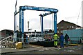
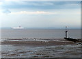
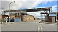
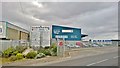
95 photos from this area
Area Information
Key information about the DN32 7RS including its size, population, and administrative classification.
- Area Type
- Postcode
- Area Size
- 9931 m²
- Population
- 1245
- Population Density
- 928 people/km²
House Prices in DN32 7RS
19
Properties
£120,371
Average Sold Price
£15,000
Lowest Price
£1,000,000
Highest Price
Showing 19 properties
| Address | Type | Beds | Baths | Last Sale Price | Last Sale Date | |
|---|---|---|---|---|---|---|
| 45 Rutland Street, Grimsby, DN32 7RS | Terraced | 3 | 1 | £49,000 | Dec 2025 | |
| 41 Rutland Street, Grimsby, DN32 7RS | Terraced | 2 | 1 | £48,000 | Sep 2025 | |
| The Anchorage, 426-450 Cleethorpe Road, Grimsby, DN32 7RS | hospital_care_home | - | - | £1,000,000 | Aug 2025 | |
| 37 Rutland Street, Grimsby, DN32 7RS | Terraced | 2 | 1 | £62,950 | Jan 2024 | |
| 49 Rutland Street, Grimsby, DN32 7RS | Terraced | 3 | 1 | £46,000 | Jan 2024 | |
| 57 Rutland Street, Grimsby, DN32 7RS | Terraced | 2 | 1 | £52,000 | Nov 2023 | |
| 51 Rutland Street, Grimsby, DN32 7RS | Terraced | 3 | 1 | £46,500 | Aug 2021 | |
| 47 Rutland Street, Grimsby, DN32 7RS | Terraced | 2 | 2 | £40,000 | May 2013 | |
| 43 Rutland Street, Grimsby, DN32 7RS | Terraced | 3 | 1 | £33,000 | May 2006 | |
| 33 Rutland Street, Grimsby, DN32 7RS | house | 3 | - | £32,000 | Nov 2003 |
Page 1 of 2
Energy Efficiency in DN32 7RS
Amenities
Schools
| Rank | School | Type | Entry gender | Ages |
|---|
Explore more schools in this area
Go to Schools tabDemographics
Household Size
One person
most common
Accommodation Type
Flats
most common
Tenure
11
majority
Ethnic Group
White
most common
Religion
N/A
most common
Household Composition
N/A
most common
Age
47
median
Adults (30-64 years)
most common
Household Deprivation
N/A
with no deprivation
NS-SEC
8
in Lower managerial occupations
Explore more demographic insights in this area
Go to Demographics tabPlanning
Planning Constraints
- Flood RiskPremium
- Ramsar Wetland SitesPremium
- Area of Outstanding Natural BeautyPremium
- Protected Nature ReservePremium
- Protected WoodlandPremium