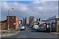
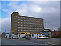
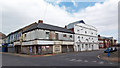
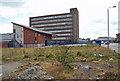
Area Overview for DN32 7DJ
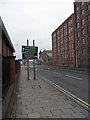
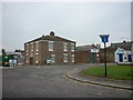
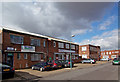
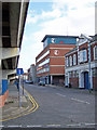
Photos of DN32 7DJ


Area Information
Living in DN32 7DJ means inhabiting a compact, densely populated residential cluster in England. The area covers just 1,772 square metres, yet it is home to 2,131 people, resulting in a population density of over 1.2 million per square kilometre. This high density suggests a tightly knit community, though the area’s small size means it is more of a micro-locale than a sprawling suburb. The postcode is characterised by a mix of housing types, though the data indicates a strong presence of single-family homes. Daily life here is likely shaped by proximity to local amenities and transport links, with schools and rail stations within reach. The area’s demographics, dominated by adults aged 30–64, suggest a mature population profile, which may influence the pace of life and local services. While the data does not specify cultural or social hubs, the presence of multiple schools and retail outlets hints at a functional, service-oriented environment. For those considering DN32 7DJ, the compact nature of the area means every resident is likely within walking distance of key facilities, though the high population density could impact personal space and community dynamics.
- Area Type
- Postcode
- Area Size
- 1772 m²
- Population
- 2131
- Population Density
- 3870 people/km²
The property market in DN32 7DJ is defined by a low home ownership rate of 15%, suggesting that the majority of properties are rented rather than owned. The accommodation type is predominantly houses, which implies a market skewed towards single-family homes rather than apartments or flats. This combination of low ownership and house-dominated stock may indicate a rental-focused area, possibly attracting tenants seeking larger living spaces. For buyers, this small postcode area offers limited scope for owner-occupied properties, with the surrounding region likely presenting similar dynamics. The compact size of DN32 7DJ means that property availability is constrained, and the high population density may contribute to competitive demand. Prospective buyers should consider the area’s limited home ownership as a potential indicator of market saturation, though the presence of houses may appeal to those prioritising space over investment potential.
House Prices in DN32 7DJ
Showing 1 properties
| Address | Type | Beds | Baths | Last Sale Price | Last Sale Date | |
|---|---|---|---|---|---|---|
| Health Centre, William Molson Centre, Kent Street, Grimsby, DN32 7DJ | commercial | - | - | - | - |
Energy Efficiency in DN32 7DJ
The lifestyle in DN32 7DJ is shaped by its proximity to retail and rail amenities. Nearby shops include Heron East, Iceland Grimsby, and Farmfoods East, offering convenience for daily errands and grocery needs. The rail network, with stations like Grimsby Docks and New Clee, provides access to broader regional transport links, supporting both commuting and leisure travel. While the data does not mention parks or recreational facilities, the presence of multiple schools and retail outlets suggests a focus on practicality over leisure. The compact nature of the area means amenities are within walking distance, fostering a sense of accessibility. However, the lack of detailed information on green spaces or cultural venues leaves room for uncertainty about recreational opportunities. For those prioritising convenience and connectivity, the area’s retail and rail infrastructure is a strength, but those seeking expansive leisure options may need to look beyond the immediate vicinity.
Amenities
Schools
Residents of DN32 7DJ have access to several primary and secondary schools, including Weelsby Primary School, Strand Infants’ School, and St Mary’s Catholic Primary School. For secondary education, Weelsby Academy and Saint Mary’s Catholic Voluntary Academy are both rated ‘good’ by Ofsted. This mix of primary and academy schools offers families a range of educational options, with the academies providing structured, possibly faith-based curricula. The presence of two ‘good’-rated secondary schools suggests a solid foundation for secondary education, though the data does not specify catchment areas or student performance. The concentration of schools within proximity indicates that the area is well-served for families, with multiple choices for both early and advanced education. However, the lack of diversity in school types—no independent or specialist institutions—is notable, which may influence decisions for parents seeking specific educational environments.
| Rank | School | Type | Entry gender | Ages |
|---|
Explore more schools in this area
Go to Schools tabDemographics
The community in DN32 7DJ is predominantly composed of adults aged 30–64, with a median age of 47. This suggests a mature population, likely with established careers and families. Home ownership is relatively low at 15%, indicating that most residents are renters rather than property owners. The accommodation type is primarily houses, which contrasts with the low home ownership rate, pointing to a rental market dominated by single-family homes. The predominant ethnic group is White, with no specific data provided on other demographics. The high population density—over 1.2 million people per square kilometre—means the area is intensely populated, which can influence local infrastructure and social interactions. For quality of life, this density may mean limited green space or privacy, though it also ensures proximity to services. The data does not indicate levels of deprivation, but the combination of high density and low home ownership may suggest economic pressures or a transient population.
Household Size
Accommodation Type
Tenure
Ethnic Group
Religion
Household Composition
Age
Household Deprivation
NS-SEC
Explore more demographic insights in this area
Go to Demographics tabPlanning
Planning Constraints
- Flood RiskPremium
- Ramsar Wetland SitesPremium
- Area of Outstanding Natural BeautyPremium
- Protected Nature ReservePremium
- Protected WoodlandPremium