Area Overview for DN3 2BW
Photos of DN3 2BW


Area Information
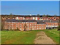
Living in DN3 2BW offers a quiet, residential lifestyle within a small cluster of homes. With a population of 1,652, this area is compact yet well-served by essential amenities. The community is primarily composed of adults aged 30–64, reflecting a mature demographic with strong family ties. Daily life here is shaped by proximity to local schools, rail links, and retail hubs. The area’s modest size fosters a close-knit environment, where residents are likely to know their neighbours. While it lacks the vibrancy of larger towns, DN3 2BW provides a stable, low-risk setting for homebuyers seeking affordability and practicality. The absence of major environmental constraints, such as protected woodlands or flood-prone zones, adds to its appeal. However, the medium crime risk score of 65 means standard security measures remain prudent. For those prioritising safety, connectivity, and a straightforward lifestyle, this postcode could be an attractive option.
- Area Type
- Postcode
- Area Size
- Not available
- Population
- 1652
- Population Density
- 3710 people/km²
DN3 2BW is a predominantly owner-occupied area, with 57% of homes owned by residents rather than rented. The housing stock is largely composed of houses, which contrasts with areas where flats or apartments dominate. This suggests a community prioritising family homes and long-term investment. Given the small population and limited land, the property market is likely tight, with limited scope for new developments. Buyers should consider that the area’s size means competition for available homes, particularly for those seeking larger properties. The focus on owner-occupation also implies stable prices and a lower turnover of properties. For those looking to move into the area, the existing stock of houses may offer a good balance of space and affordability, though buyers should be mindful of the small footprint of the postcode and its immediate surroundings.
House Prices in DN3 2BW
No properties found in this postcode.
Energy Efficiency in DN3 2BW
Residents of DN3 2BW benefit from a range of nearby amenities within practical reach. Retail options include Spar, Sainsburys Edenthorpe, and Morrisons Armthorpe, offering everyday shopping needs. The rail network provides access to multiple stations, facilitating travel to nearby towns and cities. The proximity to Robin Hood Doncaster Sheffield Airport adds convenience for regional travel. While the area lacks large parks or leisure facilities, the presence of schools, shops, and rail links ensures a functional daily life. The compact nature of the postcode means amenities are concentrated, reducing travel times. For those who value accessibility and practicality over sprawling leisure options, DN3 2BW provides a straightforward, well-connected lifestyle.
Amenities
Schools
Residents of DN3 2BW have access to two key educational institutions: Our Lady of Sorrows Catholic Primary School and Our Lady of Sorrows Catholic Voluntary Academy. Both are Catholic schools, offering a faith-based education for children from early years through to secondary level. The academy holds an Ofsted rating of ‘good’, indicating a satisfactory standard of teaching and outcomes. This mix of primary and secondary provision provides families with a seamless educational pathway, reducing the need for long commutes. The presence of a rated school is a significant advantage for parents, though the area’s small size means limited alternative options. For those prioritising school quality, this pairing offers a reliable foundation for children’s learning and development.
| Rank | School | Type | Entry gender | Ages |
|---|
Explore more schools in this area
Go to Schools tabDemographics
The residents of DN3 2BW are predominantly adults aged 30–64, with a median age of 47. This suggests a community focused on family life and long-term stability. Home ownership is strong, with 57% of properties occupied by owners, indicating a preference for settled living. The area is characterised by houses rather than flats, reflecting a traditional housing stock. The predominant ethnic group is White, though no specific data on diversity or deprivation levels is provided. The age profile and ownership rates suggest a mature, family-oriented population with established roots. This demographic structure likely influences local services, with schools and amenities tailored to adult and family needs. The absence of younger or older age groups may mean fewer childcare facilities or senior-focused amenities, but the area’s practicality and safety make it appealing to those seeking a balanced lifestyle.
Household Size
Accommodation Type
Tenure
Ethnic Group
Religion
Household Composition
Age
Household Deprivation
NS-SEC
Explore more demographic insights in this area
Go to Demographics tabPlanning
Planning Constraints
- Flood RiskPremium
- Ramsar Wetland SitesPremium
- Area of Outstanding Natural BeautyPremium
- Protected Nature ReservePremium
- Protected WoodlandPremium