Area Overview for DN3 1RH
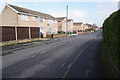
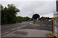
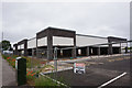
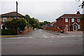
Photos of DN3 1RH


Area Information
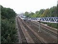
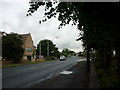
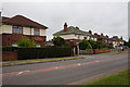
Living in DN3 1RH offers a quiet, tightly knit residential experience in a small cluster of homes. With a population of 1,923 spread across 456 people per square kilometre, the area feels intimate yet functional. The neighbourhood is characterised by its low-rise housing stock, reflecting a mature demographic with a median age of 47. Daily life here is shaped by proximity to essential services, including three primary schools, retail outlets, and rail links. The area’s small size means amenities are within practical reach, though it is not a sprawling suburb. Residents benefit from a low crime risk, with a safety score of 70, and no significant environmental constraints such as flood zones or protected landscapes. This makes DN3 1RH appealing for those seeking a stable, low-maintenance lifestyle without sacrificing access to transport or education. The presence of multiple railway stations and a nearby airport further enhances connectivity, supporting both local and regional mobility. For buyers, the area’s compact nature means property choices are limited, but the existing homes are well-established and largely owner-occupied.
- Area Type
- Postcode
- Area Size
- Not available
- Population
- 1923
- Population Density
- 456 people/km²
The property market in DN3 1RH is dominated by owner-occupied homes, with 84% of residents living in properties they own. The accommodation type is exclusively houses, which contrasts with areas where flats or apartments predominate. This suggests a market geared toward families or individuals preferring single-family homes. The small size of the area means the housing stock is limited, and buyers may need to consider nearby regions for more options. The high home ownership rate indicates a stable market with little rental activity, which can be advantageous for long-term investors but may limit short-term rental opportunities. Given the compact nature of the postcode, property values are likely influenced by proximity to schools, transport links, and local amenities. Buyers should note that the area’s small footprint means competition for available homes could be intense, particularly for those prioritising specific features such as garden space or proximity to rail networks.
House Prices in DN3 1RH
No properties found in this postcode.
Energy Efficiency in DN3 1RH
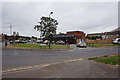
The lifestyle in DN3 1RH is shaped by its proximity to retail, dining, and transport hubs. Within the area, residents can access five retail outlets, including Aldi Doncaster, Co-op Kirk, and Tesco Doncaster, ensuring everyday shopping needs are met. The nearby railway stations offer access to broader leisure opportunities, while the Robin Hood Airport provides connections to regional airports. Though specific dining venues are not listed, the retail presence suggests a range of local services. The area’s compact nature means amenities are clustered, reducing the need for long commutes. The availability of multiple railway stations also supports social activities, from visiting nearby towns to attending cultural events. For those prioritising convenience, the balance of retail, transport, and low environmental constraints makes DN3 1RH a practical choice.
Amenities
Schools
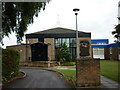
Residents of DN3 1RH have access to three primary schools within practical reach: Barnby Dun Primary School, Barnby Dun First School, and Barnby Dun Primary Academy. The latter holds an Ofsted rating of ‘good’, which is a clear indicator of quality for families prioritising educational standards. The presence of multiple primary schools suggests a focus on early education, catering to local children from nursery through to Year 6. While no secondary schools are listed, the proximity to nearby towns may provide additional options. The mix of school types allows parents to choose between different teaching approaches or facilities. However, the lack of specific data on school capacity or catchment areas means prospective buyers should investigate further to ensure their child’s needs are met. Overall, the availability of primary education is a strong point for families considering the area.
| Rank | School | Type | Entry gender | Ages |
|---|---|---|---|---|
| 1 | Barnby Dun Primary School | primary | N/A | N/A |
| 2 | Barnby Dun First School | primary | N/A | N/A |
| 3 | Barnby Dun Primary Academy | primary | N/A | N/A |
Explore more schools in this area
Go to Schools tabDemographics
The community in DN3 1RH is predominantly composed of adults aged 30–64, with a median age of 47. This suggests a mature, settled population, likely with established careers and families. Home ownership is high at 84%, indicating a strong preference for long-term residency over renting. The accommodation type is primarily houses, reflecting a suburban or semi-rural character rather than high-density living. The predominant ethnic group is White, which aligns with broader demographic trends in the region. While specific data on deprivation is not provided, the high home ownership rate and low crime score suggest a relatively stable quality of life. The absence of significant age groups such as teenagers or retirees implies a community focused on middle-aged households, possibly with children in primary education. This profile may appeal to buyers seeking a family-friendly environment with minimal turnover.
Household Size
Accommodation Type
Tenure
Ethnic Group
Religion
Household Composition
Age
Household Deprivation
NS-SEC
Explore more demographic insights in this area
Go to Demographics tabPlanning
Planning Constraints
- Flood RiskPremium
- Ramsar Wetland SitesPremium
- Area of Outstanding Natural BeautyPremium
- Protected Nature ReservePremium
- Protected WoodlandPremium
- Crime RiskPremium