Area Overview for DN3 1NG
Photos of DN3 1NG
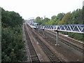

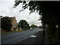
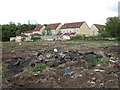

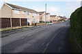

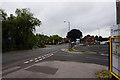
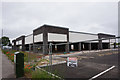
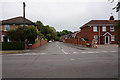
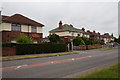
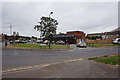
30 photos from this area
Area Information
Key information about the DN3 1NG including its size, population, and administrative classification.
- Area Type
- Postcode
- Area Size
- 1.6 hectares
- Population
- 1394
- Population Density
- 638 people/km²
House Prices in DN3 1NG
36
Properties
£140,966
Average Sold Price
£43,000
Lowest Price
£200,000
Highest Price
Showing 36 properties
| Address | Type | Beds | Baths | Last Sale Price | Last Sale Date | |
|---|---|---|---|---|---|---|
| 24 Lancaster Avenue, Kirk Sandall, Doncaster, DN3 1NG | house | - | - | £165,000 | Mar 2023 | |
| 52 Lancaster Avenue, Kirk Sandall, Doncaster, DN3 1NG | house | - | - | £200,000 | Jun 2021 | |
| 20 Lancaster Avenue, Kirk Sandall, Doncaster, DN3 1NG | house | - | - | £193,000 | Nov 2020 | |
| 38 Lancaster Avenue, Kirk Sandall, Doncaster, DN3 1NG | Semi-detached | 3 | - | £175,000 | Oct 2020 | |
| 66 Lancaster Avenue, Kirk Sandall, Doncaster, DN3 1NG | house | - | - | £185,000 | Nov 2019 | |
| 32 Lancaster Avenue, Kirk Sandall, Doncaster, DN3 1NG | Semi-detached | 4 | 1 | £175,000 | Oct 2019 | |
| 30 Lancaster Avenue, Kirk Sandall, Doncaster, DN3 1NG | house | - | - | £170,000 | Aug 2019 | |
| 70 Lancaster Avenue, Kirk Sandall, Doncaster, DN3 1NG | house | - | - | £100,000 | Aug 2018 | |
| 68 Lancaster Avenue, Kirk Sandall, Doncaster, DN3 1NG | Terraced | 3 | 1 | £159,750 | Nov 2017 | |
| 26 Lancaster Avenue, Kirk Sandall, Doncaster, DN3 1NG | house | - | - | £161,000 | May 2017 |
Page 1 of 4
Energy Efficiency in DN3 1NG
Amenities
Schools
| Rank | School | Type | Entry gender | Ages |
|---|
Explore more schools in this area
Go to Schools tabDemographics
Household Size
Family (3-5 people)
most common
Accommodation Type
Houses
most common
Tenure
86
majority
Ethnic Group
White
most common
Religion
N/A
most common
Household Composition
N/A
most common
Age
47
median
Adults (30-64 years)
most common
Household Deprivation
N/A
with no deprivation
NS-SEC
31
in Lower managerial occupations
Explore more demographic insights in this area
Go to Demographics tabPlanning
Planning Constraints
- Flood RiskPremium
- Ramsar Wetland SitesPremium
- Area of Outstanding Natural BeautyPremium
- Protected Nature ReservePremium
- Protected WoodlandPremium