Area Overview for DN21 4DL
Photos of DN21 4DL
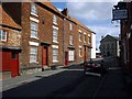

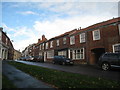


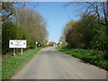

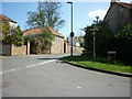
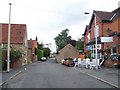


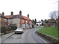
76 photos from this area
Area Information
Key information about the DN21 4DL including its size, population, and administrative classification.
- Area Type
- Postcode
- Area Size
- 3.5 hectares
- Population
- 1562
- Population Density
- 62 people/km²
House Prices in DN21 4DL
49
Properties
£90,365
Average Sold Price
£15,910
Lowest Price
£315,000
Highest Price
Showing 49 properties
| Address | Type | Beds | Baths | Last Sale Price | Last Sale Date | |
|---|---|---|---|---|---|---|
| 36 Dunstan Villas, Kirton In Lindsey, DN21 4DL | Terraced | 3 | 1 | £141,500 | Jun 2025 | |
| 15 Dunstan Villas, Kirton In Lindsey, DN21 4DL | Terraced | 3 | 1 | £122,500 | Mar 2025 | |
| Primula Cottage, 51 Dunstan Villas, Kirton In Lindsey, DN21 4DL | house | 4 | 2 | £315,000 | Mar 2025 | |
| 12 Dunstan Villas, Kirton In Lindsey, DN21 4DL | house | 2 | 1 | £120,000 | Dec 2024 | |
| 23 Dunstan Villas, Kirton In Lindsey, DN21 4DL | house | 3 | - | £140,000 | Apr 2023 | |
| 14 Dunstan Villas, Kirton In Lindsey, DN21 4DL | house | 3 | - | £104,000 | Apr 2022 | |
| 53 Dunstan Villas, Kirton In Lindsey, DN21 4DL | Semi-detached | 3 | 2 | £154,950 | Aug 2018 | |
| 3 Dunstan Villas, Kirton In Lindsey, DN21 4DL | house | - | - | £75,000 | Apr 2015 | |
| 43 Dunstan Villas, Kirton In Lindsey, DN21 4DL | house | 2 | 1 | £91,000 | Jun 2014 | |
| 4 Dunstan Villas, Kirton In Lindsey, DN21 4DL | house | - | - | £70,000 | May 2011 |
Page 1 of 5
Energy Efficiency in DN21 4DL
Amenities
Schools
| Rank | School | Type | Entry gender | Ages |
|---|
Explore more schools in this area
Go to Schools tabDemographics
Household Size
Two person
most common
Accommodation Type
Houses
most common
Tenure
70
majority
Ethnic Group
White
most common
Religion
N/A
most common
Household Composition
N/A
most common
Age
47
median
Adults (30-64 years)
most common
Household Deprivation
N/A
with no deprivation
NS-SEC
31
in Lower managerial occupations
Explore more demographic insights in this area
Go to Demographics tabPlanning
Planning Constraints
- Flood RiskPremium
- Ramsar Wetland SitesPremium
- Area of Outstanding Natural BeautyPremium
- Protected Nature ReservePremium
- Protected WoodlandPremium