Area Overview for DN20 8QG
Photos of DN20 8QG
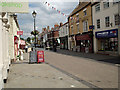
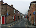
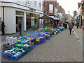
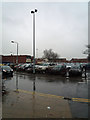


100 photos from this area
Area Information
Key information about the DN20 8QG including its size, population, and administrative classification.
- Area Type
- Postcode
- Area Size
- 6914 m²
- Population
- 2000
- Population Density
- 1789 people/km²
House Prices in DN20 8QG
27
Properties
£82,787
Average Sold Price
£5,000
Lowest Price
£141,500
Highest Price
Showing 27 properties
| Address | Type | Beds | Baths | Last Sale Price | Last Sale Date | |
|---|---|---|---|---|---|---|
| 45 Glebe Road, Brigg, DN20 8QG | Terraced | 2 | 1 | £107,500 | Sep 2025 | |
| 40 Glebe Road, Brigg, DN20 8QG | Terraced | 3 | 1 | £130,000 | Dec 2024 | |
| 26 Glebe Road, Brigg, DN20 8QG | house | - | - | £85,000 | Dec 2023 | |
| 32 Glebe Road, Brigg, DN20 8QG | Terraced | 2 | 1 | £82,500 | Jun 2023 | |
| 38 Glebe Road, Brigg, DN20 8QG | Terraced | 3 | 1 | £119,000 | Apr 2023 | |
| 25 Glebe Road, Brigg, DN20 8QG | Terraced | 2 | 1 | £141,500 | Oct 2022 | |
| 42 Glebe Road, Brigg, DN20 8QG | Terraced | 3 | 1 | £125,000 | Apr 2022 | |
| 35 Glebe Road, Brigg, DN20 8QG | Terraced | 3 | 1 | £90,000 | Nov 2021 | |
| 30 Glebe Road, Brigg, DN20 8QG | Terraced | 3 | 1 | £100,000 | Feb 2021 | |
| 37 Glebe Road, Brigg, DN20 8QG | Terraced | 3 | 1 | £95,000 | Sep 2020 |
Page 1 of 3
Energy Efficiency in DN20 8QG
Amenities
Schools
| Rank | School | Type | Entry gender | Ages |
|---|
Explore more schools in this area
Go to Schools tabDemographics
Household Size
Two person
most common
Accommodation Type
Houses
most common
Tenure
59
majority
Ethnic Group
White
most common
Religion
N/A
most common
Household Composition
N/A
most common
Age
47
median
Adults (30-64 years)
most common
Household Deprivation
N/A
with no deprivation
NS-SEC
22
in Lower managerial occupations
Explore more demographic insights in this area
Go to Demographics tabPlanning
Planning Constraints
- Flood RiskPremium
- Ramsar Wetland SitesPremium
- Area of Outstanding Natural BeautyPremium
- Protected Nature ReservePremium
- Protected WoodlandPremium