Area Overview for DN20 8LE
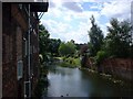
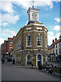
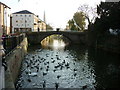
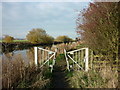
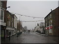
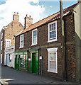
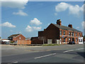
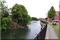
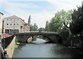
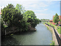
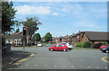
Photos of DN20 8LE

Area Information
DN20 8LE is a small residential postcode in England, home to around 1,700 people spread across a densely populated area with 1,337 residents per square kilometre. This compact cluster is defined by its proximity to essential services and transport links, making it a practical choice for those seeking a balance between convenience and community. The area’s demographic profile suggests a mature population, with a median age of 47 and a strong presence of adults aged 30–64. Daily life here is shaped by its location, which offers access to nearby schools, retail hubs, and rail networks. While the area is not expansive, its strategic placement near Brigg Railway Station and Humberside Airport ensures connectivity to larger towns and cities. For residents, this means a lifestyle that combines local amenities with broader regional opportunities, though the small scale of the area means community dynamics are tightly knit.
- Area Type
- Postcode
- Area Size
- Not available
- Population
- 1700
- Population Density
- 1337 people/km²
The property market in DN20 8LE is characterised by a 47% home ownership rate, suggesting that nearly half of the properties are rented. This implies a rental market that may cater to both long-term tenants and those seeking temporary housing. The accommodation type is predominantly houses, which is unusual for areas with high population density. This mix of house-based housing stock may appeal to families or individuals preferring standalone properties over flats. However, the small size of the area means the housing stock is limited, and buyers may need to consider nearby regions for more options. The market’s reliance on houses could also mean higher property values relative to rental yields, though specific price data is not available. For buyers, this suggests a focus on properties that meet the needs of established households rather than younger, transient populations.
House Prices in DN20 8LE
No properties found in this postcode.
Energy Efficiency in DN20 8LE
The lifestyle in DN20 8LE is shaped by its proximity to retail, transport, and travel hubs. Within the area, residents can access five notable retail outlets, including Tesco Brigg, Morrisons Daily, and Lidl Brigg, ensuring everyday shopping needs are met. The three nearby railway stations—Brigg, Barnetby, and Kirton Lindsey—offer regular connections to surrounding areas, while Humberside Airport provides access to national and international destinations. This combination of retail and transport options supports a practical lifestyle, allowing residents to balance local convenience with broader connectivity. While the area lacks expansive parks or leisure facilities, its compact size means amenities are easily reachable on foot or by car. The presence of schools and shops reinforces a community-focused environment, though the absence of larger recreational spaces may be a limitation for some.
Amenities
Schools
Residents of DN20 8LE have access to two distinct educational institutions. Brigg Preparatory School is an independent school, offering a private education option for families seeking alternative schooling. Nearby, Hestia School is a special school with an Ofsted rating of satisfactory, providing tailored support for students with specific needs. This combination of school types means families can choose between independent education or state-funded special provisions. The presence of Hestia School highlights the area’s suitability for households with children requiring specialist support, while Brigg Preparatory School caters to those preferring a private curriculum. However, the absence of mainstream state schools in the immediate vicinity may require families to commute for broader educational options.
| Rank | School | Type | Entry gender | Ages |
|---|
Explore more schools in this area
Go to Schools tabDemographics
The population of DN20 8LE is predominantly composed of adults aged 30–64, reflecting a mature demographic with a median age of 47. Home ownership stands at 47%, indicating a mix of owner-occupied properties and rental units. The accommodation type is primarily houses, which aligns with the area’s residential character. The predominant ethnic group is White, though specific data on diversity or deprivation is not provided. The age profile suggests a community with established households, potentially influencing local services and amenities. With a population density of 1,337 people per square kilometre, the area is compact, which may impact the availability of larger properties or open spaces. This density also means that social interactions and community engagement are likely to be frequent, though the small size may limit options for those seeking more expansive living environments.
Household Size
Accommodation Type
Tenure
Ethnic Group
Religion
Household Composition
Age
Household Deprivation
NS-SEC
Explore more demographic insights in this area
Go to Demographics tabPlanning
Planning Constraints
- Flood RiskPremium
- Ramsar Wetland SitesPremium
- Area of Outstanding Natural BeautyPremium
- Protected Nature ReservePremium
- Protected WoodlandPremium