Area Overview for DN20 8FH
Photos of DN20 8FH


Area Information
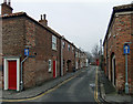
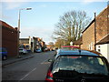
Living in DN20 8FH means being part of a small, tightly knit residential cluster in England with a population of 1,688. The area is characterised by its stability, with 85% of residents owning their homes. Most properties are houses, reflecting a community that prioritises family living. The median age of 47 suggests a mature demographic, with the majority of residents falling between 30 and 64 years old. This makes DN20 8FH a place where established families and long-term residents predominate. Daily life here is shaped by proximity to essential services, including retail outlets, railway stations, and two airports. The area’s low crime risk, with a safety score of 83, adds to its appeal as a secure environment. While the postcode covers a limited geographical footprint, its amenities and infrastructure cater to both practical needs and convenience. For those seeking a balance between quiet living and accessibility, DN20 8FH offers a straightforward, no-frills lifestyle with minimal environmental constraints.
- Area Type
- Postcode
- Area Size
- Not available
- Population
- 1688
- Population Density
- 1722 people/km²
The property market in DN20 8FH is dominated by owner-occupied homes, with 85% of residents owning their properties. This high rate of home ownership suggests a stable, long-term community with limited rental activity. The accommodation type is exclusively houses, which are likely to be family homes given the area’s demographic profile. This makes DN20 8FH an attractive option for buyers seeking a traditional, low-density living environment. However, the small size of the postcode means the housing stock is limited, and the immediate surroundings may offer more variety. For investors, the market is not rental-focused, which could affect returns. Buyers should consider the area’s practicality for daily life, with proximity to retail and transport, rather than speculative growth potential.
House Prices in DN20 8FH
No properties found in this postcode.
Energy Efficiency in DN20 8FH
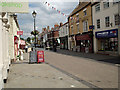
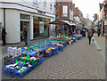
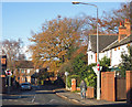
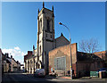
The lifestyle in DN20 8FH is shaped by its proximity to essential amenities. Retail options include Morrisons Daily, Tesco Brigg, and Lidl Brigg, offering everyday shopping convenience. Two railway stations—Brigg and Barnetby—provide access to broader transport networks, while Humberside Airport is within reach for those needing travel connections. The area’s small size means these amenities are within practical walking or driving distance, enhancing daily convenience. While there is no mention of parks or leisure facilities in the data, the absence of environmental constraints like protected woodlands or AONB designations suggests space for local recreation. The mix of retail, transport, and travel options supports a practical, low-maintenance lifestyle, ideal for those prioritising accessibility over urban amenities.
Amenities
Schools
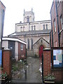
The schools near DN20 8FH include Sir John Nelthorpe School, a primary school with a good Ofsted rating, and The Brigg Sixth Form College, which specialises in post-16 education. Robert Holme Academy, a special needs school, has an inadequate Ofsted rating. This mix of school types provides options for families at different stages of education, though the inadequate rating at Robert Holme Academy may raise concerns. The presence of a primary school and sixth-form college suggests that the area supports children’s education from early years through to higher studies. However, the lack of a secondary school within the postcode means families may need to travel for middle schooling. The quality of education varies, with some institutions performing well and others requiring improvement.
| Rank | School | Type | Entry gender | Ages |
|---|
Explore more schools in this area
Go to Schools tabDemographics
The community in DN20 8FH is predominantly composed of adults aged 30 to 64, with a median age of 47. This suggests a population that is largely settled, with few young families or elderly residents. Home ownership is high, at 85%, indicating a stable housing market where most residents have long-term ties to the area. The accommodation type is primarily houses, which aligns with the demographic profile of older, family-oriented households. The predominant ethnic group is White, though the data does not specify further diversity metrics. The absence of detailed deprivation data means that quality of life is inferred from the low crime risk and robust digital connectivity. With no significant environmental constraints, the area appears to support a lifestyle that prioritises security and convenience over urban vibrancy.
Household Size
Accommodation Type
Tenure
Ethnic Group
Religion
Household Composition
Age
Household Deprivation
NS-SEC
Explore more demographic insights in this area
Go to Demographics tabPlanning
Planning Constraints
- Flood RiskPremium
- Ramsar Wetland SitesPremium
- Area of Outstanding Natural BeautyPremium
- Protected Nature ReservePremium
- Protected WoodlandPremium