Area Overview for DN20 8ET
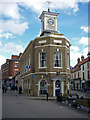
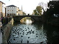
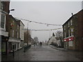
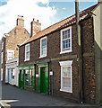
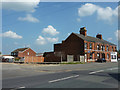
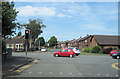
Photos of DN20 8ET


Area Information
DN20 8ET is a compact residential postcode in England, home to around 1,700 people. Its high population density of 1,337 people per square kilometre suggests a tightly knit community, though the area remains small enough to feel intimate. This is a place where daily life revolves around local amenities and nearby transport links. The postcode’s proximity to Brigg Railway Station and Barnetby Railway Station makes it accessible for commuters, while Humberside Airport offers regional travel options. The area’s character is shaped by its mix of housing stock and the presence of schools like Brigg Preparatory School, which cater to families. While the population is relatively small, the density means residents are likely to know their neighbours. The area is not defined by sprawling development but by its practical, residential focus, with shops and services within practical reach. For those seeking a quiet, community-oriented setting with good connectivity, DN20 8ET offers a blend of convenience and proximity to essential services.
- Area Type
- Postcode
- Area Size
- Not available
- Population
- 1700
- Population Density
- 1337 people/km²
DN20 8ET is a small area with a housing stock that is predominantly composed of houses. With home ownership at 47%, the market appears to be more rental-focused than owner-occupied, which may affect property values and availability. The low number of properties means the market is limited in scale, and buyers should consider the area’s small size when evaluating options. The presence of houses suggests a preference for private, detached living, though the high population density indicates that properties are likely to be closely spaced. For those seeking a home in this postcode, the market is niche, with limited scope for expansion. Buyers should also consider the area’s proximity to amenities and transport links, which may make it attractive to those prioritising convenience over space.
House Prices in DN20 8ET
No properties found in this postcode.
Energy Efficiency in DN20 8ET
The lifestyle in DN20 8ET is shaped by its proximity to practical amenities. Within reach are five retail outlets, including Tesco Brigg, Morrisons Daily, and Lidl Brigg, offering everyday shopping needs. The area’s rail stations connect residents to broader networks, while Humberside Airport provides regional travel options. Though the postcode is small, these amenities contribute to a convenient, self-contained lifestyle. The presence of multiple shops suggests a focus on accessibility, allowing residents to manage daily errands without long journeys. For leisure, the area’s limited size means activities are likely centred on local services and nearby towns. The combination of retail, transport, and travel options ensures a balance between practicality and connectivity for residents.
Amenities
Schools
Near DN20 8ET are two schools: Brigg Preparatory School, an independent institution, and Hestia School, a special school with an Ofsted rating of satisfactory. The presence of both independent and special schools offers families a choice between private education and specialist support for children with specific needs. Brigg Preparatory School likely caters to younger students, while Hestia School provides tailored education for those requiring additional resources. The Ofsted rating for Hestia School indicates it meets basic standards but does not highlight exceptional performance. For families prioritising independent schooling, Brigg Preparatory School may be a key draw, while those needing special education support will find Hestia School accessible. The combination of school types reflects a community with varied educational needs.
| Rank | School | Type | Entry gender | Ages |
|---|
Explore more schools in this area
Go to Schools tabDemographics
The median age in DN20 8ET is 47, with the majority of residents aged between 30 and 64. This suggests a population skewed towards middle-aged adults, likely including professionals and families. Home ownership stands at 47%, which is below the national average, indicating that rental properties may be more common. The accommodation type is predominantly houses, which is unusual in areas with high density but aligns with the postcode’s small, residential nature. The predominant ethnic group is White, though no specific data on diversity or deprivation is provided. The age profile implies a stable community with fewer young children or retirees, which may influence local services and amenities. For buyers, this demographic suggests a market where properties are likely to be occupied by long-term residents rather than short-term renters.
Household Size
Accommodation Type
Tenure
Ethnic Group
Religion
Household Composition
Age
Household Deprivation
NS-SEC
Explore more demographic insights in this area
Go to Demographics tabPlanning
Planning Constraints
- Flood RiskPremium
- Ramsar Wetland SitesPremium
- Area of Outstanding Natural BeautyPremium
- Protected Nature ReservePremium
- Protected WoodlandPremium