Area Overview for DN20 8BB
Photos of DN20 8BB


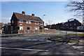
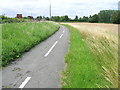
22 photos from this area
Area Information
Key information about the DN20 8BB including its size, population, and administrative classification.
- Area Type
- Postcode
- Area Size
- 7.7 hectares
- Population
- 2000
- Population Density
- 1789 people/km²
House Prices in DN20 8BB
19
Properties
£120,467
Average Sold Price
£37,250
Lowest Price
£225,000
Highest Price
Showing 19 properties
| Address | Type | Beds | Baths | Last Sale Price | Last Sale Date | |
|---|---|---|---|---|---|---|
| 114 Grammar School Road, Brigg, DN20 8BB | Semi-detached | 3 | 1 | £144,000 | Jan 2023 | |
| Kestrels, Grammar School Road, Brigg, DN20 8BB | Bungalow | 3 | 2 | £225,000 | Mar 2022 | |
| Kei Vi Lyn, Grammar School Road, Brigg, DN20 8BB | house | - | - | £186,000 | Dec 2015 | |
| 110 Grammar School Road, Brigg, DN20 8BB | house | 3 | 1 | £82,000 | Nov 2015 | |
| 108 Grammar School Road, Brigg, DN20 8BB | Semi-detached | 3 | - | £131,000 | Aug 2015 | |
| 112 Grammar School Road, Brigg, DN20 8BB | house | - | - | £92,000 | Aug 2012 | |
| 116 Grammar School Road, Brigg, DN20 8BB | house | - | - | £135,000 | Aug 2007 | |
| 100 Grammar School Road, Brigg, DN20 8BB | house | - | - | £51,950 | Aug 1998 | |
| 104 Grammar School Road, Brigg, DN20 8BB | Terraced | - | - | £37,250 | Sep 1996 | |
| Humberside Independent Care, The Birches Care Home, Grammar School Road, Brigg, DN20 8BB | Terraced | 3 | 2 | - | - |
Page 1 of 2
Energy Efficiency in DN20 8BB
Amenities
Schools
| Rank | School | Type | Entry gender | Ages |
|---|
Explore more schools in this area
Go to Schools tabDemographics
Household Size
Two person
most common
Accommodation Type
Houses
most common
Tenure
59
majority
Ethnic Group
White
most common
Religion
N/A
most common
Household Composition
N/A
most common
Age
47
median
Adults (30-64 years)
most common
Household Deprivation
N/A
with no deprivation
NS-SEC
22
in Lower managerial occupations
Explore more demographic insights in this area
Go to Demographics tabPlanning
Planning Constraints
- Flood RiskPremium
- Ramsar Wetland SitesPremium
- Area of Outstanding Natural BeautyPremium
- Protected Nature ReservePremium
- Protected WoodlandPremium