Area Overview for DN20 0WZ
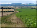
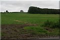
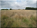
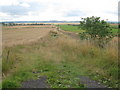
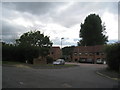
Photos of DN20 0WZ


Area Information
Living in DN20 0WZ offers a quiet, residential experience shaped by its small-scale character. With a population of 1,218 spread across 34 people per square kilometre, the area feels intimate, avoiding the density of larger towns. The community is predominantly composed of adults aged 30–64, reflecting a mature demographic that prioritises stability. Home ownership is high at 76%, with most properties being houses rather than flats, suggesting a focus on family-friendly living. Daily life here is defined by proximity to local amenities, including shops, rail links, and a nearby airport, while the low population density ensures a slower pace. The area’s safety profile is strong, with a crime risk score of 92, indicating a secure environment. Though small, DN20 0WZ balances practicality with a sense of community, making it appealing to those seeking a peaceful, well-connected home without the pressures of urban living.
- Area Type
- Postcode
- Area Size
- Not available
- Population
- 1218
- Population Density
- 34 people/km²
The property market in DN20 0WZ is characterised by high home ownership (76%) and a predominance of houses over flats, indicating a market skewed towards owner-occupation rather than rental demand. This suggests a community of long-term residents who value stability and space. The small population and low density mean the housing stock is limited in scale, with properties likely to be family homes rather than speculative investments. Buyers should consider the area’s size and the fact that new developments are unlikely to significantly alter the existing stock. The focus on houses also implies that properties may be larger and more suited to those prioritising privacy and garden space. For those seeking a quiet, established home, DN20 0WZ offers a niche market with limited competition but potential for strong community ties.
House Prices in DN20 0WZ
No properties found in this postcode.
Energy Efficiency in DN20 0WZ
Residents of DN20 0WZ have access to a modest but functional selection of amenities. The area includes five retail outlets, such as Asda Barton-Upon, Lidl Barton-upon, and the Lincolnshire Co-operative Co, providing everyday shopping and grocery needs. Three rail stations—Barnetby, Brigg, and Barton—offer regional connectivity, while Humberside Airport is within reach for travel. Though the data does not mention parks or leisure facilities, the presence of retail and transport options suggests a practical lifestyle focused on convenience. The small size of the area means amenities are closely grouped, reducing travel time for essentials. For those prioritising accessibility over leisure, DN20 0WZ delivers a straightforward, no-frills approach to daily living.
Amenities
Schools
Residents of DN20 0WZ have access to two schools: Worlaby Primary School, which provides early education, and Worlaby Academy, an academy with a ‘good’ Ofsted rating. The presence of both a primary school and an academy offers families a range of educational options, from foundational learning to secondary education. The academy’s rating suggests a standard of teaching that meets national benchmarks, though no specific data on student outcomes or facilities is available. For parents, this mix of school types ensures continuity in their children’s education, reducing the need to travel far for schooling. The proximity of these institutions to homes in the area reinforces DN20 0WZ’s appeal as a family-friendly location, where education is accessible without compromising the quiet, residential character of the neighbourhood.
| Rank | School | Type | Entry gender | Ages |
|---|
Explore more schools in this area
Go to Schools tabDemographics
The population of DN20 0WZ is 1,218, with a median age of 47, indicating a mature community where most residents are between 30 and 64 years old. Home ownership is high, at 76%, reflecting a preference for long-term residency over rental properties. The area is predominantly composed of houses, aligning with the age profile of established families. The predominant ethnic group is White, with no data provided on other demographics. The low population density of 34 people per square kilometre suggests spacious living conditions, though this does not directly correlate with deprivation levels. For residents, this profile implies a stable, low-maintenance lifestyle with limited pressure from transient populations or high turnover. The community’s age range and ownership patterns suggest a focus on comfort and continuity rather than rapid development.
Household Size
Accommodation Type
Tenure
Ethnic Group
Religion
Household Composition
Age
Household Deprivation
NS-SEC
Explore more demographic insights in this area
Go to Demographics tabPlanning
Planning Constraints
- Flood RiskPremium
- Ramsar Wetland SitesPremium
- Area of Outstanding Natural BeautyPremium
- Protected Nature ReservePremium
- Protected WoodlandPremium