Area Overview for DN20 0WQ
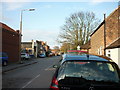
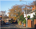
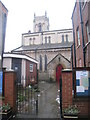
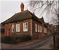
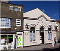
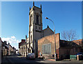
Photos of DN20 0WQ


Area Information
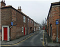
Living in DN20 0WQ means inhabiting a compact, residential postcode area with a population of 1700 people, spread across a densely populated landscape of 1337 people per square kilometre. This small cluster of homes is defined by its proximity to essential services and a mix of local amenities. The area is home to a mature demographic, with a median age of 47 and a strong presence of adults aged 30–64. Daily life here is shaped by the balance of practicality and accessibility, with nearby schools, retail hubs, and rail links within reach. The broadband connectivity score of 96 and mobile coverage of 82 ensure reliable digital access, supporting both remote work and everyday internet use. While the area lacks natural beauty designations or protected landscapes, it offers a straightforward, no-frills living environment. Residents benefit from a tightly knit community, though the high crime risk score of 29 highlights the need for vigilance. For those prioritising convenience over scenic surroundings, DN20 0WQ provides a functional base with minimal environmental constraints.
- Area Type
- Postcode
- Area Size
- Not available
- Population
- 1700
- Population Density
- 1337 people/km²
The property market in DN20 0WQ reflects a mix of ownership and rental activity, with 47% of homes owned by residents. This suggests a significant portion of the housing stock is available for rent, potentially attracting a range of buyers and renters. The accommodation type is primarily houses, which is unusual for a small postcode area but may indicate a focus on family homes or larger properties. This could make the area appealing to buyers seeking space, though the limited size of the postcode means the housing stock is unlikely to be vast. For those considering purchase, the market’s small scale means competition may be limited, but the predominance of houses could affect availability. Buyers should also consider the area’s practical amenities and the need for security measures, given the high crime risk. The property landscape here is straightforward: a small cluster of homes, mostly owner-occupied, with a rental market that complements it.
House Prices in DN20 0WQ
No properties found in this postcode.
Energy Efficiency in DN20 0WQ
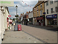
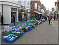
The lifestyle in DN20 0WQ is shaped by its proximity to retail, transport, and travel hubs. Within practical reach are five retail outlets, including Morrisons Daily, Tesco Brigg, and Lidl Brigg, ensuring everyday shopping needs are met. The area’s two railway stations—Brigg and Barnetby—provide access to regional travel, while Humberside Airport offers flight connections. Though there is no mention of parks or leisure facilities, the retail and transport options contribute to a convenient, functional lifestyle. The compact nature of the postcode means amenities are concentrated, reducing the need for long commutes. For residents prioritising accessibility over expansive recreational spaces, the area’s practical layout and nearby services offer a straightforward, no-nonsense approach to daily living.
Amenities
Schools
Near DN20 0WQ are two schools: Brigg Preparatory School, an independent institution, and Hestia School, a special needs school with an Ofsted rating of satisfactory. The presence of an independent school offers families access to fee-paying education, which may be desirable for those prioritising private schooling. Hestia School caters to students with specific educational needs, providing a tailored environment. Together, these schools create a diverse educational landscape, though the Ofsted rating for Hestia suggests room for improvement. Families seeking a range of options may find this mix adequate, but the absence of other school types, such as state comprehensive schools, could be a limitation. The proximity of these institutions to the area makes them practical choices for local residents, though parents should consider the ratings and facilities before enrolling children.
| Rank | School | Type | Entry gender | Ages |
|---|---|---|---|---|
| 1 | Brigg Preparatory School | independent | N/A | N/A |
| 2 | Hestia School | special | N/A | N/A |
Explore more schools in this area
Go to Schools tabDemographics
The community in DN20 0WQ is predominantly composed of adults aged 30–64, with a median age of 47. This suggests a mature population, likely with established careers and families. Home ownership stands at 47%, indicating that just under half of residents live in properties they own, while the remainder may be renters or leaseholders. The accommodation type is primarily houses, which aligns with the area’s lower population density and the typical footprint of residential properties in such postcode clusters. The predominant ethnic group is White, though no specific data on diversity or minority representation is provided. The age profile and housing stock suggest a stable, long-term resident base, with fewer transient populations. The lack of specific deprivation data means the area’s quality of life cannot be fully assessed, but the mix of ownership and rental properties hints at a balanced but modest economic profile.
Household Size
Accommodation Type
Tenure
Ethnic Group
Religion
Household Composition
Age
Household Deprivation
NS-SEC
Explore more demographic insights in this area
Go to Demographics tabPlanning
Planning Constraints
- Flood RiskPremium
- Ramsar Wetland SitesPremium
- Area of Outstanding Natural BeautyPremium
- Protected Nature ReservePremium
- Protected WoodlandPremium
- Crime RiskPremium