Area Overview for DN2 4SY
Photos of DN2 4SY


Area Information
Living in DN2 4SY means being part of a compact, residential cluster in England with a population of 1,636 people spread over a densely populated area. The postcode covers a small but well-defined community, where the average density of 1,111 people per square kilometre reflects a mix of established homes and local amenities. Daily life here is shaped by proximity to essential services, including multiple schools, rail links, and retail options. The area’s broadband connectivity is rated 100, offering excellent internet speeds, while mobile coverage scores 84, which is good for most needs. However, the area’s safety profile includes a critical note: crime risk is high, with a score of 19, meaning residents should consider enhanced security measures. Despite this, DN2 4SY remains a practical choice for those prioritising accessibility to transport hubs like Doncaster Railway Station and the nearby Robin Hood Doncaster Sheffield Airport. The community’s character is defined by its mature age profile and a focus on owner-occupied homes, making it a stable but distinct postcode in the region.
- Area Type
- Postcode
- Area Size
- Not available
- Population
- 1636
- Population Density
- 1111 people/km²
The property market in DN2 4SY is characterised by a high rate of home ownership—61% of residents own their homes. This suggests a stable, long-term market where properties are more likely to be owner-occupied rather than rented out. The accommodation type is predominantly houses, which is unusual for a small postcode area but may indicate a mix of larger residential plots or semi-detached homes. This housing stock may appeal to families or individuals seeking more space, though the small size of the area means buyers should consider nearby suburbs for additional options. The focus on owner-occupation implies that properties may hold value over time, but the high crime risk could influence perceptions of safety and desirability. For buyers, the challenge lies in balancing the area’s practical advantages—such as proximity to rail links and schools—with the need for security and community stability.
House Prices in DN2 4SY
No properties found in this postcode.
Energy Efficiency in DN2 4SY
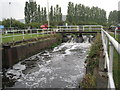
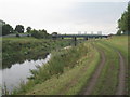
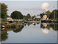
The lifestyle in DN2 4SY is shaped by its proximity to retail, transport, and community hubs. Local shops include Co-op EGMF, Iceland Thorne RP, and Lidl Intake, providing access to groceries and everyday essentials. These stores cater to the needs of a small but active population, reducing the need for long journeys to larger centres. The area’s rail stations offer convenient access to Doncaster and beyond, while the Robin Hood Doncaster Sheffield Airport provides regional flight connections. Though there is no mention of parks or leisure facilities in the data, the presence of multiple schools and community centres suggests a focus on family-oriented amenities. The compact nature of the postcode means residents can access these services without significant travel, though the lack of specific leisure venues may require trips to nearby towns for recreation. Overall, the area balances practicality with accessibility, though its small size limits diversity in amenities.
Amenities
Schools
Residents of DN2 4SY have access to a range of educational institutions, including primary schools and other facilities. The Doncaster St Aidan’s CofE Primary and Nursery School and St George’s CofE First School provide early education options, while Curlew Middle School caters to older primary students. The Long Sandall Centre and Nexus Centre are listed as other educational or community hubs, though their specific roles are not detailed. The mix of school types suggests a comprehensive educational offering for families, covering early years through to middle school. However, the absence of secondary schools in the immediate area may require families to look further afield for high school options. The presence of multiple primary schools could ease competition for places, but parents should verify admissions policies and transport links to ensure accessibility for their children.
| Rank | School | Type | Entry gender | Ages |
|---|
Explore more schools in this area
Go to Schools tabDemographics
The community in DN2 4SY is predominantly composed of adults aged 30–64, with a median age of 47. This suggests a mature, established population, likely with strong ties to local institutions and a focus on long-term residency. Home ownership is high, at 61%, indicating a stable housing market where most residents live in their own homes rather than renting. The accommodation type is primarily houses, which aligns with the area’s low population density and suggests a suburban or semi-rural character. The predominant ethnic group is White, reflecting a homogenous demographic profile. While the data does not specify deprivation levels, the high home ownership and age range imply a relatively stable economic environment. However, the high crime risk score of 19 suggests that safety could be a concern for potential residents, particularly for families or those seeking a low-risk environment.
Household Size
Accommodation Type
Tenure
Ethnic Group
Religion
Household Composition
Age
Household Deprivation
NS-SEC
Explore more demographic insights in this area
Go to Demographics tabPlanning
Planning Constraints
- Flood RiskPremium
- Ramsar Wetland SitesPremium
- Area of Outstanding Natural BeautyPremium
- Protected Nature ReservePremium
- Protected WoodlandPremium