Area Overview for DN2 4PH
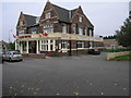
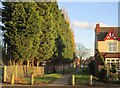
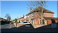
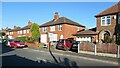
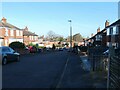
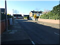
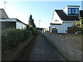
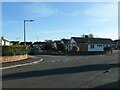
Photos of DN2 4PH


Area Information
DN2 4PH is a compact residential postcode in England, home to 1,636 people spread across a densely populated area of 1.47 km². This small cluster of homes is characterised by a mature demographic, with a median age of 47 and a majority of residents aged between 30 and 64. The area is predominantly occupied by homeowners, with 61% of properties owned by residents, and the housing stock is largely composed of family homes. Daily life here is shaped by proximity to essential services, including five retail outlets such as Lidl Intake and Co-op EGMF, and easy access to rail networks like Kirk Sandall and Doncaster stations. The postcode’s compact size means residents can reach the Robin Hood Doncaster Sheffield Airport within a short journey, adding to its practical appeal. While the area lacks natural beauty designations or protected landscapes, its safety profile is mixed, with a high crime risk score of 19. For those seeking a quiet, community-focused environment with practical connectivity, DN2 4PH offers a blend of convenience and local amenities.
- Area Type
- Postcode
- Area Size
- Not available
- Population
- 1636
- Population Density
- 1111 people/km²
The property market in DN2 4PH is dominated by owner-occupied homes, with 61% of properties owned by residents. This suggests a community where long-term residency is common, and the housing stock is largely composed of houses rather than flats or apartments. The focus on family homes aligns with the area’s demographic profile of adults aged 30–64, many of whom may have children requiring local schools. For buyers, this means a market skewed towards established properties rather than new builds or rental investments. The compact nature of the postcode means the immediate surroundings offer limited scope for expansion, making each property in DN2 4PH potentially more valuable. However, the high crime risk score of 19 could influence perceptions of safety, though this does not directly affect property values. Buyers should consider the balance between location convenience and security when evaluating homes here.
House Prices in DN2 4PH
No properties found in this postcode.
Energy Efficiency in DN2 4PH
The lifestyle in DN2 4PH is shaped by its proximity to retail, rail, and travel infrastructure. Residents can access five retail outlets, including Lidl Intake and M&S Wheatley Hall, offering everyday shopping needs. The area’s rail network, with stations like Kirk Sandall and Doncaster, provides easy access to commuting routes and regional hubs. The Robin Hood Doncaster Sheffield Airport is within practical reach, adding to the area’s connectivity for travel. While the data does not mention parks or leisure facilities, the compact nature of the postcode suggests that daily life revolves around local amenities and nearby towns. The mix of retail and transport options means residents can meet most needs without venturing far, though the absence of detailed information on leisure spaces leaves room for further exploration. The convenience of nearby services contributes to a functional, if modest, lifestyle.
Amenities
Schools
Residents of DN2 4PH have access to several schools within practical reach, including primary institutions like Doncaster St Aidan’s CofE Primary and Nursery School, Curlew Middle School, and St George’s CofE First School. These schools cater to younger children, providing a range of educational options for families. The presence of multiple primary schools suggests a focus on early education, though no secondary schools are listed in the data. The Long Sandall Centre and Nexus Centre are also nearby, though their specific educational roles are not detailed. For families prioritising primary education, the proximity to these schools is a key advantage. However, the lack of secondary school options may require longer commutes for older children. The mix of school types indicates a community where local education is accessible but may not cover all stages of schooling.
| Rank | School | Type | Entry gender | Ages |
|---|
Explore more schools in this area
Go to Schools tabDemographics
The population of DN2 4PH is 1,636, with a median age of 47, indicating a mature, stable community. The most common age range is adults aged 30–64, suggesting a mix of established families and long-term residents. Home ownership is strong here, with 61% of properties owned by their occupants, compared to 39% rented. The area is predominantly composed of houses, reflecting a focus on family living rather than apartments or flats. The predominant ethnic group is White, with no specific data on other groups provided. This demographic profile implies a community with a long-standing presence, where many residents are likely to have built careers and raised families. The high home ownership rate also suggests lower turnover, contributing to a sense of continuity. However, the absence of detailed diversity statistics means the full range of cultural or social dynamics is not fully captured.
Household Size
Accommodation Type
Tenure
Ethnic Group
Religion
Household Composition
Age
Household Deprivation
NS-SEC
Explore more demographic insights in this area
Go to Demographics tabPlanning
Planning Constraints
- Flood RiskPremium
- Ramsar Wetland SitesPremium
- Area of Outstanding Natural BeautyPremium
- Protected Nature ReservePremium
- Protected WoodlandPremium