Area Overview for DN2 4DB
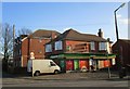
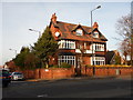
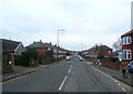
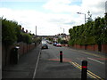
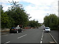
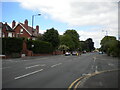
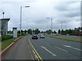
Photos of DN2 4DB


Area Information
Living in DN2 4DB means inhabiting a tightly packed residential cluster in England’s South Yorkshire region. The area spans just 1.0 hectare, housing 1,527 residents in a densely populated 147,677 people per square kilometre. This compact footprint creates a sense of proximity, with amenities and services within walking distance. The median age of 47 suggests a community of established adults, many in their 30s to 60s, reflecting a demographic skewed towards homeownership and stability. Daily life here is shaped by its small size and strategic connectivity: nearby rail links to Doncaster and Bentley stations offer swift access to regional hubs, while the Robin Hood Doncaster Sheffield Airport provides direct flight options. The area’s mix of retail outlets, from Tesco to Aldi, and its proximity to primary education at Wheatley Middle School make it practical for families. However, the high population density and limited space mean this is not a sprawling suburb but a tightly woven neighbourhood where every square metre is accounted for.
- Area Type
- Postcode
- Area Size
- 1.0 hectares
- Population
- 1527
- Population Density
- 4507 people/km²
The property market in DN2 4DB reflects a community of homeowners and renters in a small, tightly packed area. With 51% of residents owning their homes, the area is not dominated by rental properties but remains a mixed market. The accommodation type is primarily houses, which is unusual for a densely populated postcode. This suggests that properties here are likely semi-detached or terraced homes, designed for family living. Given the area’s compact size, the housing stock is limited, and buyers should consider the immediate surroundings for more options. The high population density means that properties are in close proximity, potentially offering convenience but also reducing privacy. For buyers, this area may appeal to those seeking a compact, established neighbourhood with nearby amenities, though the small footprint may limit long-term property appreciation. The focus on houses over flats or apartments also indicates a preference for traditional family housing in this demographic.
House Prices in DN2 4DB
Showing 27 properties
| Address | Type | Beds | Baths | Last Sale Price | Last Sale Date | |
|---|---|---|---|---|---|---|
| 75 Wentworth Road, Wheatley, Doncaster, DN2 4DB | Semi-detached | 3 | 1 | £143,000 | Aug 2025 | |
| 49 Wentworth Road, Wheatley, Doncaster, DN2 4DB | Semi-detached | 3 | 1 | £135,000 | Jan 2024 | |
| 73 Wentworth Road, Wheatley, Doncaster, DN2 4DB | Semi-detached | 3 | 1 | £148,000 | Jan 2024 | |
| 47 Wentworth Road, Wheatley, Doncaster, DN2 4DB | Semi-detached | 3 | - | £135,000 | Apr 2022 | |
| 67 Wentworth Road, Wheatley, Doncaster, DN2 4DB | house | - | - | £130,000 | Dec 2021 | |
| 71 Wentworth Road, Wheatley, Doncaster, DN2 4DB | house | - | - | £125,000 | Jul 2021 | |
| 31 Wentworth Road, Wheatley, Doncaster, DN2 4DB | Semi-detached | 3 | 1 | £90,500 | Jun 2015 | |
| 51 Wentworth Road, Wheatley, Doncaster, DN2 4DB | Semi-detached | 3 | - | £74,000 | Apr 2014 | |
| 77 Wentworth Road, Wheatley, Doncaster, DN2 4DB | house | 3 | - | £94,950 | Oct 2012 | |
| 69 Wentworth Road, Wheatley, Doncaster, DN2 4DB | house | - | - | £90,000 | May 2012 |
Energy Efficiency in DN2 4DB
Residents of DN2 4DB have access to a range of nearby amenities within practical reach. Retail options include Tesco Doncaster, Heron Wheatley, and Aldi Doncaster, providing everyday shopping convenience. The area’s rail links to Doncaster, Bentley, and Kirk Sandall stations facilitate commuting and regional travel. The Robin Hood Doncaster Sheffield Airport adds value for those requiring air travel. The compact nature of the area means amenities are closely clustered, reducing the need for long journeys. However, the absence of parks or leisure facilities is notable, which may affect those prioritising outdoor recreation. The lifestyle here is defined by proximity to services and transport, though the small size limits expansion or diversity of offerings. The mix of retail and transport options supports a practical, efficient daily life but may not cater to all preferences.
Amenities
Schools
Residents of DN2 4DB have access to Wheatley Middle School, a primary school, and two branches of Private Tutorial Studies, one categorised as ‘independent’ and another as ‘other’. The presence of a primary school is a key factor for families, though the absence of secondary schools nearby may require commuting. The independent school option suggests a choice for those seeking alternative education paths, while the ‘other’ category could indicate tutoring or specialist provision. The limited number of schools reflects the area’s small size but may pose challenges for parents needing a full range of educational services. Families should consider the proximity of secondary schools in surrounding areas, as the data does not specify their locations. The mix of school types offers flexibility but does not guarantee comprehensive coverage for all educational needs.
| Rank | School | Type | Entry gender | Ages |
|---|
Explore more schools in this area
Go to Schools tabDemographics
DN2 4DB’s population of 1,527 is predominantly composed of adults aged 30–64, with a median age of 47. This suggests a mature, settled community with a strong presence of middle-aged residents. Homeownership stands at 51%, indicating a balance between owner-occupied properties and rental units. The area is largely composed of houses, which aligns with the demographic profile of older, established residents. The predominant ethnic group is White, though no specific data on diversity or deprivation is provided. The high population density of 147,677 people per square kilometre implies a compact, possibly urbanised environment where proximity to services is both a benefit and a constraint. This density may influence the character of daily life, with limited private space but strong community interaction. The data does not indicate significant socioeconomic challenges, but the high population density could impact living conditions in a small area.
Household Size
Accommodation Type
Tenure
Ethnic Group
Religion
Household Composition
Age
Household Deprivation
NS-SEC
Explore more demographic insights in this area
Go to Demographics tabPlanning
Planning Constraints
- Flood RiskPremium
- Ramsar Wetland SitesPremium
- Area of Outstanding Natural BeautyPremium
- Protected Nature ReservePremium
- Protected WoodlandPremium