Area Overview for DN2 4BD
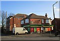
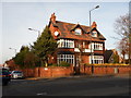
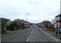
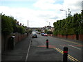
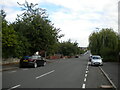
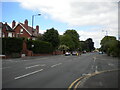
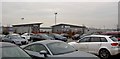
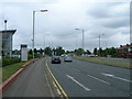
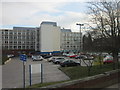
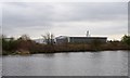
Photos of DN2 4BD

Area Information
DN2 4BD is a small, tightly knit residential area in England, covering 7,962 square metres and home to 1,837 residents. Its high population density of 230,726 people per square kilometre reflects a compact, community-focused layout. This postcode area is characterised by a mix of houses, with 51% of properties owned by residents and 49% rented. The median age of 47 suggests a mature demographic, with the majority of residents aged between 30 and 64. Daily life in DN2 4BD balances suburban tranquillity with proximity to essential services. Residents benefit from nearby retail hubs, including Tesco Doncaster and Farmfoods Intake, and multiple rail stations such as Doncaster and Bentley, offering easy access to regional travel. The area’s broadband score of 100 ensures seamless digital connectivity, while the Robin Hood Doncaster Sheffield Airport provides regional air links. Despite its small size, DN2 4BD offers a practical blend of housing, transport, and amenities, making it a viable option for those seeking a settled, connected lifestyle.
- Area Type
- Postcode
- Area Size
- 7962 m²
- Population
- 1837
- Population Density
- 5405 people/km²
The property market in DN2 4BD is defined by a 51% home ownership rate, indicating that nearly half of the area’s properties are owner-occupied, while the remaining 49% are likely rented. The accommodation type is predominantly houses, which is notable given the area’s small size. This suggests a focus on single-family homes rather than apartments or flats, which may appeal to those seeking more space or privacy. The limited area size means the housing stock is constrained, potentially leading to higher competition among buyers. For those considering the area, the presence of houses may indicate a demand for traditional, family-friendly properties. However, the small footprint of DN2 4BD means that property availability is unlikely to be extensive. Buyers should also consider the proximity to amenities such as rail stations and retail, which could influence property value and desirability. The market appears to cater more to established residents than to transient renters, given the moderate home ownership rate.
House Prices in DN2 4BD
Showing 19 properties
| Address | Type | Beds | Baths | Last Sale Price | Last Sale Date | |
|---|---|---|---|---|---|---|
| 176 Beckett Road, Wheatley, Doncaster, DN2 4BD | house | - | - | £59,250 | Jan 2013 | |
| Flat 1, 170A Beckett Road, Wheatley, Doncaster, DN2 4BD | Flat | - | - | - | - | |
| Flat Above, 170 Beckett Road, Wheatley, Doncaster, DN2 4BD | Flat | 3 | - | - | - | |
| 180 Beckett Road, Wheatley, Doncaster, DN2 4BD | house | - | - | - | - | |
| 178 Beckett Road, Wheatley, Doncaster, DN2 4BD | house | - | - | - | - | |
| 174 Beckett Road, Wheatley, Doncaster, DN2 4BD | house | - | - | - | - | |
| 182 Beckett Road, Wheatley, Doncaster, DN2 4BD | Semi-detached | - | - | - | - | |
| 172 Beckett Road, Wheatley, Doncaster, DN2 4BD | house | - | - | - | - | |
| 249A Beckett Road, Wheatley, Doncaster, DN2 4BD | Flat | - | - | - | - | |
| 255 Beckett Road, Wheatley, Doncaster, DN2 4BD | Semi-detached | - | - | - | - |
Energy Efficiency in DN2 4BD
The lifestyle in DN2 4BD is shaped by its proximity to essential amenities. Retail options include five nearby venues such as Heron Wheatley and Tesco Doncaster, offering convenience for daily shopping and errands. The area’s rail network, with stations like Doncaster and Bentley, provides easy access to regional travel, while the Robin Hood Doncaster Sheffield Airport adds regional air connectivity. These transport links support both commuting and leisure travel. The absence of named parks or leisure facilities in the data means that outdoor activities may require travel beyond the immediate area. However, the compact layout ensures that amenities are within walking or short driving distance. The mix of retail, transport, and air links creates a practical, accessible environment for residents. For those prioritising convenience and connectivity, DN2 4BD offers a balanced lifestyle with essential services readily available.
Amenities
Schools
The nearest school to DN2 4BD is Park Primary School, which provides education for younger children and holds a good Ofsted rating. This rating indicates that the school meets national standards for teaching quality, pupil outcomes, and leadership. The presence of a primary school within practical reach is a key consideration for families, though no secondary schools are listed in the data. The absence of further educational institutions suggests that parents may need to look beyond the immediate area for secondary education. For those prioritising proximity to schools, Park Primary School offers a reliable option, but the lack of additional schools could be a limitation for households with older children. The school’s good rating is a positive factor, but the overall educational infrastructure in DN2 4BD remains focused on primary-level needs.
| Rank | School | Type | Entry gender | Ages |
|---|
Explore more schools in this area
Go to Schools tabDemographics
The community in DN2 4BD is predominantly composed of adults aged 30 to 64, with a median age of 47. This suggests a population largely in their prime working years, with a strong presence of families and established households. Home ownership stands at 51%, indicating a balanced mix of owner-occupied and rental properties. The area is primarily composed of houses, reflecting a traditional housing stock that contrasts with higher-density developments. The predominant ethnic group is White, though no specific data on diversity or deprivation is provided. The high population density of 230,726 people per square kilometre implies a compact, closely knit community, where social interactions and local services are likely to be frequent. For residents, this density supports a range of nearby amenities but may also mean limited green space or larger private areas. The age profile and home ownership figures suggest a stable, long-term resident base with established roots in the area.
Household Size
Accommodation Type
Tenure
Ethnic Group
Religion
Household Composition
Age
Household Deprivation
NS-SEC
Explore more demographic insights in this area
Go to Demographics tabPlanning
Planning Constraints
- Flood RiskPremium
- Ramsar Wetland SitesPremium
- Area of Outstanding Natural BeautyPremium
- Protected Nature ReservePremium
- Protected WoodlandPremium