Area Overview for DN2 4AX
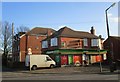
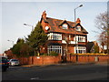
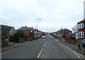
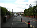
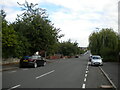
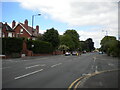
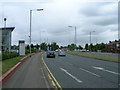
Photos of DN2 4AX


Area Information
Living in DN2 4AX offers a compact, residential experience within a small cluster of homes spread across 6,474 square metres. With a population of 1,527 people, the area is densely populated, reflecting a community-oriented environment where proximity to local amenities is key. This postcode is defined by its residential character, with houses forming the predominant accommodation type. The area’s proximity to retail hubs, rail networks, and the Robin Hood Doncaster Sheffield Airport ensures connectivity to broader regional opportunities. Daily life here balances local convenience with access to external resources, making it suitable for those prioritising ease of movement. The high broadband score of 100 ensures seamless digital access, while the nearby schools and shops cater to everyday needs. However, the area’s small size means the housing market is limited, with a 51% home ownership rate suggesting a mix of owner-occupied properties and rentals. For buyers, this compactness demands careful consideration of proximity to essential services, as the area’s character is shaped by its immediate surroundings.
- Area Type
- Postcode
- Area Size
- 6474 m²
- Population
- 1527
- Population Density
- 4507 people/km²
The property market in DN2 4AX is characterised by a 51% home ownership rate, with houses forming the primary accommodation type. This suggests a market skewed towards owner-occupied properties rather than rentals, though the relatively low ownership percentage indicates a significant portion of the housing stock is available for rent. The small area size—just 6,474 square metres—means the housing stock is limited, with few new developments likely. For buyers, this compactness means competition for available properties, particularly in a region with high population density. The presence of houses rather than flats or apartments implies a preference for traditional, family-friendly living. However, the limited size of the area means that property values and availability are closely tied to proximity to local amenities like schools, rail links, and retail centres. Buyers should consider the area’s constraints when evaluating long-term viability.
House Prices in DN2 4AX
Showing 31 properties
| Address | Type | Beds | Baths | Last Sale Price | Last Sale Date | |
|---|---|---|---|---|---|---|
| 104 Beckett Road, Wheatley, Doncaster, DN2 4AX | Terraced | 3 | 1 | £130,000 | Oct 2024 | |
| 137 Beckett Road, Wheatley, Doncaster, DN2 4AX | Terraced | 3 | 1 | £122,000 | Jul 2024 | |
| 86 Beckett Road, Wheatley, Doncaster, DN2 4AX | Terraced | 3 | 1 | £127,500 | Feb 2024 | |
| 147 Beckett Road, Wheatley, Doncaster, DN2 4AX | house | 5 | - | £110,000 | Jun 2022 | |
| 110 Beckett Road, Wheatley, Doncaster, DN2 4AX | Terraced | 3 | 2 | £110,000 | Feb 2022 | |
| 151 Beckett Road, Wheatley, Doncaster, DN2 4AX | Terraced | 3 | 1 | £87,250 | Oct 2021 | |
| 108 Beckett Road, Wheatley, Doncaster, DN2 4AX | Terraced | 3 | 1 | £112,500 | Jun 2020 | |
| 84 Beckett Road, Wheatley, Doncaster, DN2 4AX | house | - | - | £38,000 | May 2020 | |
| 106 Beckett Road, Wheatley, Doncaster, DN2 4AX | Terraced | 1 | 1 | £162,000 | Mar 2020 | |
| 102 Beckett Road, Wheatley, Doncaster, DN2 4AX | house | - | - | £72,500 | Jan 2020 |
Energy Efficiency in DN2 4AX
Residents of DN2 4AX enjoy a lifestyle shaped by its proximity to essential amenities. The area’s retail offerings include five shops, such as Tesco Doncaster, Heron Wheatley, and Aldi Doncaster, providing everyday shopping convenience. Five rail stations—Doncaster, Bentley, and Kirk Sandall—ensure easy access to regional transport networks, while the nearby Robin Hood Doncaster Sheffield Airport offers direct travel options for those requiring flights. The compact nature of the area means these amenities are within walking or short driving distance, fostering a sense of community and reducing reliance on cars. The presence of both retail and transport hubs supports a balanced lifestyle, allowing residents to access work, leisure, and travel opportunities without long commutes. However, the limited size of the area means the range of leisure and cultural facilities is constrained, with the focus on practical, functional amenities.
Amenities
Schools
Residents of DN2 4AX have access to a range of educational options, including Wheatley Middle School, a primary school, and two instances of Private Tutorial Studies, one categorised as independent and the other as ‘other’. The presence of a primary school ensures immediate access to early education, while the independent school caters to families seeking alternative educational pathways. The inclusion of a non-state-run institution suggests a demand for private schooling, though the lack of Ofsted ratings means the quality of these institutions remains unspecified. The mix of school types allows families flexibility, whether prioritising state education or private alternatives. However, the limited number of schools—just three in total—means competition for places could be intense, particularly for independent institutions. For prospective buyers, proximity to these schools is a key consideration, as it directly impacts the area’s appeal to families.
| Rank | School | Type | Entry gender | Ages |
|---|
Explore more schools in this area
Go to Schools tabDemographics
The community in DN2 4AX is predominantly composed of adults aged 30–64, with a median age of 47. This suggests a mature, stable population, likely with established careers and family structures. Home ownership stands at 51%, indicating a balance between owner-occupied properties and rental units. The area is largely composed of houses, which aligns with the demographic profile of older, settled residents. The predominant ethnic group is White, reflecting the broader regional composition. While no specific deprivation data is provided, the high population density of 235,868 people per square kilometre implies a tightly knit community with shared resources. This density may influence local dynamics, such as the availability of public transport and the need for communal spaces. The age profile suggests a focus on long-term residency rather than transient populations, which could impact the area’s social cohesion and service demands.
Household Size
Accommodation Type
Tenure
Ethnic Group
Religion
Household Composition
Age
Household Deprivation
NS-SEC
Explore more demographic insights in this area
Go to Demographics tabPlanning
Planning Constraints
- Flood RiskPremium
- Ramsar Wetland SitesPremium
- Area of Outstanding Natural BeautyPremium
- Protected Nature ReservePremium
- Protected WoodlandPremium