Area Overview for DN19 7UA
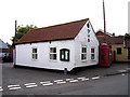
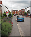
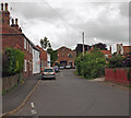
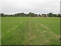
Photos of DN19 7UA


Area Information
DN19 7UA is a small, tightly packed residential area in England, covering 7,982 square metres and home to 1,596 residents. Its population density of 397 people per square kilometre suggests a compact, closely knit community. The area is characterised by its modest size and focus on single-family homes, with 83% of properties owner-occupied. This reflects a stable, long-term resident base, predominantly adults aged 30–64, with a median age of 47. Daily life here is shaped by proximity to essential services and transport links. The low crime risk score of 92 and no flood or environmental hazards make it a safe, low-stress environment. Residents benefit from nearby rail stations, retail outlets, and a ferry terminal, though the area’s small footprint means it is best suited for those prioritising convenience over expansive living space. For buyers, DN19 7UA offers a quiet, secure setting with a strong sense of local identity, though its limited size means property choices are constrained to a small cluster of homes.
- Area Type
- Postcode
- Area Size
- 7982 m²
- Population
- 1596
- Population Density
- 397 people/km²
The property market in DN19 7UA is heavily skewed towards owner-occupation, with 83% of homes owned by residents rather than rented. This suggests a stable, long-term resident base with little turnover. The accommodation type is predominantly houses, which are more common than flats or other forms of housing. Given the area’s small size of 7,982 square metres, the housing stock is limited, with properties likely concentrated in a compact cluster. Buyers should expect a niche market with fewer options, but the high home ownership rate indicates strong local demand. The focus on single-family homes may appeal to those seeking private, low-density living. However, the area’s size and proximity to amenities like rail stations and retail outlets make it practical for commuters or those prioritising convenience over space.
House Prices in DN19 7UA
Showing 14 properties
| Address | Type | Beds | Baths | Last Sale Price | Last Sale Date | |
|---|---|---|---|---|---|---|
| 7 Chestnut Way, Goxhill, DN19 7UA | Semi-detached | 3 | 1 | £166,000 | Aug 2025 | |
| 10 Chestnut Way, Goxhill, DN19 7UA | Detached | 4 | 2 | £200,000 | Apr 2019 | |
| 11 Chestnut Way, Goxhill, DN19 7UA | Bungalow | - | - | £167,000 | Jan 2018 | |
| 5 Chestnut Way, Goxhill, DN19 7UA | Detached | 3 | 2 | £157,000 | Jul 2017 | |
| 3 Chestnut Way, Goxhill, DN19 7UA | Detached | 3 | - | £156,500 | Feb 2016 | |
| 17 Chestnut Way, Goxhill, DN19 7UA | Bungalow | - | - | £149,500 | Aug 2013 | |
| 2 Chestnut Way, Goxhill, DN19 7UA | house | 3 | - | £125,000 | Aug 2012 | |
| 19 Chestnut Way, Goxhill, DN19 7UA | Detached | - | - | £136,000 | Jul 2004 | |
| 8 Chestnut Way, Goxhill, DN19 7UA | Detached | - | - | £207,000 | Jun 2004 | |
| 6 Chestnut Way, Goxhill, DN19 7UA | Detached | 4 | - | £89,950 | Aug 2003 |
Energy Efficiency in DN19 7UA
The lifestyle in DN19 7UA is shaped by its proximity to practical amenities. Within reach are five retail outlets, including Lincolnshire Co-operative Co and Makro Hull, offering grocery and general shopping needs. The rail network, with five stations nearby, provides easy access to public transport, while the Hull Ferry Terminal offers additional mobility options. Though the area is small, these amenities support a convenient, self-sufficient lifestyle. The presence of multiple rail stations and a ferry terminal suggests the area is well-integrated into regional transport networks, facilitating travel for work, leisure, or commuting. The compact nature of DN19 7UA means residents can access essentials without long journeys, though the lack of larger leisure or entertainment venues may require trips to nearby towns.
Amenities
Schools
The nearest school to DN19 7UA is Goxhill Primary School, which provides education for younger children. It holds an Ofsted rating of satisfactory, indicating it meets basic standards but may not excel in all areas. As a primary school, it serves the immediate community, though families requiring secondary education may need to look beyond the area. The absence of other schools in the data suggests that parents may need to consider nearby options or factor in travel time for secondary schooling. The presence of a primary school supports family life in the area but does not provide a full range of educational facilities.
| Rank | School | Type | Entry gender | Ages |
|---|
Explore more schools in this area
Go to Schools tabDemographics
The community in DN19 7UA is predominantly composed of adults aged 30–64, with a median age of 47. This suggests a mature, established population with strong ties to the area. Home ownership is high at 83%, indicating a stable housing market with limited rental activity. The accommodation type is primarily houses, reflecting a preference for private, standalone living spaces. The predominant ethnic group is White, with no data provided on other demographics. The population density of 397 people per square kilometre implies a mix of family homes and smaller households. While no specific deprivation data is available, the high home ownership rate and low crime risk suggest a generally secure and economically stable environment. The age profile indicates a community likely focused on long-term residency, with fewer young families or transient populations.
Household Size
Accommodation Type
Tenure
Ethnic Group
Religion
Household Composition
Age
Household Deprivation
NS-SEC
Explore more demographic insights in this area
Go to Demographics tabPlanning
Planning Constraints
- Flood RiskPremium
- Ramsar Wetland SitesPremium
- Area of Outstanding Natural BeautyPremium
- Protected Nature ReservePremium
- Protected WoodlandPremium