Area Overview for DN19 7RF
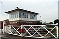
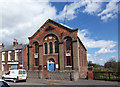
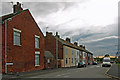
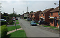
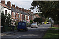
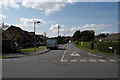
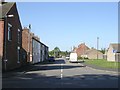
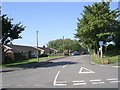
Photos of DN19 7RF


Area Information
DN19 7RF is a small, tightly knit residential cluster in England, covering just 3.3 hectares. With a population of 1,342 people, it’s a quiet, low-density area where 65 people live per square kilometre. This postcode is characterised by its modest scale, offering a sense of community without the bustle of larger towns. The area is primarily home to adults aged 30–64, many of whom own their properties. Life here revolves around proximity to local amenities, with rail stations and retail outlets within practical reach. The presence of New Holland Church of England and Methodist Primary School adds to the area’s appeal for families. While the population is small, the mix of housing and infrastructure suggests a balance between convenience and tranquillity. For those seeking a peaceful, well-connected environment with a focus on local living, DN19 7RF presents a straightforward, no-frills option. Its compact size means residents are close to essential services, though the area’s distinctiveness lies in its simplicity and the absence of urban sprawl.
- Area Type
- Postcode
- Area Size
- 3.3 hectares
- Population
- 1342
- Population Density
- 65 people/km²
The property market in DN19 7RF is dominated by owner-occupied homes, with 66% of residents living in properties they own. The accommodation type is predominantly houses, which suggests a focus on family-friendly, single-unit dwellings rather than apartments or flats. This composition indicates a market tailored to those seeking stability and space, rather than investment or rental opportunities. Given the area’s small size and low population density, the housing stock is limited, which could mean fewer choices for buyers but potentially more established properties. The high home ownership rate also implies that the market may be less influenced by rental demand, reducing competition from tenants. For prospective buyers, this environment offers the advantage of a slower, more predictable market, though the compact nature of the area means properties are likely to be in close proximity to one another. The emphasis on houses also aligns with the demographic profile of older, settled residents, reinforcing the area’s character as a place for long-term living rather than transient occupancy.
House Prices in DN19 7RF
Showing 12 properties
| Address | Type | Beds | Baths | Last Sale Price | Last Sale Date | |
|---|---|---|---|---|---|---|
| 12, Woodgarth Villas, Oxmarsh Lane, New Holland, DN19 7RF | house | - | - | £181,000 | Jun 2024 | |
| 10, Woodgarth Villas, Oxmarsh Lane, New Holland, DN19 7RF | Semi-detached | 3 | 1 | £92,000 | Sep 2017 | |
| 4, Woodgarth Villas, Oxmarsh Lane, New Holland, DN19 7RF | Semi-detached | 3 | 2 | £95,000 | Jun 2016 | |
| 5, Woodgarth Villas, Oxmarsh Lane, New Holland, DN19 7RF | Semi-detached | 2 | 1 | £89,000 | Dec 2012 | |
| 11, Woodgarth Villas, Oxmarsh Lane, New Holland, DN19 7RF | Semi-detached | - | - | £115,000 | May 2008 | |
| 8, Woodgarth Villas, Oxmarsh Lane, New Holland, DN19 7RF | Semi-detached | 3 | 1 | £25,000 | Mar 2003 | |
| 1, Woodgarth Villas, Oxmarsh Lane, New Holland, DN19 7RF | Semi-detached | - | - | - | - | |
| 2, Woodgarth Villas, Oxmarsh Lane, New Holland, DN19 7RF | Semi-detached | - | - | - | - | |
| 3, Woodgarth Villas, Oxmarsh Lane, New Holland, DN19 7RF | Semi-detached | - | - | - | - | |
| 6, Woodgarth Villas, Oxmarsh Lane, New Holland, DN19 7RF | Semi-detached | - | - | - | - |
Energy Efficiency in DN19 7RF
Living in DN19 7RF offers access to a mix of practical amenities within reach. The five rail stations—New Holland, Barrow Haven, and Goxhill—provide regular connections to nearby areas, while retail outlets like Lincolnshire Co-operative Co and Makro Hull cater to everyday shopping needs. The Hull Ferry Terminal adds another layer of connectivity, potentially linking residents to maritime routes or nearby coastal towns. While the data does not specify dining or leisure venues, the presence of multiple retail and transport hubs suggests a functional lifestyle focused on convenience rather than extensive leisure options. The area’s low population density means amenities are not overcrowded, allowing for a relaxed pace of life. For those prioritising accessibility to services and transport, DN19 7RF offers a straightforward setup, though its charm lies in its simplicity and the absence of urban sprawl.
Amenities
Schools
The nearest school to DN19 7RF is New Holland Church of England and Methodist Primary School, which serves the local community with primary education. The school holds an Ofsted rating of ‘satisfactory’, indicating it meets basic standards but may have areas for improvement. As a primary school, it caters to younger children, though no secondary schools are listed in the data, meaning families with older children may need to look beyond the immediate area for secondary education. The presence of a primary school is a key consideration for families, offering convenience for daily commutes and proximity to early childhood development resources. The single school in the vicinity suggests a limited range of educational options, which could be a factor for parents prioritising a variety of school types or higher academic standards. However, the school’s existence provides a foundational service for the area’s younger residents, supporting local families in their educational needs.
| Rank | School | Type | Entry gender | Ages |
|---|
Explore more schools in this area
Go to Schools tabDemographics
The community in DN19 7RF is predominantly composed of adults aged 30–64, with a median age of 47. This suggests a mature population, likely with established careers and families. Home ownership is high, with 66% of residents living in properties they own, compared to 34% renting. The area is largely composed of houses, indicating a preference for single-family homes over flats or apartments. The predominant ethnic group is White, though no specific data on diversity or minority representation is provided. The population density of 65 people per square kilometre is low, contributing to a spread-out, less congested living environment. The age profile and ownership rates suggest a stable, long-term community with limited turnover. For buyers, this implies a market where properties are likely to remain in private hands, potentially offering more security in ownership. The absence of detailed data on deprivation or socioeconomic status means the area’s quality of life must be inferred from its infrastructure and connectivity.
Household Size
Accommodation Type
Tenure
Ethnic Group
Religion
Household Composition
Age
Household Deprivation
NS-SEC
Explore more demographic insights in this area
Go to Demographics tabPlanning
Planning Constraints
- Flood RiskPremium
- Ramsar Wetland SitesPremium
- Area of Outstanding Natural BeautyPremium
- Protected Nature ReservePremium
- Protected WoodlandPremium