Area Overview for DN19 7PH
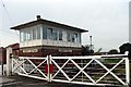
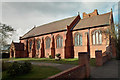
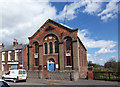
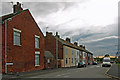
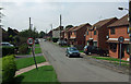
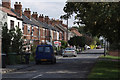
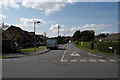
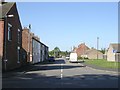
Photos of DN19 7PH


Area Information
DN19 7PH is a small, tightly knit residential area in England, covering 14 hectares and home to 1,342 people. With a population density of 65 people per square kilometre, it feels more like a close-knit village than a sprawling suburb. The area is characterised by its modest scale, where daily life is shaped by proximity to local amenities and a stable community. Most residents are adults aged 30–64, with a median age of 47, suggesting a mix of established families and long-term residents. The area’s compact size means residents can walk or cycle to nearby shops, schools, and transport links, fostering a sense of convenience. However, the postcode’s small footprint also means housing options are limited, with 66% of properties owned by residents rather than rented out. While the area lacks major landmarks, its charm lies in its simplicity—quiet streets, local schools, and easy access to rail networks. For buyers, this is a place to consider if they prioritise a low-key, community-focused lifestyle over urban vibrancy.
- Area Type
- Postcode
- Area Size
- 14.0 hectares
- Population
- 1342
- Population Density
- 65 people/km²
DN19 7PH is a predominantly owner-occupied area, with 66% of properties in private hands. The housing stock is largely composed of houses, which is unusual for a small postcode but may reflect the area’s rural or semi-rural character. This suggests a market where buyers are likely to be purchasing for long-term residence rather than investment. The limited size of the area means housing options are scarce, and the immediate surroundings may offer few alternatives. For buyers, this could mean higher competition for available properties, though the compact nature of the postcode might also mean homes are in well-maintained, established condition. The focus on owner-occupation indicates a community with a strong sense of place, where residents are less likely to move frequently. However, the small scale of the area may limit opportunities for those seeking larger or more varied housing options.
House Prices in DN19 7PH
Showing 20 properties
| Address | Type | Beds | Baths | Last Sale Price | Last Sale Date | |
|---|---|---|---|---|---|---|
| Baronscroft, Barrow Road, New Holland, DN19 7PH | Detached | 3 | 1 | £198,500 | Aug 2024 | |
| Willowdene, Barrow Road, New Holland, DN19 7PH | house | - | - | £425,000 | Aug 2023 | |
| Everglades, Barrow Road, New Holland, DN19 7PH | Semi-detached | 3 | 1 | £195,000 | Mar 2021 | |
| Ickleford, Barrow Road, New Holland, DN19 7PH | Semi-detached | 4 | 1 | £125,000 | Sep 2017 | |
| Birchleigh Lodge, Barrow Road, New Holland, DN19 7PH | Detached | 4 | 2 | £205,000 | Jul 2017 | |
| Thistledoo Paddock, Barrow Road, New Holland, DN19 7PH | Detached | 4 | 2 | £177,000 | May 2015 | |
| Willowcroft House, Barrow Road, New Holland, DN19 7PH | Detached | 4 | - | £236,000 | Aug 2014 | |
| Orchard Croft, Barrow Road, New Holland, DN19 7PH | Bungalow | 2 | - | £137,000 | Oct 2007 | |
| Norbeth, Barrow Road, New Holland, DN19 7PH | house | 2 | - | £94,000 | Oct 2006 | |
| Cavalli, Barrow Road, New Holland, DN19 7PH | Detached | - | - | £133,950 | Sep 2003 |
Energy Efficiency in DN19 7PH
The lifestyle in DN19 7PH is shaped by its proximity to practical amenities. Residents can access five rail stations, including New Holland and Goxhill, which provide links to nearby towns and cities. Retail options include Co-op Barrow upon and Makro Hull, offering everyday shopping needs within reach. A ferry terminal at Hull adds convenience for those using water transport, though it may not serve as a primary commuting route. The area’s small size means leisure and recreational facilities are limited, but the presence of rail and ferry services suggests opportunities for weekend trips or commuting to larger centres. The compact nature of the postcode fosters a self-contained lifestyle, where daily errands can be managed locally. However, those seeking extensive parks or cultural amenities may need to travel further.
Amenities
Schools
The nearest school to DN19 7PH is New Holland Church of England and Methodist Primary School, which serves the local community with primary education. Its Ofsted rating is satisfactory, indicating that it meets basic standards but may not excel in areas like academic performance or extracurricular offerings. As a primary school, it caters to younger children, but families with older students may need to look further afield for secondary education. The presence of a single school suggests that the area’s educational provision is limited to primary levels, which could be a consideration for households with children requiring secondary schooling. While the school’s rating is not outstanding, it provides a local option for families, reducing the need for long commutes.
| Rank | School | Type | Entry gender | Ages |
|---|
Explore more schools in this area
Go to Schools tabDemographics
The population of DN19 7PH is predominantly adults aged 30–64, with a median age of 47. This suggests a community of middle-aged individuals, many of whom may be in their prime working years or raising families. Home ownership is high, with 66% of properties occupied by owners, indicating a stable, long-term resident base. The area is primarily composed of houses rather than flats, reflecting a preference for single-family living. The predominant ethnic group is White, though no specific data on diversity or deprivation is provided. The age profile implies a mature demographic, potentially with fewer young children or retirees compared to other areas. This balance may appeal to professionals seeking a settled environment or families looking for a quiet, low-density neighbourhood. The absence of detailed diversity metrics means the community’s social makeup remains less defined in the data.
Household Size
Accommodation Type
Tenure
Ethnic Group
Religion
Household Composition
Age
Household Deprivation
NS-SEC
Explore more demographic insights in this area
Go to Demographics tabPlanning
Planning Constraints
- Flood RiskPremium
- Ramsar Wetland SitesPremium
- Area of Outstanding Natural BeautyPremium
- Protected Nature ReservePremium
- Protected WoodlandPremium