Area Overview for DN19 7HB
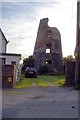
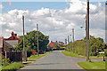
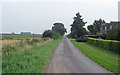
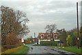
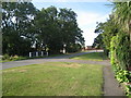
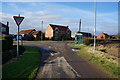
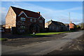
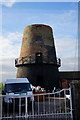
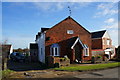
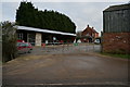
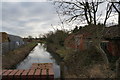
Photos of DN19 7HB

Area Information
DN19 7HB is a small, tightly knit residential postcode area in England, spanning just 18.6 hectares and home to 1,630 people. With a population density of 100 people per square kilometre, it is a compact community where daily life unfolds in a quiet, low-rise setting. The area is defined by its cluster of houses, reflecting a predominantly owner-occupied demographic, with 84% of residents living in their own homes. This suggests a stable, long-term community with a strong sense of local identity. The area’s proximity to rail and ferry services, including Barrow Haven Railway Station and Hull Ferry Terminal, offers practical connectivity for commuting or travel. While the postcode is small, it is positioned near amenities like Co-op Barton and New Holland Railway Station, ensuring basic needs are met within walking or short driving distance. The median age of 47 indicates a mature population, with most residents aged 30–64, creating a community that values stability and established living. For those considering homes in DN19 7HB, the blend of residential tranquillity and accessible transport options makes it a viable choice for those prioritising convenience and a settled lifestyle.
- Area Type
- Postcode
- Area Size
- 18.6 hectares
- Population
- 1630
- Population Density
- 100 people/km²
The property market in DN19 7HB is characterised by a high rate of home ownership—84% of residents live in their own homes—suggesting a stable, long-term community with little reliance on rental properties. The area is composed entirely of houses, with no flats or apartments, which is typical of smaller, rural or semi-rural postcode areas. This housing stock indicates a market skewed towards owner-occupation rather than landlord investment, potentially offering buyers a more predictable and established environment. Given the area’s small size (18.6 hectares) and low population density, the number of available properties is limited, meaning buyers may need to consider nearby areas for additional options. The absence of newer developments or high-density housing also implies that the market is likely to feature older, well-established homes, which may appeal to those seeking a settled, low-maintenance lifestyle.
House Prices in DN19 7HB
Showing 6 properties
| Address | Type | Beds | Baths | Last Sale Price | Last Sale Date | |
|---|---|---|---|---|---|---|
| Strawberry Cottage, Ferry Road, Barrow Haven, Barrow Upon Humber, DN19 7HB | house | - | - | £265,000 | Aug 2022 | |
| Springfield, Ferry Road, Barrow Haven, Barrow Upon Humber, DN19 7HB | Bungalow | - | - | £285,000 | Mar 2021 | |
| Longfield, Ferry Road, Barrow Haven, Barrow Upon Humber, DN19 7HB | Detached | 4 | 2 | £320,000 | Aug 2020 | |
| Lynburn, Ferry Road, Barrow Haven, Barrow Upon Humber, DN19 7HB | Detached | 4 | 2 | £13,500 | Jul 2018 | |
| Joniro, Ferry Road, Barrow Haven, Barrow Upon Humber, DN19 7HB | Semi-detached | - | - | - | - | |
| The Nurseries, Ferry Road, Barrow Upon Humber, DN19 7HB | Detached | - | - | - | - |
Energy Efficiency in DN19 7HB
Living in DN19 7HB offers access to a range of local amenities, including five retail outlets such as Co-op Barton, Lincolnshire Co-operative Co, and Co-op Barrow upon, which provide essential shopping and dining options. The proximity to rail stations like Barrow Haven and Goxhill ensures easy access to regional transport, while the Hull Ferry Terminal connects residents to the city of Hull, expanding leisure and commuting possibilities. Although the area is small, its layout ensures that basic needs are met within a short distance. The presence of multiple railway stations also suggests a community that values connectivity, whether for daily commutes or weekend trips. The combination of local shops, transport links, and the nearby ferry service creates a practical, self-sufficient lifestyle, ideal for those seeking convenience without the need for long car journeys.
Amenities
Schools
| Rank | School | Type | Entry gender | Ages |
|---|
Explore more schools in this area
Go to Schools tabDemographics
The community in DN19 7HB is predominantly composed of adults aged 30–64, with a median age of 47. This suggests a mature, established population, likely with long-term ties to the area. Home ownership is high, at 84%, indicating a strong preference for property investment over rental living. The accommodation type is exclusively houses, with no flats or apartments present, which aligns with the area’s low-density character. The predominant ethnic group is White, with no data provided on other demographics. The population density of 100 people per square kilometre reflects a balanced mix of private homes and open space, avoiding overcrowding. While no specific data on deprivation is available, the high home ownership and stable age profile suggest a community with relatively consistent access to resources. This demographic structure implies a focus on family-oriented living, with residents likely prioritising long-term residency over short-term rental flexibility.
Household Size
Accommodation Type
Tenure
Ethnic Group
Religion
Household Composition
Age
Household Deprivation
NS-SEC
Explore more demographic insights in this area
Go to Demographics tabPlanning
Planning Constraints
- Flood RiskPremium
- Ramsar Wetland SitesPremium
- Area of Outstanding Natural BeautyPremium
- Protected Nature ReservePremium
- Protected WoodlandPremium