Area Overview for DN19 7BZ
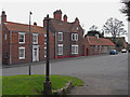
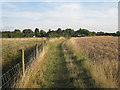
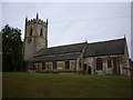
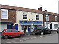
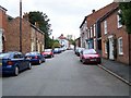
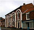
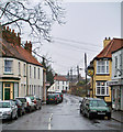
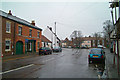
Photos of DN19 7BZ


Area Information
DN19 7BZ is a small residential postcode area in England, covering 619 square metres and home to 1796 residents. Its compact size means the community is closely knit, with a population density of 632 people per square kilometre. This area is characterised by its proximity to essential services and transport links, making it practical for daily life. The presence of five nearby railway stations, including Barrow Haven and New Holland, ensures easy access to regional hubs. While the area is small, it offers a balance of residential tranquillity and connectivity. However, residents must be mindful of the high flood risk, a critical concern for property buyers. Despite this, the area benefits from a low crime risk score of 80, indicating a generally safe environment. Living here means navigating a mix of practicality and caution, with a focus on reliable infrastructure and community stability.
- Area Type
- Postcode
- Area Size
- 619 m²
- Population
- 1796
- Population Density
- 632 people/km²
The property market in DN19 7BZ is dominated by owner-occupied homes, with 74% of properties owned outright. This high rate of home ownership indicates a community of long-term residents rather than a transient rental market. The accommodation type is primarily houses, which are more common than flats or other forms of housing. This suggests a focus on family homes and larger properties, likely catering to the area’s predominantly middle-aged population. The small size of the postcode area means the housing stock is limited, which could affect availability for buyers. For those seeking property, the market is likely to be competitive, with a strong emphasis on established, well-maintained homes. The lack of newer developments may also mean limited options for modern or contemporary housing.
House Prices in DN19 7BZ
Showing 3 properties
| Address | Type | Beds | Baths | Last Sale Price | Last Sale Date | |
|---|---|---|---|---|---|---|
| Pharmacy, The Co-operative Food, High Street, Barrow Upon Humber, DN19 7BZ | commercial | - | - | - | - | |
| Flat 2, The Co-operative Food, High Street, Barrow Upon Humber, DN19 7BZ | Flat | - | - | - | - | |
| Flat 1, The Co-operative Food, High Street, Barrow Upon Humber, DN19 7BZ | Flat | - | - | - | - |
Energy Efficiency in DN19 7BZ
The lifestyle in DN19 7BZ is shaped by its proximity to retail and transport hubs. Five nearby retail outlets, including Co-op Barrow upon and Lincolnshire Co-operative Co, provide essential shopping options for residents. These shops likely offer everyday necessities, reducing the need for long trips to larger towns. The area’s rail network, with stations like New Holland and Goxhill, enhances mobility, connecting residents to broader regional amenities. While the data does not mention parks or leisure facilities, the availability of retail and transport options suggests a practical, convenience-driven lifestyle. The compact nature of the area means residents can access daily needs without significant travel, fostering a self-contained community feel.
Amenities
Schools
The nearest school to DN19 7BZ is John Harrison C of E Primary School, which serves the local community with a good Ofsted rating. This primary school is the only educational institution listed in the data, meaning families with children will need to rely on it for early education. The absence of secondary schools in the immediate vicinity could necessitate commuting to nearby towns for further education. However, the primary school’s good rating suggests a reliable foundation for younger children’s learning. For families prioritising proximity to schools, this single institution may be a deciding factor in choosing DN19 7BZ as a place to live.
| Rank | School | Type | Entry gender | Ages |
|---|
Explore more schools in this area
Go to Schools tabDemographics
The population of DN19 7BZ has a median age of 47, with the majority of residents aged between 30 and 64. This suggests a community skewed towards middle-aged adults, likely with established careers and families. Home ownership is high at 74%, reflecting a preference for long-term residency over rental properties. The accommodation type is predominantly houses, which aligns with the demographic profile of older, family-oriented households. The predominant ethnic group is White, with no data indicating significant diversity beyond this. The age profile and ownership rates suggest a stable, low-turnover community where residents are likely to remain for extended periods. This stability may influence local services and amenities, tailored to the needs of an older, settled population.
Household Size
Accommodation Type
Tenure
Ethnic Group
Religion
Household Composition
Age
Household Deprivation
NS-SEC
Explore more demographic insights in this area
Go to Demographics tabPlanning
Planning Constraints
- Flood RiskPremium
- Ramsar Wetland SitesPremium
- Area of Outstanding Natural BeautyPremium
- Protected Nature ReservePremium
- Protected WoodlandPremium