Area Overview for DN18 5XW
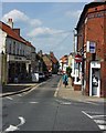
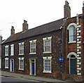
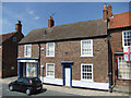
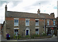
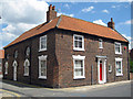
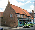
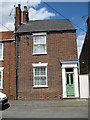
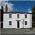
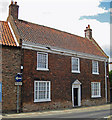
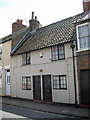
Photos of DN18 5XW
Area Information
Living in DN18 5XW means being part of a small, tightly knit residential cluster in England, home to 2066 residents. The area is characterised by a mature demographic, with a median age of 47 and the majority of residents falling within the 30-64 age range. This suggests a community of established professionals and families, many of whom own their homes—69% of properties are owner-occupied. The housing stock is predominantly houses, reflecting a quieter, more traditional living environment. DN18 5XW is not a sprawling suburb but a compact postcode area, offering a balance between residential comfort and proximity to essential services. Daily life here is likely shaped by the local amenities and transport links, with a focus on practicality over urban vibrancy. For those seeking a stable, low-maintenance lifestyle, the area’s small size and straightforward infrastructure could be appealing. However, its limited scale means it is best suited to those prioritising convenience over expansive options.
- Area Type
- Postcode
- Area Size
- Not available
- Population
- 2066
- Population Density
- 2857 people/km²
The property market in DN18 5XW is dominated by owner-occupied homes, with 69% of properties in private hands. This high rate of home ownership suggests a stable, long-term resident base with little reliance on rental markets. The accommodation type is predominantly houses, which is typical for smaller, residential postcodes. This means the housing stock is likely to be more traditional, with larger properties than flats or apartments. For buyers, this creates a market where properties are not frequently available, and competition may be limited. The small size of the area means that the immediate surroundings are also likely to have similar characteristics, reinforcing the area’s identity as a residential cluster rather than a commercial or mixed-use zone. Buyers should consider the limited supply and the potential for slower transaction times.
House Prices in DN18 5XW
No properties found in this postcode.
Energy Efficiency in DN18 5XW
The lifestyle in DN18 5XW is shaped by its proximity to essential amenities, including five retail outlets such as Spar, Heron Barton-upon, and Morrisons Daily Barton-on. These shops provide everyday convenience for residents, reducing the need to travel far for groceries or other necessities. The area’s rail stations—Barton, Barrow Haven, and Hessle—offer easy access to nearby towns, enhancing connectivity for those who commute or travel frequently. Brough Airport is also within practical reach, adding to the area’s appeal for those requiring air travel. While the data does not mention parks or leisure facilities, the retail and transport options suggest a focus on practicality over expansive recreational spaces. This makes DN18 5XW ideal for those prioritising accessibility and convenience in their daily lives.
Amenities
Schools
The nearest school to DN18 5XW is Barton St Peter’s CofE Primary School, a primary institution with a ‘good’ Ofsted rating. This school serves the local community, offering education for younger children in the area. The absence of secondary schools in the data means that families may need to look further afield for secondary education, though the primary school’s rating indicates a solid foundation for early learning. The presence of a single primary school suggests that the area’s population is small enough to support a single institution but may require additional planning for older children. For families prioritising proximity to schools, this primary option is a key consideration, though broader educational needs may necessitate travel.
| Rank | School | Type | Entry gender | Ages |
|---|
Explore more schools in this area
Go to Schools tabDemographics
The community in DN18 5XW is predominantly composed of adults aged 30-64, with a median age of 47. This suggests a population of largely middle-aged residents, many of whom are likely in their peak earning years or raising families. Home ownership is high, at 69%, indicating a stable housing market with few renters. The accommodation type is primarily houses, which aligns with the area’s small, residential character. The predominant ethnic group is White, though no specific data on diversity or deprivation is provided. This demographic profile suggests a community that values long-term residency and property investment. The absence of detailed diversity statistics means it is unclear whether the area is ethnically varied or homogenous. However, the age range and home ownership figures imply a relatively cohesive, low-turnover population.
Household Size
Accommodation Type
Tenure
Ethnic Group
Religion
Household Composition
Age
Household Deprivation
NS-SEC
Explore more demographic insights in this area
Go to Demographics tabPlanning
Planning Constraints
- Flood RiskPremium
- Ramsar Wetland SitesPremium
- Area of Outstanding Natural BeautyPremium
- Protected Nature ReservePremium
- Protected WoodlandPremium