Area Overview for DN18 5BU
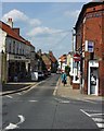
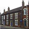
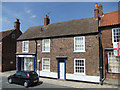
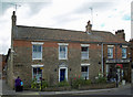
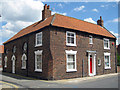
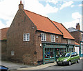
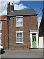
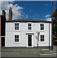
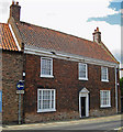
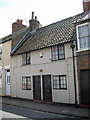
Photos of DN18 5BU
Area Information
DN18 5BU is a compact residential cluster in England, spanning just 1.2 hectares and home to 2,498 residents. Its small size means it’s a tight-knit community, with a population density of 2,472 people per square kilometre. The area is defined by its established character, with a median age of 47 and a majority of residents aged 30–64. Most properties are owner-occupied, reflecting a stable, long-term demographic. Daily life here is shaped by proximity to key amenities, including five rail stations and retail hubs like Tesco Barton and Spar. While the broadband connection is excellent, with a score of 100, the area’s high flood risk score of 71.21 is a notable challenge. However, crime rates are low, with a safety score of 77, suggesting a generally secure environment. Living in DN18 5BU offers a blend of practicality and convenience, though buyers should weigh the flood risk against the area’s other strengths.
- Area Type
- Postcode
- Area Size
- 1.2 hectares
- Population
- 2498
- Population Density
- 2472 people/km²
The property market in DN18 5BU is characterised by a high rate of home ownership, with 77% of properties owner-occupied. This indicates a market skewed towards long-term residents rather than short-term renters. The accommodation type is predominantly houses, which is unusual for areas of this size and suggests a focus on family homes or larger dwellings. Given the area’s compact footprint, the housing stock is limited, and buyers should consider the small geographical scope when exploring nearby options. The high home ownership rate also implies limited availability of rental properties, which may be a consideration for those seeking flexibility. For buyers, the presence of houses in a densely populated area could mean a mix of older, established properties and newer developments, though the exact condition and value of individual homes would require further local inspection.
House Prices in DN18 5BU
Showing 27 properties
| Address | Type | Beds | Baths | Last Sale Price | Last Sale Date | |
|---|---|---|---|---|---|---|
| 22 Ramblers Lane, Barton Upon Humber, DN18 5BU | Semi-detached | 3 | 1 | £190,000 | Apr 2025 | |
| 10 Ramblers Lane, Barton Upon Humber, DN18 5BU | Detached | 3 | 2 | £235,000 | Feb 2025 | |
| 30 Ramblers Lane, Barton Upon Humber, DN18 5BU | house | - | - | £280,000 | Jan 2025 | |
| 26 Ramblers Lane, Barton Upon Humber, DN18 5BU | Detached | 4 | 2 | £292,500 | Nov 2023 | |
| 28 Ramblers Lane, Barton Upon Humber, DN18 5BU | Detached | 5 | 3 | £355,000 | Jun 2023 | |
| 4 Ramblers Lane, Barton Upon Humber, DN18 5BU | Detached | 6 | 3 | £259,000 | Mar 2021 | |
| 12 Ramblers Lane, Barton Upon Humber, DN18 5BU | Detached | 4 | 2 | £265,000 | May 2019 | |
| 17 Ramblers Lane, Barton Upon Humber, DN18 5BU | Bungalow | 2 | 2 | £223,500 | Feb 2019 | |
| 1 Ramblers Lane, Barton Upon Humber, DN18 5BU | Detached | 3 | 2 | £180,000 | Mar 2018 | |
| 32 Ramblers Lane, Barton Upon Humber, DN18 5BU | house | 4 | 2 | £208,000 | Jun 2017 |
Energy Efficiency in DN18 5BU
Living in DN18 5BU offers access to a range of practical amenities. The area is served by five rail stations, including Barton and Barrow Haven, providing direct links to nearby towns and cities. For retail, residents can visit Heron Barton-upon, Tesco Barton, and Spar, ensuring everyday shopping needs are met without long journeys. The proximity to Brough Airport adds another layer of convenience for those requiring air travel. While the data does not mention parks or leisure facilities, the presence of multiple retail and transport hubs suggests a focus on functional, accessible living. The compact nature of the area means that amenities are closely clustered, reducing the need for lengthy commutes. This layout supports a lifestyle that prioritises efficiency, with residents able to access essential services and transport links within short distances.
Amenities
Schools
| Rank | School | Type | Entry gender | Ages |
|---|
Explore more schools in this area
Go to Schools tabDemographics
The community in DN18 5BU is predominantly composed of adults aged 30–64, with a median age of 47. This suggests a mature, settled population, likely with established careers and families. Home ownership is high at 77%, indicating a strong preference for long-term residency over rental properties. The accommodation type is primarily houses, which aligns with the area’s residential character. The predominant ethnic group is White, reflecting the broader demographic trends in the region. With a population density of 2,472 people per square kilometre, the area is densely populated for its small size, which may influence the pace of life and availability of shared spaces. The data does not provide specific information on deprivation levels, but the high home ownership and stable age profile suggest a relatively affluent, low-volatility community.
Household Size
Accommodation Type
Tenure
Ethnic Group
Religion
Household Composition
Age
Household Deprivation
NS-SEC
Explore more demographic insights in this area
Go to Demographics tabPlanning
Planning Constraints
- Flood RiskPremium
- Ramsar Wetland SitesPremium
- Area of Outstanding Natural BeautyPremium
- Protected Nature ReservePremium
- Protected WoodlandPremium