Area Overview for DN18 5AT
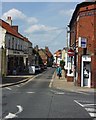
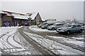
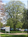
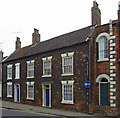
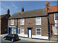
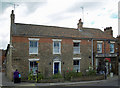
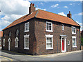
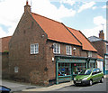
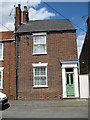
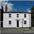
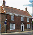
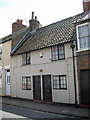
Photos of DN18 5AT
Area Information
DN18 5AT is a compact postcode area in England, covering just 2.8 hectares and home to 2,498 residents. Its high population density of 2,472 people per square kilometre reflects a tightly knit community, where homes are closely spaced. This small cluster is characterised by a mix of residential properties, predominantly houses, which dominate the local housing stock. The area is positioned near Barton-upon-Humber, offering proximity to nearby towns and transport links. Daily life here is shaped by its modest size and the presence of essential amenities within walking or short driving distance. Residents benefit from a range of retail options, including Lidl Barton-upon and Spar, as well as rail stations such as Barton and Hessle Rail Stn. The area’s proximity to Brough Airport adds to its connectivity, though it remains a quiet, residential hub rather than a commercial centre. With a median age of 47 and a population skewed toward adults aged 30–64, DN18 5AT is a stable, mature community where homeownership is common.
- Area Type
- Postcode
- Area Size
- 2.8 hectares
- Population
- 2498
- Population Density
- 2472 people/km²
DN18 5AT is a predominantly owner-occupied area, with 77% of residents living in their own homes. This high rate of homeownership suggests a stable and mature property market, where long-term residents are likely to have built equity in their properties. The area is characterised by houses rather than flats or apartments, indicating a focus on single-family homes. Given the small size of the postcode—just 2.8 hectares—the housing stock is limited, which may mean that properties are in high demand. Buyers should consider that the area’s proximity to rail stations like Barton and Hessle Rail Stn could enhance its appeal for commuters. However, the compact nature of the area means that any new developments would need to be carefully planned. For those seeking a quiet, residential environment with established infrastructure, DN18 5AT offers a blend of stability and accessibility, though the limited number of properties may mean competition for available homes.
House Prices in DN18 5AT
Showing 21 properties
| Address | Type | Beds | Baths | Last Sale Price | Last Sale Date | |
|---|---|---|---|---|---|---|
| 10 Regency Court, Barton Upon Humber, DN18 5AT | house | - | - | £282,600 | Sep 2021 | |
| 2 Regency Court, Barton Upon Humber, DN18 5AT | house | 4 | 2 | £195,000 | Apr 2013 | |
| 9 Regency Court, Barton Upon Humber, DN18 5AT | house | 4 | - | £242,500 | Jan 2012 | |
| River View, Regency Court, Barton Upon Humber, DN18 5AT | Detached | - | - | £289,000 | May 2011 | |
| 14 Regency Court, Barton Upon Humber, DN18 5AT | Detached | - | - | £175,000 | Mar 2008 | |
| 7 Regency Court, Barton Upon Humber, DN18 5AT | Detached | 4 | - | £159,950 | Jul 2006 | |
| 17 Regency Court, Barton Upon Humber, DN18 5AT | Detached | - | - | £148,000 | Nov 2002 | |
| 3 Regency Court, Barton Upon Humber, DN18 5AT | Detached | - | - | £96,000 | Feb 1999 | |
| 6 Regency Court, Barton Upon Humber, DN18 5AT | house | - | - | £70,000 | Aug 1995 | |
| 1A Regency Court, Barton Upon Humber, DN18 5AT | Bungalow | 2 | 2 | - | - |
Energy Efficiency in DN18 5AT
Living in DN18 5AT offers access to a range of essential amenities within practical reach. The area includes five retail outlets, such as Lidl Barton-upon and Spar, providing everyday shopping convenience. Rail stations like Barton and Hessle Rail Stn connect residents to nearby towns, while Brough Airport adds to the area’s accessibility. For leisure, the proximity to Barton-upon-Humber suggests opportunities for local activities, though specific parks or recreational spaces are not detailed in the data. The compact nature of the area means that residents can easily access services without long commutes. The presence of multiple rail stations also supports a lifestyle that balances local convenience with regional connectivity. While the area is small, its amenities are sufficient for daily needs, and the surrounding towns likely offer additional options. The combination of retail, transport, and proximity to larger centres makes DN18 5AT a practical choice for those seeking a self-contained yet connected environment.
Amenities
Schools
| Rank | School | Type | Entry gender | Ages |
|---|
Explore more schools in this area
Go to Schools tabDemographics
The population of DN18 5AT is predominantly adults aged 30–64, with a median age of 47. This suggests a community of established professionals and families, many of whom are likely to have long-term ties to the area. Homeownership is strong, with 77% of residents living in their own homes, indicating a stable housing market. The area is composed almost entirely of houses, reflecting a preference for single-family dwellings over flats or apartments. The predominant ethnic group is White, though specific data on diversity is not provided. The high population density of 2,472 people per square kilometre means the area is compact but not overcrowded. While no explicit data on deprivation is available, the high homeownership rate and low crime risk suggest a relatively affluent and secure environment. The absence of protected natural sites or planning constraints implies a straightforward development landscape, which may appeal to those seeking simplicity in property transactions.
Household Size
Accommodation Type
Tenure
Ethnic Group
Religion
Household Composition
Age
Household Deprivation
NS-SEC
Explore more demographic insights in this area
Go to Demographics tabPlanning
Planning Constraints
- Flood RiskPremium
- Ramsar Wetland SitesPremium
- Area of Outstanding Natural BeautyPremium
- Protected Nature ReservePremium
- Protected WoodlandPremium