Area Overview for DN17 4SE
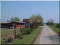
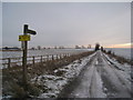
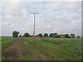
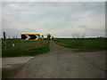
Photos of DN17 4SE


Area Information
DN17 4SE is a small residential postcode area in England, home to 1,778 people spread across a compact cluster of homes. With a population density of 452 people per square kilometre, it is a tightly knit community where most residents live in houses rather than flats. The area’s character is shaped by its mature demographic, with a median age of 47 and the majority of residents falling within the 30–64 age range. This suggests a stable, family-oriented environment where many households have been established for years. Living in DN17 4SE means being part of a community with strong home ownership—81% of properties are owner-occupied—reflecting a preference for long-term residency. The area’s small size means it is not a sprawling suburb but a focused residential cluster, ideal for those seeking a quieter, less congested lifestyle. Proximity to local amenities, schools, and transport links ensures daily life remains convenient, while the low crime risk and absence of environmental constraints make it a practical choice for buyers prioritising safety and accessibility.
- Area Type
- Postcode
- Area Size
- Not available
- Population
- 1778
- Population Density
- 452 people/km²
The property market in DN17 4SE is characterised by a strong emphasis on owner-occupation, with 81% of homes owned by residents rather than rented. This suggests a stable, long-term market where properties are less likely to be available for short-term rental or speculative investment. The accommodation type is predominantly houses, which may appeal to families or those seeking more space than a flat could offer. As a small postcode area, the housing stock is limited, meaning buyers should consider the broader surrounding region for more options. The high home ownership rate also implies that properties in DN17 4SE may hold value over time, particularly for those seeking a secure, low-maintenance lifestyle. However, the compact nature of the area means competition for available homes could be fierce, requiring buyers to act decisively when opportunities arise.
House Prices in DN17 4SE
No properties found in this postcode.
Energy Efficiency in DN17 4SE
The lifestyle in DN17 4SE is supported by a range of nearby amenities within practical reach. Retail options include Tesco Crowle, Lincolnshire Co-operative Co, and Tesco Scunthorpe, providing essential shopping and grocery needs. These stores are likely to cater to both daily necessities and occasional purchases, ensuring convenience for residents. The three railway stations—Crowle, Althorpe, and Thorne South—offer easy access to broader regional networks, facilitating travel for work, leisure, or social visits. While the data does not specify parks or leisure facilities, the presence of retail and transport hubs suggests a functional, community-focused environment. The area’s small size means amenities are concentrated, reducing the need for long commutes. This balance of retail, transport, and proximity to schools creates a practical, self-contained lifestyle for residents.
Amenities
Schools
Residents of DN17 4SE have access to two schools within practical reach. Saint Norbert’s Catholic Primary School serves the local community with a primary education offering, while St Norbert’s Catholic Voluntary Academy provides secondary education and holds an Ofsted rating of ‘good’. The presence of both a primary and secondary school within the area ensures families can plan their education needs without needing to commute far. The academy’s ‘good’ rating suggests a reliable standard of teaching and facilities, which is a significant consideration for parents. The combination of schools caters to children of all ages, making DN17 4SE an attractive option for families prioritising proximity to quality education. The absence of additional schools in the data means buyers should verify if these institutions meet the needs of all local children, but the current offerings are robust for most households.
| Rank | School | Type | Entry gender | Ages |
|---|
Explore more schools in this area
Go to Schools tabDemographics
The community in DN17 4SE is predominantly composed of adults aged 30–64, with a median age of 47. This suggests a mature, established population, many of whom may have raised families in the area. Home ownership is high, with 81% of residents owning their homes, indicating a stable housing market and long-term investment in the area. The accommodation type is primarily houses, reflecting a preference for detached or semi-detached properties over flats. The predominant ethnic group is White, which aligns with broader regional trends. While specific data on deprivation is not provided, the high home ownership rate and low crime risk suggest a relatively affluent and secure environment. The absence of significant demographic diversity, however, means the community is homogenous in composition. For those considering living in DN17 4SE, the age profile and housing stock indicate a settled, family-focused area with limited turnover in property ownership.
Household Size
Accommodation Type
Tenure
Ethnic Group
Religion
Household Composition
Age
Household Deprivation
NS-SEC
Explore more demographic insights in this area
Go to Demographics tabPlanning
Planning Constraints
- Flood RiskPremium
- Ramsar Wetland SitesPremium
- Area of Outstanding Natural BeautyPremium
- Protected Nature ReservePremium
- Protected WoodlandPremium