Area Overview for DN17 4QZ
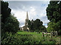
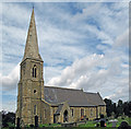
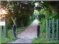
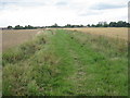
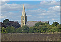
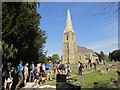
Photos of DN17 4QZ
Area Information
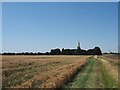
Living in DN17 4QZ means being part of a small, tightly knit residential cluster in England. The area spans 5.4 hectares, housing 1,535 residents at a density of 34 people per square kilometre. This compact community is characterised by a quiet, low-density feel, with homes predominantly in private ownership. The median age of 47 suggests a mature demographic, with a strong presence of adults aged 30–64. Daily life here is likely to be unhurried, with proximity to local amenities and schools. The area’s small size means a sense of familiarity among residents, though its limited footprint may restrict opportunities for expansion. For those seeking a stable, family-oriented environment with access to nearby services, DN17 4QZ offers a straightforward, no-frills lifestyle. Its location balances seclusion with practical connectivity, making it suitable for those prioritising comfort over urban vibrancy.
- Area Type
- Postcode
- Area Size
- 5.4 hectares
- Population
- 1535
- Population Density
- 34 people/km²
DN17 4QZ is a predominantly owner-occupied area, with 76% of homes in private hands. The housing stock consists almost entirely of houses, rather than flats or apartments, which is typical of smaller rural or semi-rural communities. This suggests a market where properties are likely to be family homes, with limited rental availability. The area’s small size—just 5.4 hectares—means the number of homes is constrained, potentially limiting opportunities for buyers seeking a wide selection. For those considering purchase, the focus on owner-occupation indicates a stable market, though the limited inventory may mean competition for available properties. Buyers should also consider the area’s proximity to larger towns for additional services or employment opportunities.
House Prices in DN17 4QZ
Showing 3 properties
| Address | Type | Beds | Baths | Last Sale Price | Last Sale Date | |
|---|---|---|---|---|---|---|
| 2 Church Lane, Luddington, DN17 4QZ | Retail | 3 | 1 | £200,000 | May 2023 | |
| Bracken House, 1 Church Lane, Luddington, DN17 4QZ | Retail | 3 | 1 | £140,000 | Dec 2001 | |
| 2 Church Lane, Luddington, DN17 4QZ | Semi-detached | - | - | - | - |
Energy Efficiency in DN17 4QZ
The lifestyle in DN17 4QZ is shaped by its proximity to essential amenities. Residents have access to five retail outlets, including Iceland Flixborough, Tesco Scunthorpe, and Aldi Gallagher, ensuring everyday shopping needs are met without long trips. The area’s rail network, with stations at Althorpe, Crowle, and Scunthorpe, offers easy access to broader regional services and employment hubs. While the data does not specify parks or leisure facilities, the low population density suggests space for informal outdoor activities. The presence of two primary schools and a stable community adds to the area’s appeal for families. Overall, DN17 4QZ provides a blend of practical convenience and a quiet, settled environment.
Amenities
Schools
Residents of DN17 4QZ have access to two primary schools within practical reach: Luddington & Garthorpe Primary and Eastoft Church of England Primary School. Both institutions hold a ‘good’ Ofsted rating, ensuring a standard of education that meets national benchmarks. The presence of two primary schools provides families with choice and flexibility, reducing pressure on individual schools. As a small area, the proximity of these schools is a significant advantage, minimising travel time for parents and children. The mix of school types—though both are primary—suggests a focus on early education, which is essential for young families. These schools are likely to be central to the local community, fostering connections among residents.
| Rank | School | Type | Entry gender | Ages |
|---|
Explore more schools in this area
Go to Schools tabDemographics
DN17 4QZ has a median age of 47, with the majority of residents falling into the 30–64 age range. This suggests a community of middle-aged and older adults, likely including families with children. Home ownership is high at 76%, indicating a stable, long-term population. The area is composed almost entirely of houses, rather than flats or apartments, reflecting a traditional, suburban housing stock. The predominant ethnic group is White, though no further breakdown of diversity is provided. With a population density of 34 people per square kilometre, the area avoids overcrowding, offering a relaxed living environment. The age profile and ownership rates suggest a community focused on stability and long-term residence, with fewer transient residents.
Household Size
Accommodation Type
Tenure
Ethnic Group
Religion
Household Composition
Age
Household Deprivation
NS-SEC
Explore more demographic insights in this area
Go to Demographics tabPlanning
Planning Constraints
- Flood RiskPremium
- Ramsar Wetland SitesPremium
- Area of Outstanding Natural BeautyPremium
- Protected Nature ReservePremium
- Protected WoodlandPremium