Area Overview for DN17 4DU
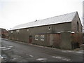
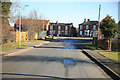
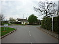
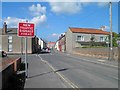
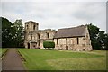
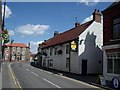
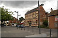
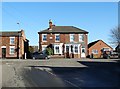
Photos of DN17 4DU


Area Information
DN17 4DU is a small, densely populated residential cluster in England, covering just 1.3 hectares and home to 1,802 residents. Its compact size means the area is tightly knit, with a high population density of 1,491 people per square kilometre. This postcode is characterised by a mature community, with a median age of 47 and the majority of residents falling within the 30-64 age range. The area is predominantly owner-occupied, with 60% of homes owned by residents, and most properties are houses rather than flats. Living here offers proximity to essential services, including two primary schools, multiple retail outlets, and rail stations within practical reach. The broadband score of 96 ensures excellent connectivity, while the area’s small footprint means residents are likely to know their neighbours. However, the high flood risk score of 98.28 raises concerns for potential buyers, requiring careful consideration of property location and flood defences. Despite this, the area’s mix of practical amenities and community-focused living makes it a viable option for those prioritising convenience and connectivity.
- Area Type
- Postcode
- Area Size
- 1.3 hectares
- Population
- 1802
- Population Density
- 1491 people/km²
The property market in DN17 4DU is dominated by owner-occupied homes, with 60% of properties owned by residents. The accommodation type is primarily houses, which is unusual for a small postcode area but may indicate a mix of larger family homes and smaller detached properties. Given the area’s size and high population density, the housing stock is limited, potentially leading to competition for available properties. The small footprint of DN17 4DU suggests that buyers should consider proximity to nearby amenities, such as rail stations and retail outlets, as the immediate surroundings may offer additional options. However, the high flood risk score of 98.28 could impact property values and desirability, particularly for those prioritising safety. Buyers should also note the lack of protected natural areas or planning constraints, which may simplify development or renovation opportunities.
House Prices in DN17 4DU
Showing 15 properties
| Address | Type | Beds | Baths | Last Sale Price | Last Sale Date | |
|---|---|---|---|---|---|---|
| 1 Godnow Road, Crowle, DN17 4DU | Detached | 3 | 1 | £215,000 | Jul 2025 | |
| 1, Bishops Wharf, Godnow Road, Crowle, DN17 4DU | house | - | - | £155,000 | Apr 2021 | |
| 9 Godnow Road, Crowle, DN17 4DU | Bungalow | 4 | 2 | £275,000 | Dec 2020 | |
| 7 Godnow Road, Crowle, DN17 4DU | Bungalow | 3 | - | £138,500 | May 2012 | |
| 3, Bishops Wharf, Godnow Road, Crowle, DN17 4DU | Terraced | - | - | £75,000 | Nov 2010 | |
| 2, Bishops Wharf, Godnow Road, Crowle, DN17 4DU | house | 4 | - | £135,000 | Jan 2008 | |
| 10 Godnow Road, Crowle, DN17 4DU | Semi-detached | 4 | - | £38,500 | Feb 2001 | |
| 17 Godnow Road, Crowle, DN17 4DU | house | - | - | £33,000 | Aug 1995 | |
| 11 Godnow Road, Crowle, DN17 4DU | Land | - | - | - | - | |
| 3 Godnow Road, Crowle, DN17 4DU | Detached | - | - | - | - |
Energy Efficiency in DN17 4DU
The lifestyle in DN17 4DU is shaped by its proximity to essential amenities. Retail options include the Lincolnshire Co-operative Co, Tesco Crowle, and Co-op Petrol, offering everyday shopping and fuel needs. The area’s rail stations connect residents to broader networks, supporting both work and leisure travel. While the data does not specify parks or leisure facilities, the lack of protected natural areas suggests that recreational spaces may be limited to local green belts or community areas. The compact nature of the postcode means that daily life revolves around a tight cluster of services, encouraging a walkable, neighbourly environment. For those who prioritise convenience over expansive amenities, the area’s practical layout and accessibility to nearby towns provide a balance between local convenience and regional opportunities.
Amenities
Schools
Residents of DN17 4DU have access to two primary schools: Crowle Primary School and Crowle Primary Academy. Both institutions cater to younger children, providing essential early education for families in the area. The presence of two primary schools within proximity suggests a focus on local schooling, reducing the need for long commutes. However, no secondary schools are listed in the data, meaning students may need to travel to nearby towns for further education. The availability of two primary schools could ease pressure on local education resources, though parents should verify the schools’ Ofsted ratings and performance metrics independently. For families prioritising proximity to schools, the combination of two primary options may be a significant advantage, though additional research into secondary education options is advisable.
| Rank | School | Type | Entry gender | Ages |
|---|
Explore more schools in this area
Go to Schools tabDemographics
The community in DN17 4DU is predominantly composed of adults aged 30-64, with a median age of 47. This suggests a settled population, likely with established careers and families. Home ownership is strong, with 60% of residents owning their homes, while the remaining 40% are likely to be renters. The accommodation type is primarily houses, reflecting a suburban or semi-rural character. The predominant ethnic group is White, with no data provided on other demographics. The population density of 1,491 people per square kilometre indicates a compact, possibly mixed-use area where residential properties are closely spaced. While no specific deprivation data is listed, the high population density and limited area size suggest that housing and community resources are shared among a relatively small number of residents. This could influence local dynamics, with a focus on shared amenities and neighbourly interaction.
Household Size
Accommodation Type
Tenure
Ethnic Group
Religion
Household Composition
Age
Household Deprivation
NS-SEC
Explore more demographic insights in this area
Go to Demographics tabPlanning
Planning Constraints
- Flood RiskPremium
- Ramsar Wetland SitesPremium
- Area of Outstanding Natural BeautyPremium
- Protected Nature ReservePremium
- Protected WoodlandPremium