Area Overview for DN17 4DA
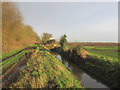
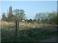
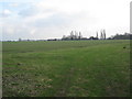
Photos of DN17 4DA


Area Information
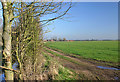
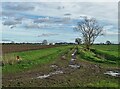
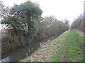
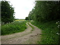
Living in DN17 4DA means residing in a small, compact residential cluster spanning 1.1 km², home to 1,842 people. This area is defined by its low population density of 62 people per square kilometre, suggesting a quiet, spread-out community. The demographic profile is clear: most residents are adults aged 30–64, with a median age of 47, indicating a mature, stable population. Owner-occupation dominates, with 90% of homes owned by their residents, and the housing stock is predominantly single-family dwellings. While the area lacks the vibrancy of larger towns, its small size fosters a close-knit environment. However, the critical flood risk rating—linked to high flood coverage—presents a significant challenge for homeowners. Conversely, crime rates are low, with a safety score of 74, suggesting a secure neighbourhood. For those prioritising tranquillity and proximity to essential services, DN17 4DA offers a snapshot of rural living with a practical balance of amenities within reach.
- Area Type
- Postcode
- Area Size
- 1.1 km²
- Population
- 1842
- Population Density
- 62 people/km²
The property market in DN17 4DA is characterised by high home ownership and a focus on single-family homes. With 90% of properties owned by residents, the area is not a rental hotspot but rather a place where long-term occupancy is the norm. The predominance of houses over flats or apartments suggests a market tailored to families or individuals seeking space and privacy. Given the small size of the area—just 1.1 km²—housing stock is limited, which may mean fewer options for buyers and potentially higher competition for available properties. The flood risk, rated as critical, adds a layer of complexity for prospective buyers, requiring careful consideration of insurance and property resilience. For those prioritising stability and a low-crime environment, DN17 4DA offers a niche market, but its small footprint means buyers should explore nearby areas for broader choices.
House Prices in DN17 4DA
Showing 5 properties
Energy Efficiency in DN17 4DA
The lifestyle in DN17 4DA is shaped by its proximity to essential retail amenities, including five notable venues such as Lincolnshire Co-operative Co, Tesco Crowle, and Co-op Mowbray. These shops provide access to groceries, household goods, and everyday necessities, reducing the need for long trips to larger towns. However, the data does not mention parks, leisure facilities, or dining options, suggesting that recreational opportunities may be limited to nearby natural spaces or community hubs. The area’s small size means that residents must look beyond the immediate postcode for more extensive leisure options. Despite this, the availability of basic retail services and the low crime rate contribute to a practical, low-maintenance lifestyle. For those who value self-sufficiency and a quiet environment, DN17 4DA offers a simple, functional living experience, though it may not cater to those seeking a vibrant social or cultural scene.
Amenities
Schools
The nearest school to DN17 4DA is Belton All Saints CofE Primary School, which serves the local community with a good Ofsted rating. This institution is a primary school, catering to younger children, but no secondary schools are listed in the data. Families with children under 11 may find this school adequate, but those requiring secondary education would need to look further afield. The absence of additional schools in the immediate area suggests that parents may need to consider commuting or enrolling their children in larger nearby towns. The single primary school available reflects the small scale of DN17 4DA’s population, which may not support a broader range of educational institutions. For buyers prioritising schools, this area is best suited to those with young children, though secondary education options remain a consideration.
| Rank | School | Type | Entry gender | Ages |
|---|
Explore more schools in this area
Go to Schools tabDemographics
The community in DN17 4DA is predominantly composed of adults aged 30–64, reflecting a mature population with a median age of 47. Home ownership is exceptionally high at 90%, indicating a strong preference for long-term residency over rental properties. The housing stock is almost entirely made up of houses, which aligns with the area’s low population density and suburban character. The predominant ethnic group is White, with no specific data on other demographics provided. This suggests a homogenous community, though the absence of detailed diversity metrics means the full picture of social composition remains unclear. The low deprivation indicators, coupled with stable household structures, imply a relatively affluent and settled population. For buyers, this profile signals a neighbourhood where families and older residents are likely to find a sense of permanence, though the lack of data on younger demographics or ethnic diversity limits a complete understanding of the community’s evolving dynamics.
Household Size
Accommodation Type
Tenure
Ethnic Group
Religion
Household Composition
Age
Household Deprivation
NS-SEC
Explore more demographic insights in this area
Go to Demographics tabPlanning
Planning Constraints
- Flood RiskPremium
- Ramsar Wetland SitesPremium
- Area of Outstanding Natural BeautyPremium
- Protected Nature ReservePremium
- Protected WoodlandPremium