Area Overview for DN17 3UD
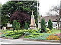
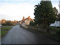
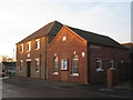
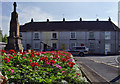
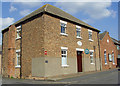
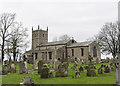
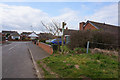
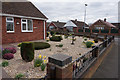
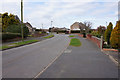
Photos of DN17 3UD

Area Information
Living in DN17 3UD means inhabiting a small, tightly knit residential cluster in England. The area spans 18.2 hectares, housing 1,442 people at a density of 26 per square kilometre, creating a quiet, low-traffic environment. This postcode is defined by its compact size and the presence of family-oriented homes, with 83% of properties owner-occupied. The community is predominantly middle-aged, with a median age of 47 and a strong concentration of adults aged 30–64. Daily life here is shaped by proximity to nearby rail networks and a handful of local shops, while the absence of major urban infrastructure ensures a peaceful, rural feel. Residents benefit from low crime rates and minimal environmental risks, making it an appealing choice for those seeking stability. The area’s small scale means it is not a hub for nightlife or large-scale retail, but its practical amenities and safety profile cater to those prioritising comfort over convenience.
- Area Type
- Postcode
- Area Size
- 18.2 hectares
- Population
- 1442
- Population Density
- 26 people/km²
The property market in DN17 3UD is largely dominated by owner-occupied homes, with 83% of properties in private hands. The accommodation type is exclusively houses, which aligns with the area’s small, rural character and suggests a focus on family homes rather than apartments or rental units. This makes the market less dynamic than larger urban areas, with limited scope for investment or speculative buying. The compact size of the postcode means the housing stock is finite, and buyers may need to consider nearby areas for more options. The high home ownership rate indicates long-term residency and stability, which can be reassuring for prospective buyers. However, the lack of diverse property types may limit appeal for those seeking alternative living arrangements.
House Prices in DN17 3UD
Showing 75 properties
| Address | Type | Beds | Baths | Last Sale Price | Last Sale Date | |
|---|---|---|---|---|---|---|
| 20 The Meadows, Messingham, DN17 3UD | Detached | 4 | 3 | £292,000 | Mar 2024 | |
| 35 The Meadows, Messingham, DN17 3UD | Semi-detached | 3 | 1 | £180,000 | Dec 2023 | |
| 25 The Meadows, Messingham, DN17 3UD | house | - | - | £275,000 | Nov 2022 | |
| 63 The Meadows, Messingham, DN17 3UD | house | - | - | £298,000 | Aug 2021 | |
| 31 The Meadows, Messingham, DN17 3UD | house | - | - | £262,000 | Jun 2021 | |
| 64 The Meadows, Messingham, DN17 3UD | house | - | - | £320,000 | May 2021 | |
| 17 The Meadows, Messingham, DN17 3UD | Detached | 5 | 2 | £267,000 | May 2021 | |
| 54 The Meadows, Messingham, DN17 3UD | Detached | 4 | - | £298,000 | Jan 2021 | |
| 2 The Meadows, Messingham, DN17 3UD | house | - | - | £260,000 | Jul 2019 | |
| 52 The Meadows, Messingham, DN17 3UD | Detached | 4 | 2 | £215,000 | Jun 2018 |
Energy Efficiency in DN17 3UD
Daily life in DN17 3UD is shaped by its modest retail and transport options. Five local retail outlets, including Lincolnshire Co-operative Co and Heron Riddings, provide basic shopping needs within practical reach. The three nearby rail stations enhance mobility, allowing residents to access larger centres for more extensive amenities. While the area lacks parks or leisure facilities, the low population density and absence of major infrastructure contribute to a tranquil lifestyle. The combination of retail convenience and rail access ensures a functional, if unpretentious, quality of life.
Amenities
Schools
The only school listed near DN17 3UD is Act Fast NL Ltd, a special school with a good Ofsted rating. This suggests the area has limited mainstream educational options, though the presence of a special school may indicate support for specific educational needs. Families requiring a broader range of schooling may need to look beyond the immediate vicinity. The absence of other schools in the data highlights the importance of checking nearby districts for comprehensive educational facilities. For those prioritising accessibility, the proximity to rail stations could ease commuting to larger towns with more school choices.
| Rank | School | Type | Entry gender | Ages |
|---|
Explore more schools in this area
Go to Schools tabDemographics
The population of DN17 3UD is characterised by a median age of 47, with the majority of residents falling within the 30–64 age bracket. This suggests a community of established adults, many of whom are likely to be homeowners, as 83% of properties are owner-occupied. The accommodation type is predominantly houses, indicating a lack of high-density housing or flats. The predominant ethnic group is White, reflecting a homogenous demographic profile. With a population density of 26 people per square kilometre, the area avoids overcrowding, contributing to a relaxed living environment. The age distribution implies a mature community with fewer young families, though the presence of a special school nearby may serve specific local needs. The low levels of deprivation, inferred from the high home ownership and safety metrics, suggest a generally stable and secure quality of life.
Household Size
Accommodation Type
Tenure
Ethnic Group
Religion
Household Composition
Age
Household Deprivation
NS-SEC
Explore more demographic insights in this area
Go to Demographics tabPlanning
Planning Constraints
- Flood RiskPremium
- Ramsar Wetland SitesPremium
- Area of Outstanding Natural BeautyPremium
- Protected Nature ReservePremium
- Protected WoodlandPremium