Area Overview for DN17 3TH
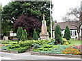
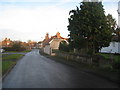
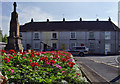
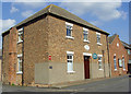
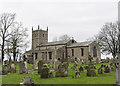
Photos of DN17 3TH


Area Information
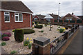
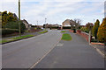
Living in DN17 3TH means inhabiting a small, densely populated residential cluster in England, where 1,372 people reside across just 3,502 square metres. This compact area, while limited in size, offers a tightly knit community feel with practical access to nearby amenities. The high population density—391,743 people per square kilometre—suggests a focus on close-knit living, where residents share proximity to essential services. The area’s character is defined by its modest scale, with homes predominantly in private ownership, reflecting a stable, long-term residential base. Daily life here balances simplicity with connectivity, with rail stations and retail outlets within practical reach. Though small, DN17 3TH is positioned to offer convenience without the sprawl of larger towns, making it appealing to those seeking a manageable, self-contained environment.
- Area Type
- Postcode
- Area Size
- 3502 m²
- Population
- 1372
- Population Density
- 1667 people/km²
The property market in DN17 3TH is dominated by owner-occupied homes, with 78% of residents living in houses rather than flats or other formats. This suggests a focus on family-sized dwellings, likely with gardens or outdoor space, given the area’s small scale. The high home ownership rate indicates a community where long-term residency is common, reducing the turnover typical of rental markets. For buyers, this means a limited inventory of properties, with most available homes being single-family residences. The compact size of the area means the immediate surroundings are crucial, and proximity to nearby rail stations may be a key factor for buyers prioritising transport links. The market’s stability, however, could also mean fewer opportunities for investment or speculative purchase.
House Prices in DN17 3TH
Showing 11 properties
| Address | Type | Beds | Baths | Last Sale Price | Last Sale Date | |
|---|---|---|---|---|---|---|
| 11 Danby Road, Messingham, DN17 3TH | Bungalow | 2 | 1 | £185,000 | Jul 2020 | |
| 4 Danby Road, Messingham, DN17 3TH | house | 3 | - | £121,000 | May 2011 | |
| 3 Danby Road, Messingham, DN17 3TH | house | - | - | £145,000 | Jul 2008 | |
| 10 Danby Road, Messingham, DN17 3TH | Detached | - | - | £63,000 | Aug 1998 | |
| 8 Danby Road, Messingham, DN17 3TH | Detached | 3 | 1 | - | - | |
| 9 Danby Road, Messingham, DN17 3TH | Detached | 3 | 1 | - | - | |
| 5 Danby Road, Messingham, DN17 3TH | house | - | - | - | - | |
| 1 Danby Road, Messingham, DN17 3TH | Semi-detached | - | - | - | - | |
| 6 Danby Road, Messingham, DN17 3TH | Semi-detached | - | - | - | - | |
| 7 Danby Road, Messingham, DN17 3TH | Terraced | - | - | - | - |
Energy Efficiency in DN17 3TH
Residents of DN17 3TH have access to five retail outlets, including Lincolnshire Co-operative Co and Heron Riddings, offering everyday shopping needs. The rail network, with stations at Kirton Lindsey, Scunthorpe, and Althorpe, provides direct links to broader regional opportunities. While the area lacks large-scale leisure facilities, the proximity to rail stations suggests easy access to cultural or recreational hubs beyond the immediate postcode. The retail presence, though modest, supports daily convenience, and the rail connections ensure that residents are not isolated from larger centres. The lifestyle here is practical, prioritising accessibility over extensive local amenities, with the community’s needs met by nearby services and transport links.
Amenities
Schools
| Rank | School | Type | Entry gender | Ages |
|---|
Explore more schools in this area
Go to Schools tabDemographics
DN17 3TH’s population skews towards adults aged 30–64, with a median age of 47, indicating a mature, established community. Home ownership is high at 78%, suggesting a preference for long-term residency over rental properties. The area is predominantly White, with no data provided on other ethnic groups. The accommodation type is largely houses, which aligns with the high ownership rate and implies a family-oriented demographic. The absence of specific data on deprivation or diversity means the area’s social fabric remains opaque, but the age profile and ownership figures suggest a settled, low-turnover population. This demographic stability may contribute to a consistent local identity, though it also limits the visibility of broader societal shifts.
Household Size
Accommodation Type
Tenure
Ethnic Group
Religion
Household Composition
Age
Household Deprivation
NS-SEC
Explore more demographic insights in this area
Go to Demographics tabPlanning
Planning Constraints
- Flood RiskPremium
- Ramsar Wetland SitesPremium
- Area of Outstanding Natural BeautyPremium
- Protected Nature ReservePremium
- Protected WoodlandPremium