Area Overview for DN17 3SZ
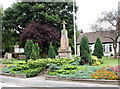
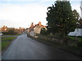
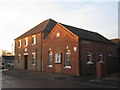
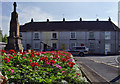
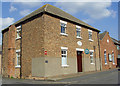
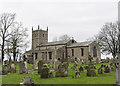
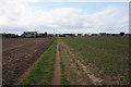
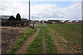
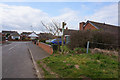
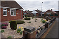
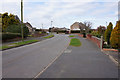
Photos of DN17 3SZ

Area Information
DN17 3SZ is a small, tightly knit residential cluster in England, spanning just 5.1 hectares and home to 1,442 residents. Its low population density of 26 people per square kilometre suggests a quiet, uncluttered living environment, ideal for those seeking a peaceful retreat. The area’s compact size means it’s easy to navigate on foot or by bike, with local amenities within practical reach. Daily life here is shaped by its demographic profile: predominantly adults aged 30–64, with a median age of 47, reflecting a stable, mature community. Home ownership is high at 83%, indicating a strong sense of local attachment. While the area lacks large-scale developments, its proximity to rail networks and modest retail options offers a balance between seclusion and connectivity. For buyers, DN17 3SZ represents a rare blend of low-density living, established community ties, and practical access to nearby towns and services.
- Area Type
- Postcode
- Area Size
- 5.1 hectares
- Population
- 1442
- Population Density
- 26 people/km²
DN17 3SZ is primarily an owner-occupied area, with 83% of residents living in houses rather than rental properties. This indicates a market skewed towards long-term homeownership, with limited availability of flats or apartments. The small size of the area—just 5.1 hectares—means the housing stock is tightly concentrated, likely comprising a mix of older, family-sized homes. For buyers, this presents both opportunities and challenges: the area’s compact nature may limit property choice, but it also ensures a sense of community and low competition. Given the high home ownership rate, the local property market is likely to be stable, with demand driven by those seeking a quiet, established residential environment. Prospective buyers should consider the limited scope for new developments in such a small area.
House Prices in DN17 3SZ
Showing 18 properties
| Address | Type | Beds | Baths | Last Sale Price | Last Sale Date | |
|---|---|---|---|---|---|---|
| 16 Saltergate Road, Messingham, DN17 3SZ | Bungalow | 2 | 1 | £185,000 | Nov 2025 | |
| 7 Saltergate Road, Messingham, DN17 3SZ | Bungalow | 3 | 1 | £170,000 | Apr 2016 | |
| 5 Saltergate Road, Messingham, DN17 3SZ | Bungalow | 3 | - | £174,950 | Jan 2016 | |
| 11 Saltergate Road, Messingham, DN17 3SZ | Bungalow | 3 | 1 | £164,000 | Jul 2015 | |
| 10 Saltergate Road, Messingham, DN17 3SZ | Bungalow | - | - | £102,500 | Apr 2015 | |
| 18 Saltergate Road, Messingham, DN17 3SZ | Semi-detached | 2 | - | £100,000 | May 2013 | |
| 6 Saltergate Road, Messingham, DN17 3SZ | Bungalow | 2 | - | £132,500 | Oct 2012 | |
| 12 Saltergate Road, Messingham, DN17 3SZ | Bungalow | - | - | £120,000 | Sep 2009 | |
| 14 Saltergate Road, Messingham, DN17 3SZ | Detached | - | - | £120,000 | Aug 2009 | |
| 2 Saltergate Road, Messingham, DN17 3SZ | Detached | - | - | £109,000 | Nov 2003 |
Energy Efficiency in DN17 3SZ
The lifestyle in DN17 3SZ is shaped by its proximity to modest retail and transport hubs. Within practical reach are five retail outlets, including Lincolnshire Co-operative Co and Heron Riddings, offering essential shopping and services. The area’s rail connections to Kirton Lindsey, Scunthorpe, and Althorpe provide access to broader amenities, from dining to leisure. While the data does not specify parks or recreational facilities, the absence of planning constraints like protected woodlands or AONB designations suggests space for informal outdoor activities. The compact nature of the area means residents can easily access daily necessities without long commutes, fostering a self-contained, convenient lifestyle.
Amenities
Schools
The nearest school to DN17 3SZ is Act Fast NL Ltd, a special school with a good Ofsted rating. This institution caters to students with specific educational needs, offering tailored support and resources. The presence of a special school suggests the area may attract families with children requiring additional learning provisions. However, no other schools are listed in the data, meaning parents may need to look beyond DN17 3SZ for primary or secondary education. For those prioritising specialist schooling, the nearby Act Fast NL Ltd provides a reliable option, but broader educational choices would depend on commuting to nearby towns.
| Rank | School | Type | Entry gender | Ages |
|---|
Explore more schools in this area
Go to Schools tabDemographics
The population of DN17 3SZ is predominantly adults aged 30–64, with a median age of 47, suggesting a mature, settled community. Home ownership is exceptionally high at 83%, with the majority of residents living in houses rather than flats. The area’s ethnic composition is largely White, reflecting a homogeneous demographic profile. This stability is reinforced by the absence of significant deprivation indicators in the data, though no specific figures on deprivation are provided. The age range of residents implies a focus on family-oriented living, with many likely to be in their prime working years. The high proportion of homeowners suggests a long-term investment in the area, which may contribute to a cohesive, low-turnover neighbourhood.
Household Size
Accommodation Type
Tenure
Ethnic Group
Religion
Household Composition
Age
Household Deprivation
NS-SEC
Explore more demographic insights in this area
Go to Demographics tabPlanning
Planning Constraints
- Flood RiskPremium
- Ramsar Wetland SitesPremium
- Area of Outstanding Natural BeautyPremium
- Protected Nature ReservePremium
- Protected WoodlandPremium