Area Overview for DN17 2UR
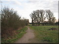
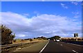
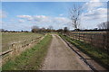
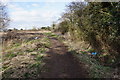
Photos of DN17 2UR
Area Information
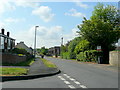
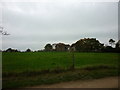
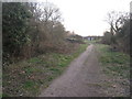
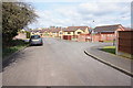
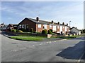
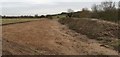
DN17 2UR is a small, tightly knit residential cluster in North Lincolnshire, part of the broader Scunthorpe conurbation but retaining pockets of rural character. With a population of 1,576 and a density of 1,403 people per square kilometre, it is a compact area where history and modernity intersect. The village of Bottesford, which shares proximity to this postcode, has roots stretching back to the Domesday Book, with a legacy of farming, industry, and strategic transport links. Today, the area balances suburban living with access to natural landscapes, including the River Trent and historic sites like Fleming’s Bridge. Residents benefit from nearby railway stations, including Scunthorpe and Althorpe, offering connections to major cities. The area’s charm lies in its blend of traditional architecture, such as the 16th-century parish church, and contemporary amenities like supermarkets and co-ops. For those seeking a quieter life with easy access to urban opportunities, DN17 2UR offers a distinctive mix of rural tranquillity and practical connectivity.
- Area Type
- Postcode
- Area Size
- Not available
- Population
- 1576
- Population Density
- 1403 people/km²
DN17 2UR is predominantly an owner-occupied area, with 92% of homes privately owned. The accommodation type is exclusively houses, indicating a lack of flats or apartments in the area. This suggests a housing stock suited to families or individuals seeking more space and privacy, typical of suburban or rural settings. The high home ownership rate implies limited rental availability, which may make the area less attractive to tenants or first-time buyers seeking affordability. Given the small size of the postcode and its focus on houses, property choices are likely limited to individual homes rather than larger developments. Buyers considering this area may need to look beyond DN17 2UR for more diverse options, though the existing stock offers a stable, long-term investment potential. The absence of rental properties also means the market is less dynamic, with fewer opportunities for short-term gains.
House Prices in DN17 2UR
No properties found in this postcode.
Energy Efficiency in DN17 2UR
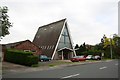
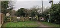
Living in DN17 2UR offers access to a range of practical amenities within reach. Retail options include Heron Riddings, Lincolnshire Co-operative Co, and Tesco Ashby, providing everyday shopping needs. The area’s railway stations, such as Scunthorpe and Althorpe, connect residents to broader networks for commuting or travel. Historically, the village of Bottesford, near this postcode, features notable sites like the 14th–16th century parish church, Fleming’s Bridge (a 1620 packhorse bridge), and the Duke of Rutland’s Hospital. The Millennium Green offers open space for leisure, while the Bottesford water mill, now a private house, hints at the area’s industrial past. These amenities blend practicality with heritage, offering both convenience and a sense of place. The mix of retail, transport, and historical sites creates a lifestyle that balances modern needs with local character.
Amenities
Schools
| Rank | School | Type | Entry gender | Ages |
|---|
Explore more schools in this area
Go to Schools tabDemographics
The population of DN17 2UR has a median age of 47, with the majority of residents aged between 30 and 64. This suggests a community dominated by established adults, likely with long-term ties to the area. Home ownership is exceptionally high at 92%, indicating a stable, settled population with a strong preference for private residence over rental properties. The predominant accommodation type is houses, reflecting a suburban or semi-rural housing stock rather than flats or apartments. The predominant ethnic group is White, though specific data on diversity or deprivation is not provided. The age profile and ownership rates imply a mature, low-turnover community, where families and professionals may be more likely to reside. With no data on income distribution or deprivation levels, it is difficult to assess socioeconomic variation, but the high home ownership rate suggests a relatively affluent or stable local economy.
Household Size
Accommodation Type
Tenure
Ethnic Group
Religion
Household Composition
Age
Household Deprivation
NS-SEC
Explore more demographic insights in this area
Go to Demographics tabPlanning
Planning Constraints
- Flood RiskPremium
- Ramsar Wetland SitesPremium
- Area of Outstanding Natural BeautyPremium
- Protected Nature ReservePremium
- Protected WoodlandPremium