Area Overview for DN17 2QT
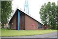
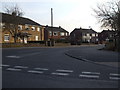
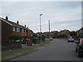
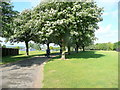
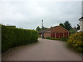
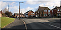
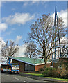
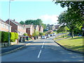
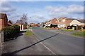
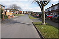
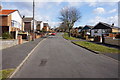
Photos of DN17 2QT

Area Information
DN17 2QT is a compact residential postcode in North Lincolnshire, covering just 1.2 hectares with a population of 1,398 people. Its high population density of 118,431 people per square kilometre reflects its small, closely knit character. This area lies within the Scunthorpe conurbation, yet retains elements of rural farmland to the west, extending toward the River Trent. Daily life here is shaped by its proximity to Scunthorpe, a larger town offering services and transport links, while the surrounding landscape offers a quieter, more traditional feel. The village of Bottesford, though not explicitly named in the postcode, is nearby, with historical sites like the parish church and Fleming’s Bridge adding cultural depth. Residents benefit from a mix of modern amenities and historical heritage, with a community skewed toward adults aged 30–64. The area’s compact size means residents are likely within walking or short driving distance of local shops, schools, and transport hubs, creating a practical, efficient lifestyle.
- Area Type
- Postcode
- Area Size
- 1.2 hectares
- Population
- 1398
- Population Density
- 3728 people/km²
DN17 2QT is overwhelmingly an owner-occupied area, with 89% of homes owned by residents rather than rented. The accommodation type is exclusively houses, not flats, which is unusual for a small postcode and suggests a focus on family homes or larger properties. This makes the area attractive to buyers seeking private, stable housing with potential for long-term investment. The high home ownership rate also implies limited rental availability, which could be a challenge for those seeking short-term housing solutions. Given the postcode’s small size, the property stock is likely limited, but the presence of historical features—such as the nearby Bottesford water mill—may add character to homes. Buyers should consider the area’s proximity to Scunthorpe for broader property options, though the immediate surroundings offer a mix of residential and rural elements.
House Prices in DN17 2QT
Showing 34 properties
| Address | Type | Beds | Baths | Last Sale Price | Last Sale Date | |
|---|---|---|---|---|---|---|
| 25 Parkin Road, Bottesford, DN17 2QT | house | - | - | £160,000 | Mar 2025 | |
| 31 Parkin Road, Bottesford, DN17 2QT | Semi-detached | 3 | 1 | £200,000 | Apr 2024 | |
| 9 Parkin Road, Bottesford, DN17 2QT | Semi-detached | 3 | 1 | £210,000 | Dec 2023 | |
| 28 Parkin Road, Bottesford, DN17 2QT | Semi-detached | 3 | 1 | £182,000 | Apr 2023 | |
| 24 Parkin Road, Bottesford, DN17 2QT | Semi-detached | 3 | 1 | £196,500 | Mar 2022 | |
| 5 Parkin Road, Bottesford, DN17 2QT | house | - | - | £161,000 | Jan 2021 | |
| 7 Parkin Road, Bottesford, DN17 2QT | Semi-detached | 3 | 1 | £154,000 | Sep 2020 | |
| 4 Parkin Road, Bottesford, DN17 2QT | Semi-detached | 3 | 1 | £125,000 | Sep 2019 | |
| 33 Parkin Road, Bottesford, DN17 2QT | Semi-detached | 3 | - | £133,000 | Jun 2016 | |
| 8 Parkin Road, Bottesford, DN17 2QT | Semi-detached | 3 | - | £129,000 | Apr 2014 |
Energy Efficiency in DN17 2QT
Residents of DN17 2QT have access to a range of amenities within practical reach. Retail options include five local shops, such as Heron Riddings and Tesco Ashby, offering everyday goods and services. The three nearby railway stations—Scunthorpe, Althorpe, and Kirton Lindsey—provide direct links to larger towns and cities, enhancing connectivity. While the area lacks detailed information on parks or leisure facilities, its historical context suggests cultural attractions like the parish church and Bottesford water mill may contribute to a sense of local identity. The compact nature of the postcode means amenities are concentrated, reducing travel time for essentials. However, the absence of specific data on dining or recreational venues means the full lifestyle offering remains partially unexplored.
Amenities
Schools
The nearest school to DN17 2QT is Leys Farm Junior School, a primary institution with a ‘good’ Ofsted rating. This school serves the local community, providing education for younger children, but families requiring secondary schooling would need to look beyond the immediate area. The absence of secondary schools nearby means parents must factor in travel time to larger towns like Scunthorpe. The single school listed suggests a limited range of educational options, though the ‘good’ rating indicates a reliable standard of teaching. For families prioritising proximity to schools, this area offers a solid foundation for early education but may require planning for future academic needs.
| Rank | School | Type | Entry gender | Ages |
|---|
Explore more schools in this area
Go to Schools tabDemographics
The population of DN17 2QT has a median age of 47, with the majority of residents aged 30–64. This suggests a community of established professionals and families, rather than a younger or retired demographic. Home ownership is exceptionally high at 89%, indicating a stable, long-term resident base. The area is predominantly composed of houses, not flats, reflecting a preference for single-family dwellings. The predominant ethnic group is White, with no specific data on other demographics. The high home ownership rate and age profile suggest a mature, settled population with limited turnover. The area’s density, while extreme, is manageable due to its small size, allowing for a close-knit community feel. However, the lack of diversity data means the full range of cultural or socioeconomic factors influencing quality of life remains unexplored.
Household Size
Accommodation Type
Tenure
Ethnic Group
Religion
Household Composition
Age
Household Deprivation
NS-SEC
Explore more demographic insights in this area
Go to Demographics tabPlanning
Planning Constraints
- Flood RiskPremium
- Ramsar Wetland SitesPremium
- Area of Outstanding Natural BeautyPremium
- Protected Nature ReservePremium
- Protected WoodlandPremium