Area Overview for DN17 2JB
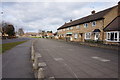
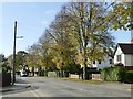
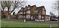
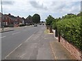
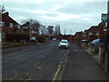
Photos of DN17 2JB


Area Information
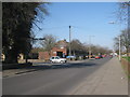
Living in DN17 2JB means inhabiting a tightly packed residential cluster in Scunthorpe, North Lincolnshire. The area covers 7,435 square metres and is home to 1,524 residents, resulting in a population density of 204,985 people per square kilometre — a stark reflection of its compact nature. This postcode falls within the Brumby electoral ward, which has a population of around 1,452 residents. Daily life here is shaped by proximity to key services, including two railway stations and multiple schools. The area’s small footprint means amenities are within practical reach, though the high density may influence the pace of community interactions. DN17 2JB is part of the Scunthorpe parliamentary constituency, and its residents benefit from direct links to nearby towns and cities. While the area lacks expansive green spaces, its strategic location near transport routes and retail hubs makes it functional for commuters and families alike.
- Area Type
- Postcode
- Area Size
- 7435 m²
- Population
- 1524
- Population Density
- 5112 people/km²
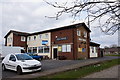
The property market in DN17 2JB is defined by a 46% home ownership rate, suggesting that just under half of properties are owner-occupied, while the rest are likely in the rental market. The accommodation type is predominantly houses, not flats, which indicates a focus on family homes or larger properties. Given the area’s small size and high population density, the housing stock is limited, and buyers should consider proximity to nearby towns for additional options. The concentration of houses may appeal to those seeking traditional family homes, but the compact nature of the postcode means competition for properties could be fierce. For buyers, this area is best suited for those prioritising proximity to schools, transport, and local amenities over expansive living spaces. The market’s character is shaped by its role as a residential cluster within a larger urban framework.
House Prices in DN17 2JB
Showing 19 properties
| Address | Type | Beds | Baths | Last Sale Price | Last Sale Date | |
|---|---|---|---|---|---|---|
| 16 Spilsby Road, Scunthorpe, DN17 2JB | Semi-detached | 3 | 1 | £110,000 | Jan 2024 | |
| 35 Spilsby Road, Scunthorpe, DN17 2JB | house | 3 | 1 | £125,000 | Aug 2022 | |
| 19 Spilsby Road, Scunthorpe, DN17 2JB | house | 3 | - | £135,000 | Aug 2021 | |
| 20 Spilsby Road, Scunthorpe, DN17 2JB | house | 3 | - | £67,500 | May 2014 | |
| 27 Spilsby Road, Scunthorpe, DN17 2JB | Semi-detached | 3 | - | £55,000 | Nov 2013 | |
| 26 Spilsby Road, Scunthorpe, DN17 2JB | Semi-detached | 3 | 1 | £62,000 | Apr 2010 | |
| 18 Spilsby Road, Scunthorpe, DN17 2JB | house | - | - | £39,500 | Dec 2002 | |
| 31 Spilsby Road, Scunthorpe, DN17 2JB | Semi-detached | - | - | £24,000 | Jul 2002 | |
| 22 Spilsby Road, Scunthorpe, DN17 2JB | Semi-detached | - | - | - | - | |
| 25 Spilsby Road, Scunthorpe, DN17 2JB | house | - | - | - | - |
Energy Efficiency in DN17 2JB
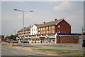
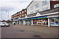
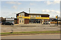
Residents of DN17 2JB have access to five notable retail venues, including Lincolnshire Co-operative Co, Heron Riddings, and Tesco Ashby, ensuring everyday shopping needs are met within the area. These shops provide convenience for groceries, household items, and local services. The presence of two railway stations — Scunthorpe and Althorpe — adds to the area’s connectivity, enabling easy travel to nearby towns and cities. While the data does not specify parks or leisure facilities, the compact nature of the postcode suggests that local amenities are likely concentrated within a short walk or drive. The mix of retail and transport options supports a practical lifestyle, though residents may need to venture further for more extensive recreational or leisure opportunities.
Amenities
Schools
Residents of DN17 2JB have access to three primary schools within practical reach. These include Willoughby Road Primary School, Riddings Junior School, and Willoughby Road Primary Academy, which holds an Ofsted rating of ‘good’. The presence of multiple primary schools suggests a strong focus on early education, though the absence of secondary schools may require families to travel to nearby areas. The mix of school types — all primary — indicates that the area is well-served for younger children but may lack comprehensive educational infrastructure for older students. For families prioritising school quality, the ‘good’ rating at Willoughby Road Primary Academy is a positive sign, though parents should verify the full range of curricula and facilities available.
| Rank | School | Type | Entry gender | Ages |
|---|
Explore more schools in this area
Go to Schools tabDemographics
DN17 2JB has a median age of 47, with the majority of residents falling within the 30-64 age range. This suggests a community skewed towards adults, likely including working professionals and families. Home ownership stands at 46%, indicating that nearly half of properties are owner-occupied, while the remaining 54% are likely rented. The area is predominantly composed of houses, not flats, which aligns with the demographic profile of older, established households. The predominant ethnic group is White, reflecting broader trends in North Lincolnshire. The population density of 204,985 people per square kilometre is exceptionally high, which may influence the character of the area — compact, perhaps with shared spaces or close-knit neighbourly interactions. This density does not necessarily correlate with deprivation, but it does mean that resources and services must serve a concentrated population efficiently.
Household Size
Accommodation Type
Tenure
Ethnic Group
Religion
Household Composition
Age
Household Deprivation
NS-SEC
Explore more demographic insights in this area
Go to Demographics tabPlanning
Planning Constraints
- Flood RiskPremium
- Ramsar Wetland SitesPremium
- Area of Outstanding Natural BeautyPremium
- Protected Nature ReservePremium
- Protected WoodlandPremium