Area Overview for DN17 2HE
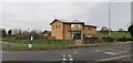
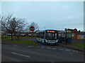
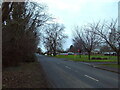
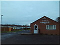
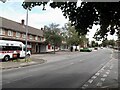
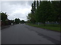
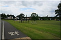
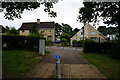
Photos of DN17 2HE
Area Information
DN17 2HE is a compact residential postcode in North Lincolnshire, situated within the Brumby Ward of Scunthorpe. With a population of 1,495 spread across 4,703 square metres, the area is densely populated, reflecting a small, tightly knit community. The ward falls under the Scunthorpe parliamentary constituency, and its postcode has been in use since 1980. Daily life here is shaped by proximity to local amenities and transport links, though the area’s character is defined by its practical, suburban layout. Residents benefit from being near Scunthorpe’s infrastructure, including retail hubs and rail services, while the postcode’s small size means the community is closely connected. The area’s demographics suggest a stable, middle-aged population, with many households likely to be long-term residents. For buyers, DN17 2HE offers a blend of convenience and affordability, though its density and limited space mean the housing stock is tightly focused. The area’s location within North Lincolnshire positions it as a commuter zone for nearby cities, balancing local living with broader opportunities.
- Area Type
- Postcode
- Area Size
- 4703 m²
- Population
- 1495
- Population Density
- 2325 people/km²
The property market in DN17 2HE is characterised by a 46% home ownership rate, with houses being the predominant accommodation type. This suggests a mix of owner-occupied and rented properties, though the small area size means the housing stock is limited. The focus on houses, rather than flats or apartments, is noteworthy in a high-density postcode, potentially indicating a preference for family-friendly or long-term living. For buyers, this means the available properties are likely to be single-family homes, which may be in short supply given the area’s compact nature. The proximity to Scunthorpe’s retail and transport hubs could make the area attractive to those seeking affordability with access to amenities. However, the limited space and high density may also mean competition for properties, particularly for those prioritising larger homes or private gardens.
House Prices in DN17 2HE
Showing 10 properties
| Address | Type | Beds | Baths | Last Sale Price | Last Sale Date | |
|---|---|---|---|---|---|---|
| 84 Enderby Road, Scunthorpe, DN17 2HE | Semi-detached | 3 | 1 | £94,950 | Nov 2019 | |
| 78 Enderby Road, Scunthorpe, DN17 2HE | house | 3 | - | £75,000 | Jun 2014 | |
| 82 Enderby Road, Scunthorpe, DN17 2HE | house | - | - | £65,000 | Nov 2006 | |
| 76 Enderby Road, Scunthorpe, DN17 2HE | Detached | 3 | 1 | - | - | |
| 74 Enderby Road, Scunthorpe, DN17 2HE | Semi-detached | - | - | - | - | |
| 80 Enderby Road, Scunthorpe, DN17 2HE | Semi-detached | - | - | - | - | |
| Office Rear Of, 65 Enderby Road, Scunthorpe, DN17 2HE | Office | - | - | - | - | |
| 71A Enderby Road, Scunthorpe, DN17 2HE | Flat | - | - | - | - | |
| 73A Enderby Road, Scunthorpe, DN17 2HE | Maisonette | - | - | - | - | |
| 69A Enderby Road, Scunthorpe, DN17 2HE | Flat | - | - | - | - |
Energy Efficiency in DN17 2HE
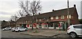
The lifestyle in DN17 2HE is shaped by its proximity to retail and transport hubs. Five notable retail venues are within reach, including Lincolnshire Co-operative Co, Heron Riddings, and Asda Scunthorpe, offering a range of shopping and daily essentials. The three nearby rail stations—Scunthorpe, Althorpe, and Crowle—provide easy access to public transport, enhancing mobility for residents. While the area is small, the availability of these amenities ensures convenience for everyday needs. The character of daily life is likely practical and efficient, with residents relying on nearby services for shopping, commuting, and leisure. The absence of detailed information on parks or leisure facilities means the area’s recreational options are not specified, though the proximity to Scunthorpe suggests access to broader facilities. Overall, the lifestyle in DN17 2HE balances local convenience with regional connectivity.
Amenities
Schools
Residents of DN17 2HE have access to two primary schools: Enderby Road Infant School, which holds a good Ofsted rating, and South Leys Business and Enterprise College. Both institutions cater to younger children, providing a foundation for primary education. The presence of two primary schools within practical reach is a key consideration for families, offering options for early education. While the data does not specify secondary schools, the availability of primary education suggests the area is suited to raising children. The good Ofsted rating at Enderby Road Infant School indicates a reliable standard of teaching, which is a positive factor for prospective buyers. However, the absence of secondary school data means families may need to look beyond the immediate area for comprehensive schooling.
| Rank | School | Type | Entry gender | Ages |
|---|
Explore more schools in this area
Go to Schools tabDemographics
The population of DN17 2HE has a median age of 47, with the majority of residents falling within the 30–64 age range. This suggests a community dominated by middle-aged adults, likely including families and professionals. Home ownership rates stand at 46%, indicating a mix of owner-occupied and rental properties. The predominant accommodation type is houses, which is unusual in high-density areas, pointing to a focus on single-family homes despite the compact footprint. The predominant ethnic group is White, with no specific data on other groups provided. The high population density of 317,869 people per square kilometre underscores the area’s tight living conditions, which may influence quality of life factors such as noise and space. While the data does not explicitly mention deprivation levels, the combination of high density and limited housing diversity could imply challenges in accessing larger homes or private outdoor space.
Household Size
Accommodation Type
Tenure
Ethnic Group
Religion
Household Composition
Age
Household Deprivation
NS-SEC
Explore more demographic insights in this area
Go to Demographics tabPlanning
Planning Constraints
- Flood RiskPremium
- Ramsar Wetland SitesPremium
- Area of Outstanding Natural BeautyPremium
- Protected Nature ReservePremium
- Protected WoodlandPremium