Area Overview for DN17 2EA
Photos of DN17 2EA


Area Information
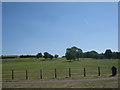
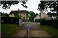
DN17 2EA lies within Ashby Parkland, a small civil parish in North Lincolnshire, just west of Scunthorpe. This postcode area covers 6.6 hectares, housing 2,249 residents in a compact residential cluster. The M181 motorway forms its eastern boundary, marking its proximity to Burringham and Scunthorpe. With a population density of 297 people per square kilometre, the area is tightly knit, blending rural tranquillity with easy access to nearby towns. Daily life here is shaped by its location: residents can commute to Scunthorpe’s amenities or use nearby rail links. The area’s recent administrative history as a civil parish since 2004 reflects its integration into modern infrastructure, though its character remains rooted in traditional North Lincolnshire landscapes. Living here means balancing a quiet, low-density environment with connectivity to larger services. The mix of local shops and transport options ensures practicality, while the relatively small size of the area suggests a close-knit community feel. For those seeking a peaceful yet accessible location, DN17 2EA offers a blend of simplicity and convenience.
- Area Type
- Postcode
- Area Size
- 6.6 hectares
- Population
- 2249
- Population Density
- 297 people/km²
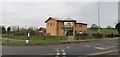
DN17 2EA is primarily an owner-occupied area, with 62% of homes owned by their residents rather than rented. The accommodation type is predominantly houses, which is typical for smaller, rural postcodes where detached or semi-detached properties dominate. This suggests a housing stock that is likely older, with limited new developments, given the area’s small size. The low population density of 297 people per square kilometre reinforces the idea of spacious, private living. For buyers, this means a market where properties are likely to be family homes, not high-density housing. However, the small size of the area may limit availability, requiring buyers to consider nearby postcodes for more options. The focus on owner-occupation also implies a slower turnover rate, potentially leading to a more stable property market with fewer speculative investments.
House Prices in DN17 2EA
Showing 71 properties
| Address | Type | Beds | Baths | Last Sale Price | Last Sale Date | |
|---|---|---|---|---|---|---|
| 35 Woodside Drive, Scunthorpe, DN17 2EA | Semi-detached | 4 | 2 | £165,000 | Jun 2025 | |
| 46 Woodside Drive, Scunthorpe, DN17 2EA | Terraced | 2 | 1 | £116,000 | Apr 2025 | |
| 39 Woodside Drive, Scunthorpe, DN17 2EA | Detached | 3 | 2 | £214,000 | Nov 2024 | |
| 45 Woodside Drive, Scunthorpe, DN17 2EA | Semi-detached | 3 | 2 | £143,000 | May 2024 | |
| 90 Woodside Drive, Scunthorpe, DN17 2EA | Detached | 4 | 2 | £240,000 | Mar 2024 | |
| 94 Woodside Drive, Scunthorpe, DN17 2EA | Detached | 4 | 3 | £240,000 | Jul 2023 | |
| 2 Woodside Drive, Scunthorpe, DN17 2EA | Terraced | 3 | 1 | £235,000 | Nov 2022 | |
| 25 Woodside Drive, Scunthorpe, DN17 2EA | Terraced | 3 | 1 | £155,000 | Oct 2022 | |
| 66 Woodside Drive, Scunthorpe, DN17 2EA | Retail | 3 | 2 | £175,000 | Aug 2022 | |
| 76 Woodside Drive, Scunthorpe, DN17 2EA | house | - | - | £146,000 | May 2022 |
Energy Efficiency in DN17 2EA
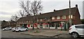
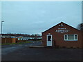
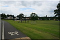
Residents of DN17 2EA have access to a range of local amenities within practical reach. Retail options include Asda Scunthorpe, Tesco Lichfield, and Lincolnshire Co-operative Co, providing essential shopping and services. The three nearby rail stations—Scunthorpe, Althorpe, and Crowle—offer convenient transport links to surrounding areas, supporting both daily commutes and weekend excursions. While there is no specific data on parks or leisure facilities, the area’s proximity to Scunthorpe suggests access to larger recreational spaces. The presence of multiple retail outlets and rail connections contributes to a lifestyle that balances local convenience with regional connectivity. For those who enjoy a mix of practicality and accessibility, DN17 2EA offers a straightforward, no-frills approach to daily living.
Amenities
Schools
| Rank | School | Type | Entry gender | Ages |
|---|
Explore more schools in this area
Go to Schools tabDemographics
The population of DN17 2EA has a median age of 47, with the majority of residents aged between 30 and 64. This suggests a community skewed toward middle-aged adults, likely including families and professionals. Home ownership stands at 62%, indicating a stable, owner-occupied market rather than a high-rental area. The predominant accommodation type is houses, reflecting a preference for detached or semi-detached properties over flats. The ethnic composition is overwhelmingly White, with no specific data on other groups provided. This demographic profile implies a mature, settled population with established roots. The absence of detailed diversity statistics means the area’s social fabric is not explicitly defined by multiculturalism. However, the age range and home ownership rate suggest a community focused on long-term residency, with limited turnover. For prospective buyers, this could indicate a stable neighbourhood with fewer transient residents.
Household Size
Accommodation Type
Tenure
Ethnic Group
Religion
Household Composition
Age
Household Deprivation
NS-SEC
Explore more demographic insights in this area
Go to Demographics tabPlanning
Planning Constraints
- Flood RiskPremium
- Ramsar Wetland SitesPremium
- Area of Outstanding Natural BeautyPremium
- Protected Nature ReservePremium
- Protected WoodlandPremium