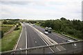
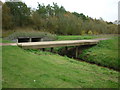
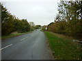
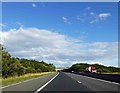
Area Overview for DN17 2AX
Photos of DN17 2AX

Area Information
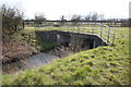
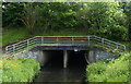
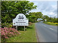
DN17 2AX is a small residential cluster in England, covering 3.3 hectares and home to 1,837 people. The area’s population density of 463 people per square kilometre suggests a tightly knit community, with a focus on established housing. While it lies within the broader Scunthorpe conurbation, parts of the surrounding area retain rural character, including farmland extending to the River Trent. Historically, the region was shaped by agriculture and local industry, with landmarks like Bottesford’s parish church and Fleming’s Bridge reflecting centuries of settlement. Today, DN17 2AX offers a quiet, low-density living environment with proximity to Scunthorpe’s urban amenities. Residents benefit from nearby rail links and a mix of retail options, while the area’s low crime risk and absence of environmental constraints make it appealing for families seeking stability. The postcode’s compact size means its immediate surroundings are key to daily life, with local shops, schools, and transport nodes within practical reach.
- Area Type
- Postcode
- Area Size
- 3.3 hectares
- Population
- 1837
- Population Density
- 463 people/km²
DN17 2AX is a predominantly owner-occupied area, with 80% of residents living in their own homes. The accommodation type is exclusively houses, which contrasts with areas where flats or apartments dominate. This suggests a housing stock tailored to families or individuals seeking larger, more private living spaces. The small size of the postcode (3.3 hectares) means the property market is limited in scale, with fewer options available compared to larger urban areas. However, the high home ownership rate implies strong local demand, potentially leading to competitive pricing for available properties. Buyers should consider the area’s proximity to Scunthorpe’s infrastructure, which may influence property value trends. The absence of rental properties indicates a focus on long-term residency rather than transient populations, which could be a factor for those considering investment or relocation.
House Prices in DN17 2AX
Showing 2 properties
| Address | Type | Beds | Baths | Last Sale Price | Last Sale Date | |
|---|---|---|---|---|---|---|
| Unit 20A, Wentworth Road, South Park Industrial Estate, Bottesford, DN17 2AX | warehouse | - | - | - | - | |
| Flat, 22 Wentworth Road, South Park Industrial Estate, Bottesford, DN17 2AX | Flat | - | - | - | - |
Energy Efficiency in DN17 2AX
Residents of DN17 2AX have access to a range of nearby amenities, including five retail outlets such as Heron Riddings, Lincolnshire Co-operative Co, and Asda Scunthorpe. These shops provide essential services and shopping options within practical reach. The area’s rail connections—Scunthorpe, Althorpe, and Kirton Lindsey stations—offer convenient travel to surrounding regions. While the data does not list parks or leisure facilities explicitly, the historical context of the area suggests proximity to natural spaces, such as the River Trent and rural farmland. The presence of retail and transport hubs indicates a lifestyle that balances local convenience with broader connectivity. For those prioritising ease of access to services and a mix of urban and rural elements, DN17 2AX offers a functional, well-served environment.
Amenities
Schools
The nearest school to DN17 2AX is South Park Enterprise College, an independent school serving students aged 11–19. It holds a ‘good’ Ofsted rating, reflecting its performance in education quality and student outcomes. The presence of an independent school suggests the area appeals to families seeking alternative educational options beyond state-run institutions. While no other schools are listed in the data, the single school’s rating indicates a reliable option for secondary education. Families prioritising independent schooling may find this a key advantage, though they should consider the need for additional transport arrangements, given the school’s location relative to the postcode. The absence of primary schools in the immediate vicinity means parents may need to look further afield for younger children’s education.
| Rank | School | Type | Entry gender | Ages |
|---|
Explore more schools in this area
Go to Schools tabDemographics
The population of DN17 2AX is predominantly adults aged 30–64, with a median age of 47. This suggests a mature, established community with a strong presence of middle-aged residents. Home ownership is high at 80%, indicating a stable housing market where most residents live in their own homes rather than renting. The accommodation type is exclusively houses, which aligns with the area’s low-density profile. The predominant ethnic group is White, reflecting the broader demographic patterns of North Lincolnshire. While specific data on deprivation is not provided, the high home ownership rate and low crime risk (70/100 safety score) suggest a relatively affluent and secure environment. The absence of significant diversity metrics means the community is likely homogenous, though this does not necessarily imply a lack of inclusivity. The area’s demographic makeup is well-suited to those prioritising stability, family-oriented living, and proximity to essential services.
Household Size
Accommodation Type
Tenure
Ethnic Group
Religion
Household Composition
Age
Household Deprivation
NS-SEC
Explore more demographic insights in this area
Go to Demographics tabPlanning
Planning Constraints
- Flood RiskPremium
- Ramsar Wetland SitesPremium
- Area of Outstanding Natural BeautyPremium
- Protected Nature ReservePremium
- Protected WoodlandPremium