Area Overview for DN17 1YD
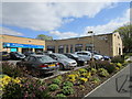
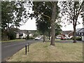
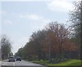
Photos of DN17 1YD

Area Information
Living in DN17 1YD means inhabiting a small, densely populated residential cluster in Scunthorpe, North Lincolnshire. The area covers 2,473 square metres and is home to 1,536 residents, making it one of the most densely populated postcode areas in England. Its compact size and proximity to Scunthorpe’s core infrastructure mean daily life is shaped by proximity to local services, transport links, and community hubs. The area falls within the Brumby Ward, a unitary authority district under the Scunthorpe parliamentary constituency. While historical details are sparse, its modern postcode system dates to 1980, reflecting its integration into regional planning. Residents here benefit from being part of a tightly knit community, though the high population density may influence local dynamics. The area’s small footprint means it is ideal for those seeking a compact, manageable environment with access to nearby amenities, though its limited size also means any development or change can have immediate local impact.
- Area Type
- Postcode
- Area Size
- 2473 m²
- Population
- 1536
- Population Density
- 4625 people/km²
The property market in DN17 1YD is defined by a low home ownership rate of 25%, suggesting that the area is primarily a rental market rather than one dominated by owner-occupied homes. The accommodation type is predominantly houses, which is unusual for a small, densely populated postcode area. This mix implies a focus on single-family homes, possibly with gardens or larger living spaces, which may appeal to families or individuals seeking more private, spacious housing. However, the limited number of owner-occupied properties could mean fewer long-term investment opportunities for buyers. The small size of the area also means that property availability is constrained, and any new developments are likely to be closely scrutinised. For buyers, this suggests a niche market where properties may be in high demand, but competition could be fierce. The predominance of houses over flats or apartments may also influence the types of properties available, with fewer options for those seeking urban-style living.
House Prices in DN17 1YD
Showing 10 properties
| Address | Type | Beds | Baths | Last Sale Price | Last Sale Date | |
|---|---|---|---|---|---|---|
| 9 Wareham Court, Scunthorpe, DN17 1YD | Semi-detached | 3 | - | £74,000 | Jun 2015 | |
| 8 Wareham Court, Scunthorpe, DN17 1YD | Bungalow | 2 | 1 | £52,840 | Jun 2008 | |
| 7 Wareham Court, Scunthorpe, DN17 1YD | house | - | - | £79,950 | Nov 2006 | |
| 10 Wareham Court, Scunthorpe, DN17 1YD | Detached | 3 | 1 | - | - | |
| 5 Wareham Court, Scunthorpe, DN17 1YD | Semi-detached | 3 | 1 | - | - | |
| 1 Wareham Court, Scunthorpe, DN17 1YD | Bungalow | - | - | - | - | |
| 2 Wareham Court, Scunthorpe, DN17 1YD | house | - | - | - | - | |
| 3 Wareham Court, Scunthorpe, DN17 1YD | Bungalow | - | - | - | - | |
| 6 Wareham Court, Scunthorpe, DN17 1YD | house | - | - | - | - | |
| 4 Wareham Court, Scunthorpe, DN17 1YD | house | - | - | - | - |
Energy Efficiency in DN17 1YD
The lifestyle in DN17 1YD is shaped by its proximity to essential retail and transport amenities. Nearby shops include Tesco Lichfield, Asda Scunthorpe, and Spar, offering a range of grocery and convenience services within practical reach. These retail options support daily errands and reduce the need for long trips to larger shopping centres. The area’s rail stations—Scunthorpe, Althorpe, and Crowle—provide access to broader regional networks, enabling residents to travel to nearby towns for work, leisure, or social activities. While the data does not specify parks or leisure facilities, the presence of multiple schools and retail outlets suggests a community-oriented environment. The compact nature of the area means that amenities are closely clustered, fostering a sense of convenience. However, the lack of detailed information on green spaces or recreational areas leaves gaps in understanding the full range of lifestyle options available. For those prioritising accessibility and practicality, the combination of retail and transport links makes DN17 1YD a functional choice.
Amenities
Schools
Residents of DN17 1YD have access to a range of primary schools, including Parkwood Infant School, Parkwood Junior School, Parkwood Primary School, and the academy-style Oasis Academy Parkwood, which holds an Ofsted rating of ‘good’. The presence of three primary schools suggests a strong focus on early education, with options for different age groups and educational approaches. The inclusion of an academy indicates a broader curriculum and possibly higher standards, though no secondary schools are listed in the data. For families, this mix of school types provides flexibility, allowing parents to choose between traditional primary education or the structured environment of an academy. The proximity of these schools to the area means that daily routines for children are likely to involve short commutes, which can be a significant advantage for working parents. However, the lack of secondary education options within the immediate vicinity may require families to consider longer travel times for older children.
| Rank | School | Type | Entry gender | Ages |
|---|
Explore more schools in this area
Go to Schools tabDemographics
The population of DN17 1YD has a median age of 47, with the majority of residents aged 30–64 years. This suggests a community skewed towards middle-aged adults, likely including families and professionals. Home ownership is relatively low at 25%, indicating a rental-dominated market where many residents may be tenants rather than property owners. The area is characterised by houses as the primary accommodation type, which contrasts with higher-density housing seen in urban centres. The predominant ethnic group is White, though no specific data on diversity or deprivation levels is provided. The age profile suggests a stable, established population with fewer young children or retirees compared to other areas. This demographic mix may influence local services, with demand for amenities catering to working-age adults and families. The high population density of 621,000 people per square kilometre further underscores the compact nature of the area, potentially affecting living conditions and community interactions.
Household Size
Accommodation Type
Tenure
Ethnic Group
Religion
Household Composition
Age
Household Deprivation
NS-SEC
Explore more demographic insights in this area
Go to Demographics tabPlanning
Planning Constraints
- Flood RiskPremium
- Ramsar Wetland SitesPremium
- Area of Outstanding Natural BeautyPremium
- Protected Nature ReservePremium
- Protected WoodlandPremium