Area Overview for DN17 1XA
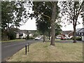
Photos of DN17 1XA


Area Information
Living in DN17 1XA means being part of a tightly packed residential cluster in Scunthorpe, North Lincolnshire. The area covers 3,000 square metres and is home to 1,536 residents, giving it a population density of over 500,000 people per square kilometre. This high density suggests a compact, possibly urbanised environment, though the exact character of the area is not detailed in the data. DN17 1XA falls within the Brumby Ward, a unitary authority area under the Scunthorpe parliamentary constituency. While the region has been assigned a postcode since 1980, historical details are sparse. Residents here likely benefit from proximity to local amenities and transport links, though the small size of the area means the community is likely tightly knit. For buyers, this postcode represents a specific, focused location rather than a sprawling suburb, with limited scope for expansion or development.
- Area Type
- Postcode
- Area Size
- 3000 m²
- Population
- 1536
- Population Density
- 4625 people/km²
The property market in DN17 1XA is characterised by a low home ownership rate of 25%, suggesting that the area is primarily a rental market rather than one dominated by owner-occupied homes. The accommodation type is houses, which is atypical for a postcode with such a high population density. This combination implies that the housing stock may consist of larger, detached properties, possibly older homes or those designed for family living. For buyers, this could mean limited availability of properties for sale, with most options being rental properties. The small size of the area also means that the immediate surroundings may offer similar housing stock, requiring buyers to consider broader local markets for choice.
House Prices in DN17 1XA
Showing 9 properties
| Address | Type | Beds | Baths | Last Sale Price | Last Sale Date | |
|---|---|---|---|---|---|---|
| 9 Dawlish Court, Scunthorpe, DN17 1XA | house | - | - | £80,000 | Feb 2021 | |
| 3 Dawlish Court, Scunthorpe, DN17 1XA | Terraced | - | - | £64,000 | Jun 2008 | |
| 1 Dawlish Court, Scunthorpe, DN17 1XA | house | - | - | - | - | |
| 6 Dawlish Court, Scunthorpe, DN17 1XA | house | - | - | - | - | |
| 2 Dawlish Court, Scunthorpe, DN17 1XA | Bungalow | - | - | - | - | |
| 4 Dawlish Court, Scunthorpe, DN17 1XA | Terraced | - | - | - | - | |
| 8 Dawlish Court, Scunthorpe, DN17 1XA | Terraced | - | - | - | - | |
| 7 Dawlish Court, Scunthorpe, DN17 1XA | Bungalow | - | - | - | - | |
| 5 Dawlish Court, Scunthorpe, DN17 1XA | house | - | - | - | - |
Energy Efficiency in DN17 1XA
The lifestyle in DN17 1XA is shaped by nearby amenities such as retail outlets including Tesco Lichfield, Asda Scunthorpe, and M&S Scunthorpe RP. These shops offer convenience for daily shopping needs. The area’s rail stations provide access to broader regional networks, enhancing mobility. While the data does not specify parks or leisure facilities, the presence of retail and transport options suggests a functional, practical lifestyle. The compact nature of the area means residents may rely on nearby towns for more extensive amenities, but the immediate vicinity offers sufficient services for basic needs.
Amenities
Schools
Residents of DN17 1XA have access to several primary schools, including Parkwood Infant School, Parkwood Junior School, and Parkwood Primary School. These institutions cater to younger children, offering a range of educational options for families. Additionally, Oasis Academy Parkwood, an academy with a ‘good’ Ofsted rating, provides secondary education. The presence of multiple primary schools suggests a strong local education infrastructure for younger students, though no secondary schools are explicitly named in the data. Families may need to look beyond the immediate area for secondary schooling, but the availability of a rated academy indicates a focus on quality education.
| Rank | School | Type | Entry gender | Ages |
|---|
Explore more schools in this area
Go to Schools tabDemographics
The population of DN17 1XA is predominantly adults aged 30–64, with a median age of 47. This suggests a community of middle-aged individuals, possibly families or professionals in their peak earning years. Home ownership is low at 25%, indicating that most residents rent their homes. The accommodation type is primarily houses, which is unusual for areas with high population density, hinting at a mix of larger properties or detached homes. The predominant ethnic group is White, though no further breakdown of diversity is provided. The high population density, combined with the low home ownership rate, may reflect a rental market skewed towards transient or younger households. For buyers, this could mean a competitive market with limited long-term residency patterns.
Household Size
Accommodation Type
Tenure
Ethnic Group
Religion
Household Composition
Age
Household Deprivation
NS-SEC
Explore more demographic insights in this area
Go to Demographics tabPlanning
Planning Constraints
- Flood RiskPremium
- Ramsar Wetland SitesPremium
- Area of Outstanding Natural BeautyPremium
- Protected Nature ReservePremium
- Protected WoodlandPremium