Area Overview for DN17 1AD
Photos of DN17 1AD

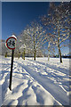
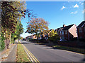
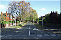
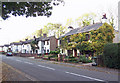

46 photos from this area
Area Information
Key information about the DN17 1AD including its size, population, and administrative classification.
- Area Type
- Postcode
- Area Size
- 3.1 hectares
- Population
- 1633
- Population Density
- 1734 people/km²
House Prices in DN17 1AD
19
Properties
£102,621
Average Sold Price
£31,000
Lowest Price
£249,999
Highest Price
Showing 19 properties
| Address | Type | Beds | Baths | Last Sale Price | Last Sale Date | |
|---|---|---|---|---|---|---|
| 85 Brumby Wood Lane, Scunthorpe, DN17 1AD | Semi-detached | 5 | 2 | £235,000 | Jan 2023 | |
| 91 Brumby Wood Lane, Scunthorpe, DN17 1AD | house | 3 | 1 | £165,000 | Aug 2018 | |
| 79 Brumby Wood Lane, Scunthorpe, DN17 1AD | Semi-detached | 4 | 2 | £170,500 | May 2014 | |
| 107 Brumby Wood Lane, Scunthorpe, DN17 1AD | Bungalow | 4 | - | £249,999 | Oct 2012 | |
| 97A Brumby Wood Lane, Scunthorpe, DN17 1AD | Bungalow | 2 | - | £95,000 | May 2012 | |
| 77 Brumby Wood Lane, Scunthorpe, DN17 1AD | Semi-detached | 3 | - | £110,000 | Feb 2012 | |
| 75 Brumby Wood Lane, Scunthorpe, DN17 1AD | house | - | - | £88,000 | Jul 2003 | |
| 93 Brumby Wood Lane, Scunthorpe, DN17 1AD | Semi-detached | - | - | £69,000 | Sep 2002 | |
| 83 Brumby Wood Lane, Scunthorpe, DN17 1AD | Semi-detached | 3 | 1 | £53,000 | Jun 2001 | |
| 81 Brumby Wood Lane, Scunthorpe, DN17 1AD | Semi-detached | - | - | £44,950 | Apr 2000 |
Page 1 of 2
Energy Efficiency in DN17 1AD
Amenities
Schools
| Rank | School | Type | Entry gender | Ages |
|---|
Explore more schools in this area
Go to Schools tabDemographics
Household Size
Two person
most common
Accommodation Type
Houses
most common
Tenure
83
majority
Ethnic Group
White
most common
Religion
N/A
most common
Household Composition
N/A
most common
Age
47
median
Adults (30-64 years)
most common
Household Deprivation
N/A
with no deprivation
NS-SEC
33
in Lower managerial occupations
Explore more demographic insights in this area
Go to Demographics tabPlanning
Planning Constraints
- Flood RiskPremium
- Ramsar Wetland SitesPremium
- Area of Outstanding Natural BeautyPremium
- Protected Nature ReservePremium
- Protected WoodlandPremium